The Annapurna Base Camp Trek Map is more than a sketch of trails - it’s a step-by-step guide to one of Nepal’s most loved treks. With this map, you can trace the ABC trek route from Pokhara all the way up to the Annapurna Sanctuary at 4,130 meters. Along the way, you’ll see forests, waterfalls, traditional villages, and views of giants like Machapuchhre and Annapurna I.
This blog explains the Annapurna Base Camp trek route map, daily itinerary, altitude profile, and highlights so you know exactly what to expect. If you’d rather walk this trail with everything arranged, you can also check out our Annapurna Base Camp Trek package.
Annapurna Base Camp Trek Overview
If you’re planning the Annapurna Base Camp trek, it helps to know the key details at a glance. The trek is moderately challenging, takes just under two weeks, and is best enjoyed during clear weather seasons. Below is a quick breakdown of the essentials to guide your preparation:
- Duration: 13 days
- Difficulty: Moderate
- Best Seasons: Spring (March-May) & Autumn (September-November)
- Highlights: Sunrise from Poon Hill, the natural amphitheater of the Annapurna Sanctuary, Machapuchhre and Annapurna views, and encounters with Gurung and Magar culture
Experience the Annapurna Base Camp with Nepal Gateway Trekking—our expert guides will make sure every step of your journey is safe and unforgettable.
Annapurna Base Camp Trek Route Map

The total Annapurna Base Camp trek distance covers roughly 110 km round trip, spread across 13 days of trekking through forests, villages, and alpine landscapes. Your trek begins with a drive from Kathmandu to Pokhara and then to Nayapul, where the real walk starts. From here, the route climbs through villages and forests until you reach the heart of the Annapurna Sanctuary.
To enjoy the trek with confidence, you’ll want the best Annapurna Base Camp trek map available—one that shows trails, elevation gains, rest stops, and side routes clearly.
Route Overview:
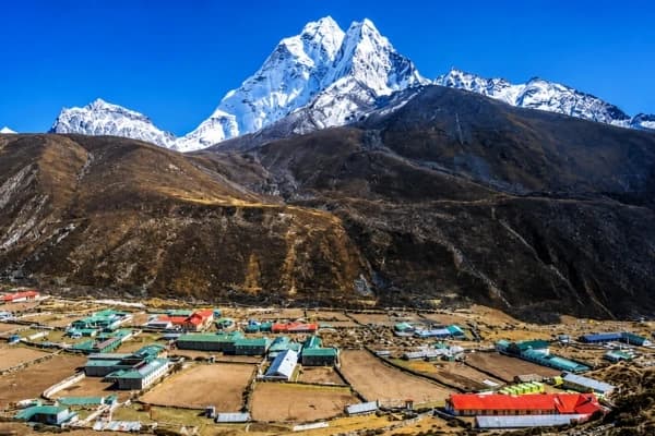
The trek usually starts from Pokhara with a short drive to Nayapul, where the trail winds through villages and terraced fields on the way to Ghorepani. After catching the sunrise from Poon Hill, the route continues through rhododendron forests and stone steps to Chhomrong. This place is also widely popular as the gateway to the Annapurna Sanctuary.
From here, the path climbs steadily past Bamboo and Deurali before reaching Annapurna Base Camp at 4,130 meters. On the return, most trekkers stop at Jhinu Danda to enjoy the natural hot springs before heading back to Pokhara.
Key Mountains Visible Along the Way:
- Annapurna I, Annapurna South, Annapurna III
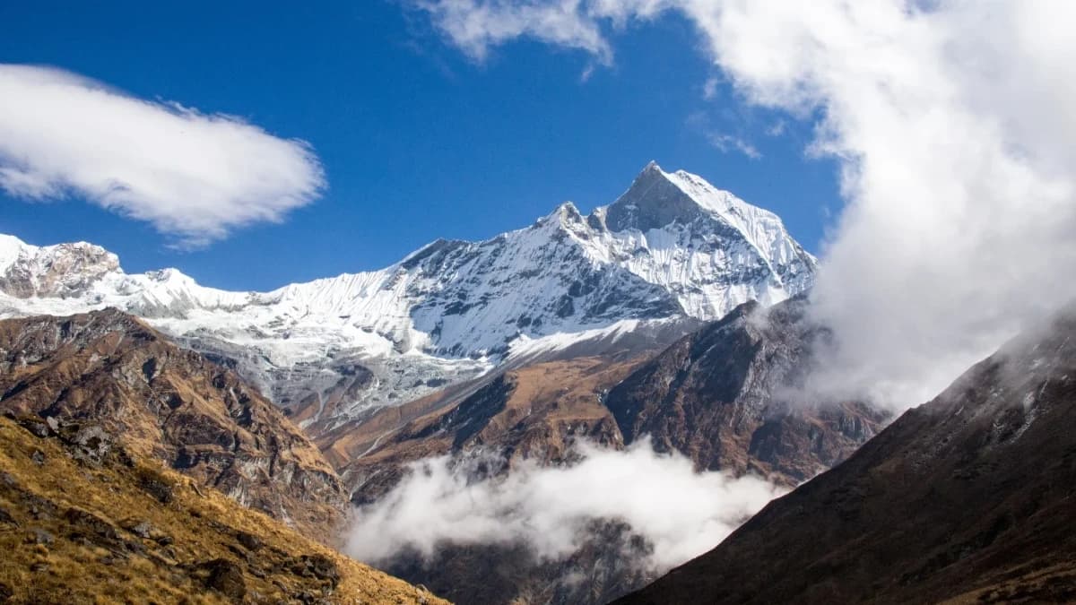
- Machapuchhre (Fishtail)
- Khangsar Kang, Tare Kang, Gandharwa Chuli
- Himchuli, Singu Chuli, Gangapurna, Bharha Chuli
Route Types:
- Trekking route → solid orange line
- Secondary route → dotted line
- Drive route → blue line
Why Do You Need a Detailed Annapurna Base Camp Trek Map?
An Annapurna Base Camp trek map with distance helps trekkers see how each day connects, showing walking hours, elevation gains, and the layout of villages along the way. Even if you’re trekking with a guide, having your own physical or digital map gives extra confidence. A detailed map is more than handy—it’s essential for planning and staying safe.
- Navigation & Safety: The trek passes through many villages and forests. A map helps you follow the correct trails, plan rest stops, and avoid getting lost.
- Altitude Awareness: The map shows altitude gains each day, which is useful to avoid climbing too fast and risking altitude sickness.
- Resource Planning: Villages, teahouses, and water sources are marked so you can plan overnight stops and refill points.
With the Annapurna Base Camp trek map, you can plan each day’s path, rest stops, and places to see for an easy and fun trek. Start your adventure today!
Annapurna Base Camp Trek Map Itinerary - 13 Days
The trek usually takes 13 days, including travel days. Here’s a simple breakdown of the ABC trek itinerary:
- Day 1: Kathmandu (1,310 m) → Drive to Pokhara (820 m) - Travel west through scenic hills to Nepal’s lake city.
- Day 2: Pokhara → Nayapul (1,220 m) → Trek to Birethanti (1,065 m) - A short drive, then start walking by riverside villages.
- Day 3: Birethanti → Hille (1,430 m) → Tikhedhunga (1,540 m) → Ulleri (1,960 m) - First climb of stone steps leads to Ulleri village.
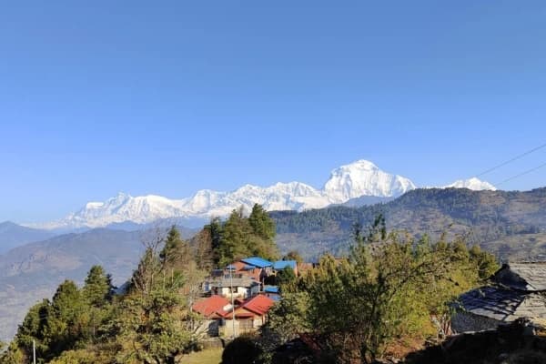
- Day 4: Ulleri → Ghorepani (2,780 m) - Pass through rhododendron forests to reach Ghorepani.
- Day 5: Ghorepani → Poon Hill (3,210 m)→ Tadapani (2,685 m) - Early hike to Poon Hill for sunrise views, then trek to Tadapani.
- Day 6: Tadapani → Chomrong (2,140 m) → Sinuwa (2,210 m) - Descend and climb again through Gurung villages.
- Day 7: Sinuwa → Bamboo (2,310 m)→ Dovan → Deurali (3,230 m) - Walk through forested valleys toward higher altitude.
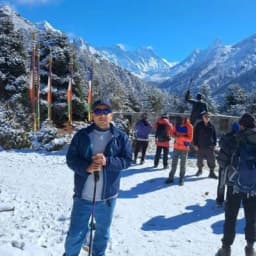
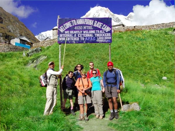
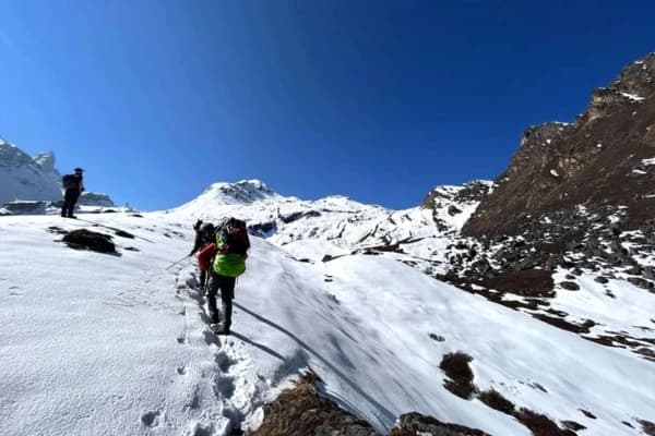
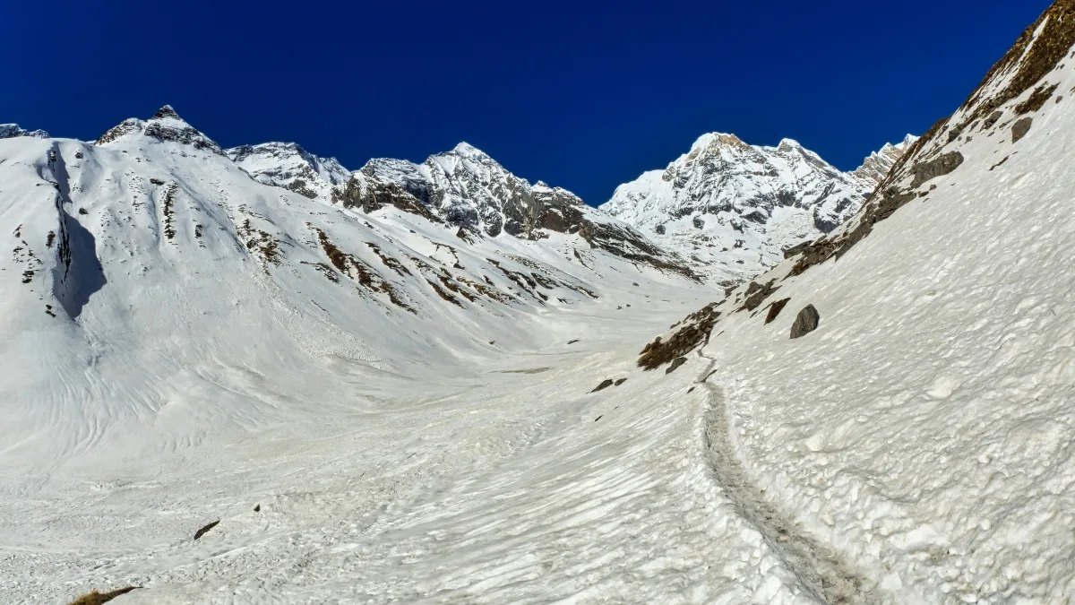
- Day 8: Deurali → MBC (3,700 m) → Annapurna Base Camp (4,130 m) - Reach the Annapurna Sanctuary, surrounded by towering peaks.
- Day 9-10: Trek back to Bamboo → Jhinu Danda (1,780 m) - Relax at natural hot springs near Jhinu.
- Day 11-13: Return to Nayapul → Pokhara → Kathmandu - End the trek with scenic views and a drive back to the capital.
Annapurna Base Camp Trek Highlights
The ABC trek is famous for combining natural beauty with cultural charm. These highlights make the ABC trek one of Nepal’s most rewarding short Himalayan adventures.
- Poon Hill: Sunrise over Dhaulagiri and the Annapurna range.
- Annapurna Sanctuary: A natural amphitheater of snow peaks.
- Diverse Landscapes: Forests, waterfalls, rivers, and alpine meadows.
- Cultural Experience: Interactions with Gurung and Magar communities.
- Iconic Peaks: Close views of Machapuchhre, Himchuli, and Annapurna South.
Annapurna Base Camp Trek Altitude Profile
The Annapurna Base Camp Trek begins at about 1,220 meters in Nayapul and slowly goes up through villages and forests. Important stops along the way are Ghorepani, Poon Hill, Deurali, and MBC, with the highest point being Annapurna Base Camp at 4,130 meters.
Although the Annapurna Base Camp trek distance might seem long at first, the gradual ascent and well-paced itinerary make it manageable for trekkers with moderate fitness levels. Knowing how the altitude changes can help you plan when to rest, how fast to go, and get used to the height.
|
Location |
Altitude (meters) |
Notes |
|
Kathmandu |
1,310 |
Start of the journey |
|
Pokhara |
820 |
Trekking region gateway city |
|
Nayapul |
1,220 |
Trailhead for the trek |
|
Tikhedhunga |
1,540 |
First significant climb |
|
Ghorepani |
2,780 |
Base for Poon Hill sunrise hike |
|
Poon Hill |
3,210 |
Panoramic Himalayan Views |
|
Deurali |
3,230 |
Rest point before MBC |
|
Machapuchhre Base Camp (MBC) |
3,700 |
Camp with views of Machapuchhre peak |
|
Annapurna Base Camp (ABC) |
4,130 |
The highest point of the trek, surrounded by towering peaks |
|
Jhinu Danda |
1,780 |
Hot springs for relaxation after descent |
Acclimatization Tips
- Ascend gradually and rest at each overnight stop.
- Stay hydrated and eat lightly at high altitudes.
- Take at least one slow day before reaching ABC to adjust to the thinner air.
- Avoid alcohol and smoking during the trek.
- Listen to your body. If you feel unwell, rest or descend immediately.
Using an Annapurna Base Camp trek map with distance makes it easier to plan breaks and keep a steady pace on the trail.
Final Takeaway
The Annapurna Base Camp trek is a great adventure full of nature and culture. From walking through green forests and traditional villages to reaching the amazing Annapurna Sanctuary, every step gives unforgettable sights and memories.
Using the best Annapurna Base Camp trek map, you can walk at a smart pace and take time to get used to the altitude, making the trek safe and fun. Whether you have trekked before or are a beginner, the ABC trek gives an amazing Himalayan experience that you’ll remember long after you’re back.
Let Nepal Gateway Trekking help you customize your ABC trek itinerary, from Poon Hill sunrise to the final ascent at Annapurna Base Camp. Contact Now!!
FAQ’s - Annapurna Base Camp Trek
What is the best time for the Annapurna Base Camp trek?
The best times to go are spring (March to May) and autumn (September to November), when the sky is clear and the weather is nice.
How long does the trek take?
The trek usually takes 10-13 days, including travel to and from Pokhara. The exact duration depends on your pace, acclimatization needs, and whether you choose to make side trips like Poon Hill for sunrise.
Do I need a guide for the ABC trek?
Yes, as per the rules and regulation changes by NTB (Nepal Tourism Board), from April 1st, 2023, all foreign trekkers have to hire a licensed guide or porter to trek in Nepal’s national parks and conservation areas, including the Annapurna Conservation Area.
What permits are required for the Annapurna Base Camp Trek?
To trek in the Annapurna region, you need the Annapurna Conservation Area Permit (ACAP) and a TIMS card. These permits help support conservation efforts and are checked at trail checkpoints. Guides or trekking agencies usually arrange them in advance.
Is the trek suitable for beginners?
Yes, beginners with a good level of fitness can complete the trek. The route involves moderate climbs and 5-7 hours of walking each day.
Are there accommodations along the route?
Yes, the trail has teahouses in nearly every village, offering basic rooms, hot showers, and meals. Facilities improve at more popular stops like Ghorepani, Chhomrong, and ABC. Booking in peak seasons may be necessary for larger groups.
How difficult is the ABC trek?
The Annapurna Base Camp trek is seen as medium in difficulty. You’ll walk on clear trails but will have to climb steep paths and go up to 4,130 meters. Having good energy, the right shoes, and time to get used to the height are important for a safe and fun trip.