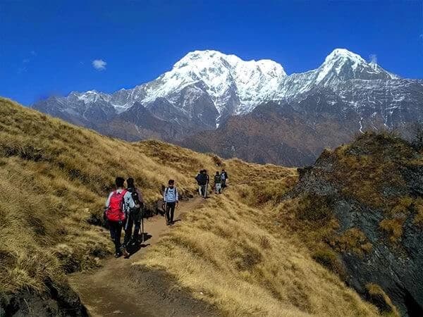
TheMardi Himal Trek offers a hidden path through the heart of the Annapurna region. With fewer crowds and equally breathtaking views of Machhapuchhre, Annapurna South, and Hiunchuli, this short yet rewarding trek is gaining popularity fast.
To plan your trip, stay safe, and get the most out of your experience, you must be familiar with the Mardi Himal Trek map. A map makes it simple to follow your path, locate important landmarks, and locate rest areas or villages along the way. Whether you are walking alone or with a group of people who are guiding you, you may confidently explore the trail and avoid getting lost if you have a map.
Let's get started with the detailed route description, elevation data, and hiking advice!
Mardi Himal Trek Map

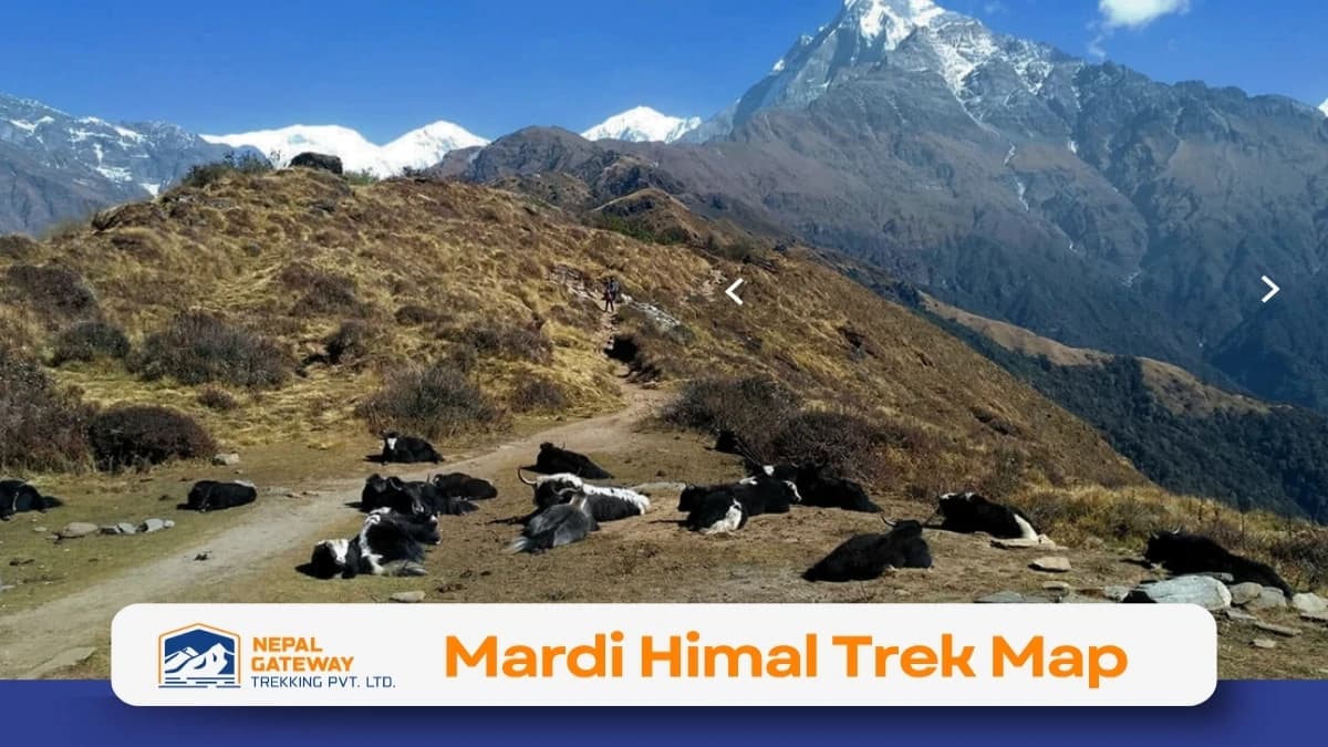
The Mardi Himal Trek Map shows a beautiful trekking route in the Annapurna region of Nepal. It starts from Kande, near Pokhara, and reaches Mardi Himal Base Camp at 4,450 meters. The Mardi Himal Trek Map outlines a beautiful trekking route in the Annapurna region of Nepal, starting from Kande, near Pokhara. The trail passes through lush rhododendron forests, traditional villages, and scenic ridgelines, gradually ascending to the Mardi Himal Base Camp at 4,450 meters. Each stop along the way—like Australian Camp, Forest Camp, Low Camp, and High Camp—offers stunning views and peaceful resting points.
With its stunning views of Hiunchuli, Annapurna South, and Machapuchare (Fishtail), this journey is a hidden gem. The Mardi Himal trail is perfect for people looking for peace and natural beauty because it is still comparatively calm compared to Nepal's major trekking routes.
From road access and trail routes to elevation variations and beautiful views, this map aids hikers in understanding the entire adventure.
Mardi Himal Trekking Route Map Highlights
- Starting Point: Kande (1,010 m), reached by road from Pokhara.
- Main Trail: Clearly marked, moving uphill through forests and mountain ridges.
- End Point: Mardi Himal Base Camp (4,450 m), then descend through different villages.
- Return Route: Comes down via Siding, Kalimati, and Lwang before reaching Khora Muk for the drive back.
11 Days Mardi Himal Trek Itinerary
The Mardi Himal base camp trek map shows a scenic trail from Pokhara to 4,250 m. This Mardi Himal trek route map includes key stops like Forest Camp, High Camp, and the viewpoint. Nepal Gateway Trekking made a perfect map for those who were looking for the best map of the Mardi Himal trek from Kathmandu.
- Day 1: Arrival in Kathmandu
Arrive and transfer to your hotel. Trek briefing in the evening. - Day 2: Drive to Pokhara (820 m)
Scenic drive (6–7 hrs) or optional flight. Explore Lakeside. - Day 3: Drive to Phedi → Trek to Deurali (2,100 m)
Short drive, then trek via Dhampus to Deurali (4–5 hrs). - Day 4: Trek to Forest Camp (2,520 m)
Walk through rhododendron forests (5–6 hrs). - Day 5: Trek to Low Camp (2,970 m)
Gradual climb with better mountain views (5–6 hrs). - Day 6: Trek to High Camp (3,540 m)
Short but steeper hike (3–4 hrs). Stunning views. - Day 7: Hike to Viewpoint (4,250 m) & Return to High Camp
Early morning hike to Mardi Himal Viewpoint. Back to High Camp. - Day 8: Trek to Sidhing Village (1,700 m)
Long descent through forest and ridges (5–6 hrs). - Day 9: Trek to Lumre → Drive to Pokhara
Short trek (2–3 hrs) and 2-hr drive to Pokhara. - Day 10: Return to Kathmandu
Drive or fly back to Kathmandu. Free time. - Day 11: Final Departure
Make your way to the airport in preparation for your next travel.
This is a concise 11-day itinerary for the Mardi Himal Trek. For a more detailed itinerary, cost breakdown, and additional information, explore our Mardi Himal Trek Package.
Key Stops Along the Mardi Himal Trail Map
- Australian Camp (1,950 m): Great early viewpoint of the surrounding hills.
- Deurali (2,100 m): The forested trail joins here.
- Forest Camp (2,500 m): Dense rhododendron forests.
- Low Camp (2,990 m): First glimpses of snow-capped peaks.
- Badal Danda (3,210 m): Open ridgeline with wide mountain views.
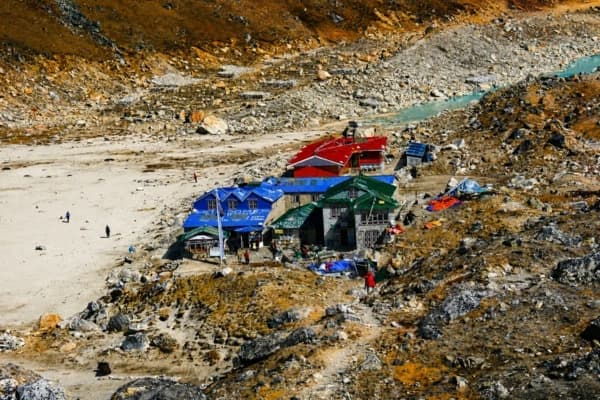
- High Camp (3,580 m): A popular place to rest before the final climb.
- Mardi Himal Base Camp (4,450 m): Spectacular views of Mardi Himal, Machhapuchhre, and Annapurna.
Drive and Road Access to Mardi Himal
- Kathmandu to Pokhara: Shown as a major driving route on the map.
- Pokhara to Kande: Drive to the trek’s starting point.
- Return Drive: From Khora Muk back to Pokhara after completing the trek.
Altitude Chart of Mardi Himal
- The map includes an altitude chart that shows the height gained and lost each day.
- Helps trekkers prepare for gradual climbs and plan for altitude acclimatization.
Mountains Visible on the Mardi Himal Trek Map
- Machhapuchhre (Fishtail) – 6,997m
- Mardi Himal—5,587 m
- Annapurna South—7,229 m
- Himchuli – 6,441m
- Tent Peak—5,695 m
Summary
From trail routes and elevation changes to road access sites and picturesque mountain views, the Mardi Himal Trek Map offers a comprehensive overview of the trip. Beginning in Kande, close to Pokhara, it leads hikers to important locations like Forest Camp and High Camp before arriving at 4,450-meter Mardi Himal Base Camp.
Trekkers may easily navigate daily camps, rest stops, and overlooks with the aid of this map, which is a vital scheduling tool. The clearly stated details guarantee a safer and more pleasurable journey in the Annapurna region, whether you're planning your itinerary, estimating walking time, or locating the greatest photo places. Contact Nepal Gateway Trekking for the best experience in trekking.
Top Questions About the Mardi Himal Trek Map
What is the trail of the Mardi Himal Trek like?
The trail is peaceful and scenic, starting in lush forests and climbing steadily to alpine terrain. You’ll pass rhododendron and oak trees before reaching grassy hills and ridges. The hike from High Camp to Base Camp is steeper but offers amazing views. It’s well-marked and great for beginners and experienced trekkers who want a quieter route.
What other mountains will I see during the Mardi Himal Trek?
You’ll see stunning peaks like Machhapuchhre (Fishtail Mountain), Mardi Himal itself, Annapurna South, Himchuli, and Tent Peak. The best views are from Badal Danda, High Camp, and the Base Camp.
Where is the Mardi Himal Trek?
The trek is in Nepal’s Annapurna region, starting from Kande, about an hour from Pokhara. It runs through the Annapurna Conservation Area, rich in natural beauty and local culture, passing villages of the Gurung and Magar communities.
What’s best about the Mardi Himal Trek?
It offers incredible mountain views with fewer crowds. You’ll enjoy close-up sights of Machhapuchhre and Mardi Himal, peaceful forests, alpine meadows, and friendly locals. Plus, it’s short enough to finish in under a week—perfect if you’re short on time.
What are the best trekking routes in Mardi Himal?
The popular route starts at Kande, passing Australian Camp, Forest Camp, Low Camp, and High Camp before the Base Camp. Many return via Siding Village to Pokhara, making a scenic loop. Some also start from Dhampus or Landruk to explore different paths.
Is the Mardi Himal Trek map important?
Yes! A map helps you see the whole trail, key stops, distances, and altitude changes. It’s great for planning and staying on track, especially if you trek without a guide. Even with a guide, it helps you follow the route better.
Do I need a map for the Mardi Himal Trek?
Yes, having a map is helpful. While the trail is relatively straightforward, a map helps identify viewpoints, tea house villages, and elevation changes—especially if you’re trekking without a guide.
Is Mardi Himal connected to other trekking routes?
Yes, Mardi Himal can connect to Annapurna Base Camp, Ghorepani, or Landruk trails if you want to extend your journey. Some maps show these connections clearly.