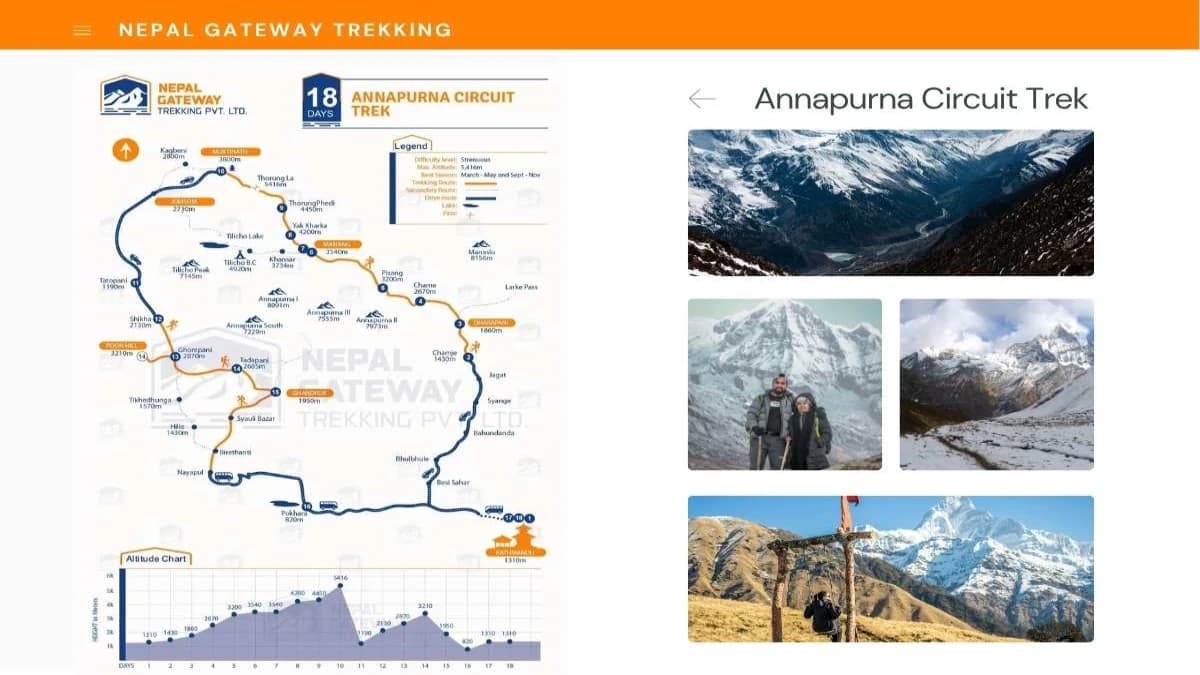
Annapurna Circuit Trek map is an essential tool for anyone wanting to explore this stunning Himalayan route. It outlines the entire journey around the Annapurna mountain range, highlighting key points like Chamje, Manang, and the challenging Thorong La Pass—the highest point on the trek.
It is easy to navigate the trail's shifting terrain and select rest stops thanks to this comprehensive map. It ensures you stay on the correct route till you arrive at Pokhara's stunning lakes by guiding you through villages and over mountain passes. Your hike will be more pleasurable and safer with this map.
Key Details About the Annapurna Circuit Trek
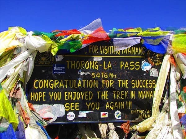
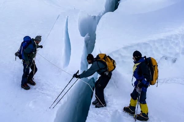
Because of the lengthy trekking days and the 5,416-meter-high Thorong La Pass crossing, the Annapurna Circuit Trek is a moderate to challenging trek that requires excellent physical condition. Having a reliable Annapurna Circuit route map or Annapurna trekking map is essential for navigating the trek confidently.
The elevation varies significantly, starting from about 1,410 meters in Chamje and reaching the highest point at Thorong La Pass. You can use an Annapurna Circuit elevation map to understand these changes and plan your acclimatization stops accordingly.
The trek covers roughly 230 kilometers, combining trekking trails with some driving sections. After a beautiful journey from Kathmandu to Chamje, the experience continues along the main trail marked on the Annapurna Circuit trail map. After trekking, you’ll drive from Nayapul to Pokhara and then back to Kathmandu using local transport options.
Before you set off, it's also worth reviewing the Annapurna Circuit altitude profile to understand the elevation changes throughout the journey. Knowing where the biggest altitude gains occur helps you pace yourself, acclimatize properly, and prepare for the challenging crossing of Thorong La Pass at 5,416 meters (17,769 feet).
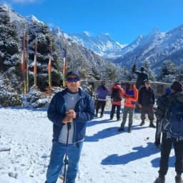
Most lodgings along the route are comfortable teahouse lodges that serve Tibetan, Nepali, and occasionally Western cuisine. To stay on course and savor each day of this amazing adventure, conform to a thorough Annapurna Circuit trip itinerary.
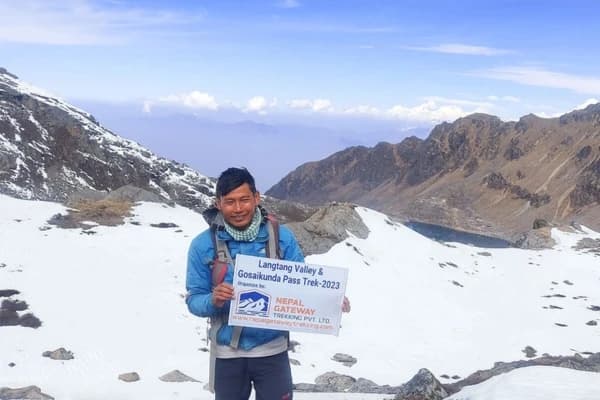
Some people also choose Annapurna Circuit Trek with Tilicho lake for the stunning view and experience.

Annapurna Circuit Trek Itinerary | 18 Days
An incredible Himalayan experience is guaranteed as you travel through breathtaking scenery, a variety of cultural practices, and high mountain passes on the 18-day Annapurna Circuit Trek program.
Day 1: Arrival in Kathmandu and transfer to the hotel.
Day 2: Drive from Kathmandu to Chamje (1,410 m).
Day 3: Trek from Chamje to Dharapani (1,860 m).
Day 4: Trek from Dharapani to Chame (2,670 m).
Day 5: Trek from Chame to Pisang (3,200 m).
Day 6: Trek from Pisang to Manang (3,540 m) via Gheru.
Day 7: Acclimatization in Manang.
Day 8: Trek from Manang to Yak Kharka (4,050 m).
Day 9: Trek from Yak Kharka to Thorong Phedi (4,450 m).
Day 10: Trek from Thorong Phedi to Muktinath (3,710 m) via Thorong La Pass (5,416 m).
Day 11: Drive from Muktinath to Tatopani (1,190 m).
Day 12: Trek from Tatopani to Shikha (2,130 m).
Day 13: Trek from Shikha to Ghorepani (2,860 m).
Day 14: Hike from Ghorepani to Poon Hill (3,210 m), then trek to Tadapani (1,685 m).
Day 15: Trek from Tadapani to Ghandruk (1,950 m).
Day 16: Trek from Ghandruk to Nayapul and drive to Pokhara (820 m)—4 hrs trekking + 1.5 hrs drive.
Day 17: Drive from Pokhara to Kathmandu.
Day 18: Departure from Kathmandu.
If you find this 18 days trek long, you can also choose short Annapurna Circuit Trek which is about 11 Days long.
Frequently Asked Questions about the Annapurna Circuit Trek Map
What is the best map to use for the Annapurna Circuit Trek?
The best map for the Annapurna Circuit Trek shows the entire route from Chamje to Pokhara, including key stops like Manang, Thorong La Pass, and Muktinath. Nepal Gateway Trekking provides detailed GPS-based maps that are easy to read and help with navigation.
How long is the Annapurna Circuit Trek according to the map?
The total trekking distance is about 230 kilometers, including both trekking paths and connecting roads. The trek usually takes around 18 days to complete.
Does the Annapurna Circuit Trek map include alternate routes?
Yes, the map includes main routes as well as popular side trips such as the Ghorepani Poon Hill hike, which offers spectacular sunrise views of the Annapurna range.
What is the highest point shown on the Annapurna Circuit Trek map?
The highest point is Thorong La Pass at 5,416 meters, which is the most challenging part of the trek and a highlight on the map.
How accurate are the road and transportation details on the Annapurna Circuit Trek map?
Our maps are updated regularly to reflect current road conditions, including the drive from Kathmandu to Chamje and from Nayapul to Pokhara, ensuring reliable travel planning.
Can I use a physical map, or should I use a digital map for the trek?
Both are useful. Physical maps help with general navigation, while digital GPS maps on smartphones provide real-time tracking and are recommended for safety and convenience.
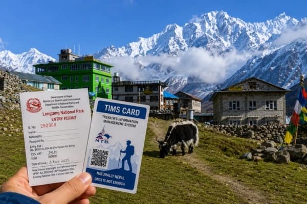
Is accommodation marked on the Annapurna Circuit Trek map?
Yes, teahouses and lodges are marked along the entire route, showing available places to stay and eat.