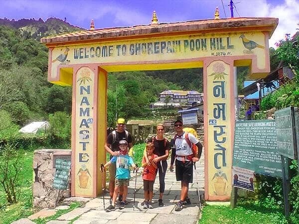
If you're planning to hike the scenic Ghorepani Poonhill trail, having a visual map can make all the difference. The Ghorepani Poonhill Trek map from Nepal Gateway Trekking gives you a detailed look at the trail, key villages, viewpoints, and elevation levels—helping you get fully prepared for the journey.
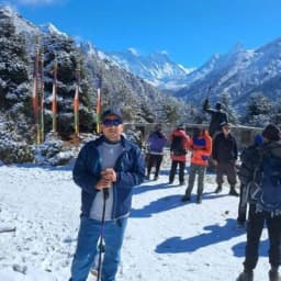
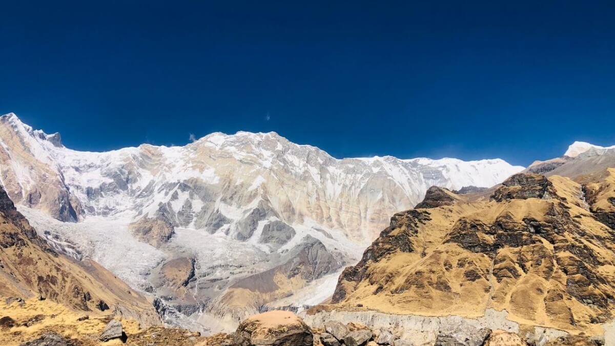
This short and rewarding trek in the Annapurna region brings you face-to-face with Himalayan peaks like Annapurna South, Dhaulagiri, Machhapuchhre, and more—all without venturing into high-altitude zones.
What makes this trek even more special?
- It’s short and beginner-friendly—no technical climbs.
- You’ll walk at comfortable altitudes (max 3,210 meters at Poon Hill).
- You can do it almost any time of the year—it’s beautiful in every season.
- And most importantly, it’s filled with raw, natural beauty.
In this guide, you’ll find
- A clear Ghorepani Poonhill trek map
- A complete 8-day route plan with daily highlights by Nepal Gateway Trekking
- A simple altitude chart to track your climb
What Does the Ghorepani Poon Hill Trek Map Show?

The Ghorepani Poon Hill map outlines an 8-day loop starting from Kathmandu, heading toward Nayapul near Pokhara, and covering well-known trekking points like Tikhedhunga, Ulleri, Ghorepani, and Ghandruk. The route also features Poonhill—the highest point of the trek—at 3,210 meters.
The map includes
- Start and end points: Kathmandu and Pokhara
- Key trekking stops: Nayapul, Tikhedhunga, Ghorepani, Tadapani, Ghandruk
- Viewpoints: Poonhill (3,210 m), Annapurna and Dhaulagiri ranges
- Altitude chart: Day-by-day elevation gain
- Transport route: Bus/jeep paths between Kathmandu and Pokhara
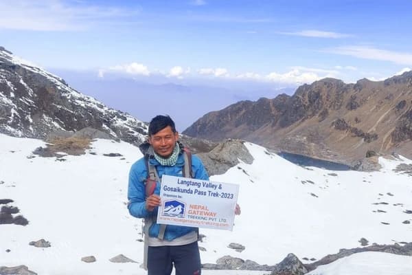
Planning to trek solo? Read the Ghorepani Poonhill Trek solo traveller experience which was possible with expert guidance from Nepal Gateway Trekking!
Popular Stops Along the Ghorepani Poonhill Trek
 The stunning villages and friendly locals along the route are equally as important to the Ghorepani Poonhill trek as the mountains. Every location on the map offers something different:
Ulleri (2,050 m):
This village is famous for its never-ending stone steps—over 3,000 of them! It may sound tough, but the climb is rewarding. Along the way, you’ll pass by terraced fields, small waterfalls, and get your first taste of rural mountain life.
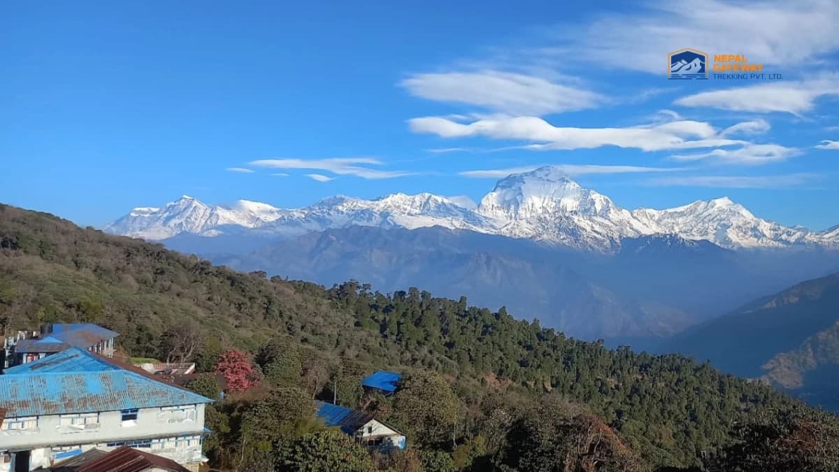
Ghorepani (2,780 m):
A peaceful village surrounded by forest, Ghorepani is the perfect place to rest before the early morning hike to Poonhill. The teahouses here face the mountains, so you can enjoy hot tea with cold Himalayan views. The air is crisp, and the atmosphere feels truly alpine.
Tadapani (2,685 m):
Hidden among oak and rhododendron trees, Tadapani offers quiet forest trails and a break from busy trails. It’s known for being calm and scenic, with a high chance of spotting birds or hearing them sing in the early morning. The sunset views here are just as lovely as the sunrise at Poonhill.
Ghandruk (1,950 m):
This large Gurung village is rich in tradition. Stone-paved paths, traditional houses, and a small museum give you a closer look at local life. You can enjoy a homemade meal, talk with locals, and watch the mountains light up in the distance—it’s a heartwarming way to end your trek.
Itinerary Based on the Ghorepani Poonhill Trek Map
Planning your Ghorepani Poonhill adventure? This 8-day itinerary follows the exact route shown in the official Ghorepani Poonhill Trekking map.
It's designed to give you a smooth trekking experience—from the drive out of Kathmandu to the scenic viewpoints of Poon Hill and cultural villages like Ghandruk. Here's a quick overview of each day to help you visualize the journey ahead:
Day 1: Arrival in Kathmandu (1,310 m)
- Drive Time: 20 minutes from the airport to the hotel.
- Highlight: World heritage sites in Kathmandu. Check in at the hotel to relax from jet lag.
- What to Expect: Meeting with the tour operator and guide. Buy or rent trekking gear in Thamel.
Day 2: Drive from Kathmandu to Pokhara (820 m)
- Drive Time: 6–8 hours
- Highlight: Scenic drive through hills, rivers, and countryside
- What to Expect: Your adventure begins with a beautiful road trip from Kathmandu to Pokhara, Nepal’s adventure capital. Along the way, enjoy views of green valleys, local villages, and rivers flowing below. In the evening, explore the lakeside vibes of Pokhara.
Day 3: Drive to Nayapul (1,220 m) & Trek to Ulleri (2,050 m) via Tikhe Dhunga (1,540 m)
- Drive Time: 1.5 hours | Trek Time: 5-6 hours
- Highlight: Riverside trekking and suspension bridges
- What to Expect: After a short drive to Nayapul, your trek officially begins! Walk along gentle paths, cross charming bridges, and pass local homes and terraced fields. Tikhedhunga is a quiet village before you ascend uphill to Ulleri village, where you’ll stay your first night in the hills.
Today’s trail is a bit of a challenge, but worth every step. You’ll climb more than 3,000 stone steps through the village of Ulleri, surrounded by lush rhododendron forests.
Day 4: Trek from Ulleri to Ghorepani (2,780 m)
- Trek Time: 6–7 hours
- Highlight: Oak and rhododendron forest, passing the beautiful village of Banthanti with a view of Mount Fishtail (6,997 m).
- What to Expect: The air gets cooler as you reach Ghorepani—a cozy village with incredible views.
Day 5: Early Morning Hike to Poonhill (3,210 m) and trek to Tadapani (2,685 m)
- Trek Time: 7–8 hours
- Highlight: Sunrise over the Himalayas from Poonhill forest walks, and ridge views.
- What to Expect: Rise before dawn for the short but steep hike to Poon Hill Viewpoint. Watch the sun rise behind the Annapurna and Dhaulagiri ranges—a magical, golden moment. Walk along peaceful ridgelines and pass through thick forests filled with oak and rhododendron. Deurali offers great views, and the path to Tadapani is rich in birdlife and natural beauty. A day to truly enjoy the silence of nature.
Day 6: Trek to Ghandruk (1,950 m) and drive to Pokhara (820 m)
- Trek Time: 3–4 hours | Drive Time: 3 hours
- Highlight: Forest walk and explore Ghandruk Village and the museum. Peaceful trails through forests and farmlands
- What to Expect: After breakfast, trek down to the beautiful village of Ghandruk, known for its Gurung culture and stunning landscapes. Your final day on the trail! Walk downhill through forests and terraced fields, saying goodbye to the mountains. From Nayapul, drive back to Pokhara for a hot shower, soft bed, and maybe a lakeside dinner.
Day 7: Drive from Pokhara to Kathmandu (1,310 m)
- Drive Time: 6–8 hours
- Highlight: Relaxing road journey back to the capital
- What to Expect: Enjoy the scenic drive back to Kathmandu. It’s a great time to reflect on your adventure and maybe sort your trek photos. By evening, you’re back in the bustling streets of the city.
Day 8: Free Day in Kathmandu or Departure
- Highlight: Explore, rest, or fly home.
- What to Expect: You can either explore cultural sites like Boudhanath and Swayambhunath or shop for souvenirs in Thamel. Or, if your flight is today, we’ll bid you farewell with a heart full of memories.
Tip: Save a digital copy of the map on your phone or carry a printed version during the trek. Mobile signals may not always be reliable in the mountains.
What You’ll See on the Map
We have categorized the features below:
Start & End Points
- Kathmandu to Pokhara: A scenic drive through hills and rivers
- Nayapul: The official starting point of the trek
- Trek ends in Ghandruk, then drive back to Pokhara and Kathmandu
Key Trekking Stops
- Tikhedhunga (1,540 m)—A Peaceful village and riverside views
- Ghorepani (2,780 m)—Gateway to the famous sunrise point, Poon Hill
- Tadapani (2,685 m)—Nestled in rhododendron forests
- Ghandruk (1,950 m)—Traditional Gurung village with Annapurna views
Top Viewpoint
- Poon Hill (3,210 m)—The highest point of the trek, offering stunning sunrise views of the Annapurna and Dhaulagiri ranges
Trek Trails & Roads
- Well-marked trails between villages
- Vehicle access roads between Kathmandu and Pokhara and Nayapul and Pokhara
Not sure where to start your trekking journey? Discover our top adventures on the Featured Trips and find the perfect trek for you!
Ghorepani Poon Hill Trek Map Altitude Profile
The altitude gradually increases over the first few days, peaking at Poon Hill (3,210 m). The map’s altitude chart shows a balanced climb and descent, making this trek suitable for beginners and families.
| Day | Location | Attitude (m) |
| 1 | Kathmandu | 1,310 |
| 2 | Pokhara | 820 |
| 3 | Ulleri | 2,050 |
| 4 | Ghorepani | 2,780 |
| 5 | Poonhill/Ghandruk | 3,210/1,950 |
| 6 | Pokhara | 820 |
| 7 | Kathmandu | 1,310 |
| 8 | Departure |
Why the Ghorepani Poonhill Trek Map Is Perfect for Trekkers?
The Ghorepani Poonhill trek map is straightforward and beginner-friendly. It clearly marks walking paths, road access, elevation changes, and stops for food and lodging. Whether you're trekking solo or with a guide, the map helps you:
- Track your daily progress
- Understand the terrain ahead
- Plan rest points based on altitude
- Locate scenic viewpoints and photo spots
The moderate difficulty and availability of teahouses make this trek ideal for all age groups.
Final Thoughts
A good map is more than just a route guide—it’s a tool to help you experience the Ghorepani Poonhill trek with confidence and clarity. Whether you’re planning for the sunrise at Poon Hill or the cultural walk through Ghandruk, this 8-day map keeps you on track and informed every step of the way.
For a guided experience with local expertise, contact Nepal Gateway Trekking and book your trip now.
Questions on the Ghorepani Poonhill Trek Map
Is the 8-day Ghorepani Poonhill Trek route suitable for beginners?
Yes, the 8-day Ghorepani Poonhill Trek is suitable for beginners. The trail is well-marked and moderately paced, with daily walking hours ranging from 4 to 6 hours. Comfortable teahouses are available along the route, making it ideal for first-time trekkers with average fitness levels.
What is the highest point in the Ghorepani Poonhill trek?
The highest point on the Ghorepani Poonhill Trek is Poonhill, which sits at an altitude of 3,210 meters. It is the main viewpoint on the trek and offers panoramic sunrise views of the Annapurna and Dhaulagiri mountain ranges.
Can I complete the Ghorepani Poonhill Trek without a guide?
You can complete the Ghorepani Poonhill Trek without a guide. The trail is well-traveled and marked with signs, especially at key junctions. However, hiring a guide is recommended for cultural insights, better navigation, and logistical support, especially if it's your first trek in Nepal.
When is the best time to do the Ghorepani Poonhill Trek?
The best time to do the Ghorepani Poonhill Trek is during spring (March to May) and autumn (September to November). These seasons offer clear mountain views, pleasant weather, and blooming rhododendrons along the trail.
Do I need an altitude chart for the Ghorepani Poonhill Trek?
Yes, having an altitude chart for the Ghorepani Poonhill Trek is helpful. It allows you to track daily elevation gain, plan rest days, and reduce the risk of altitude sickness. The trek peaks at 3,210 meters, which is manageable but still requires pacing.
Is an altitude chart necessary for the Ghorepani Poonhill trek?
An altitude chart is important for the Ghorepani Poonhill trek because it helps trekkers understand elevation gain and plan their pace accordingly. It also helps reduce the risk of altitude sickness and fatigue by allowing proper rest and acclimatization.
What altitude is Poon Hill viewpoint on the trek map?
Poon Hill lies at an altitude of 3,210 meters (10,531 ft) and is the highest point on the Ghorepani Poonhill trek map.
Which villages are marked on the Ghorepani Poonhill trekking route?
Key villages include Nayapul, Tikhedhunga, Ulleri, Ghorepani, Deurali, Tadapani, and Ghandruk — all clearly marked on most trek maps.
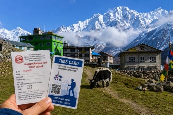
Is Poon Hill part of the Annapurna Conservation Area on the map?
Yes, the entire Ghorepani Poonhill route falls within the Annapurna Conservation Area, which is also indicated on official trekking maps.
Which is the best route variation on the Ghorepani Poonhill trek map for sunrise views?
The standard route from Ghorepani to Poon Hill before dawn is best for sunrise — it’s a short 45-minute hike clearly marked on most maps.