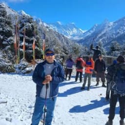
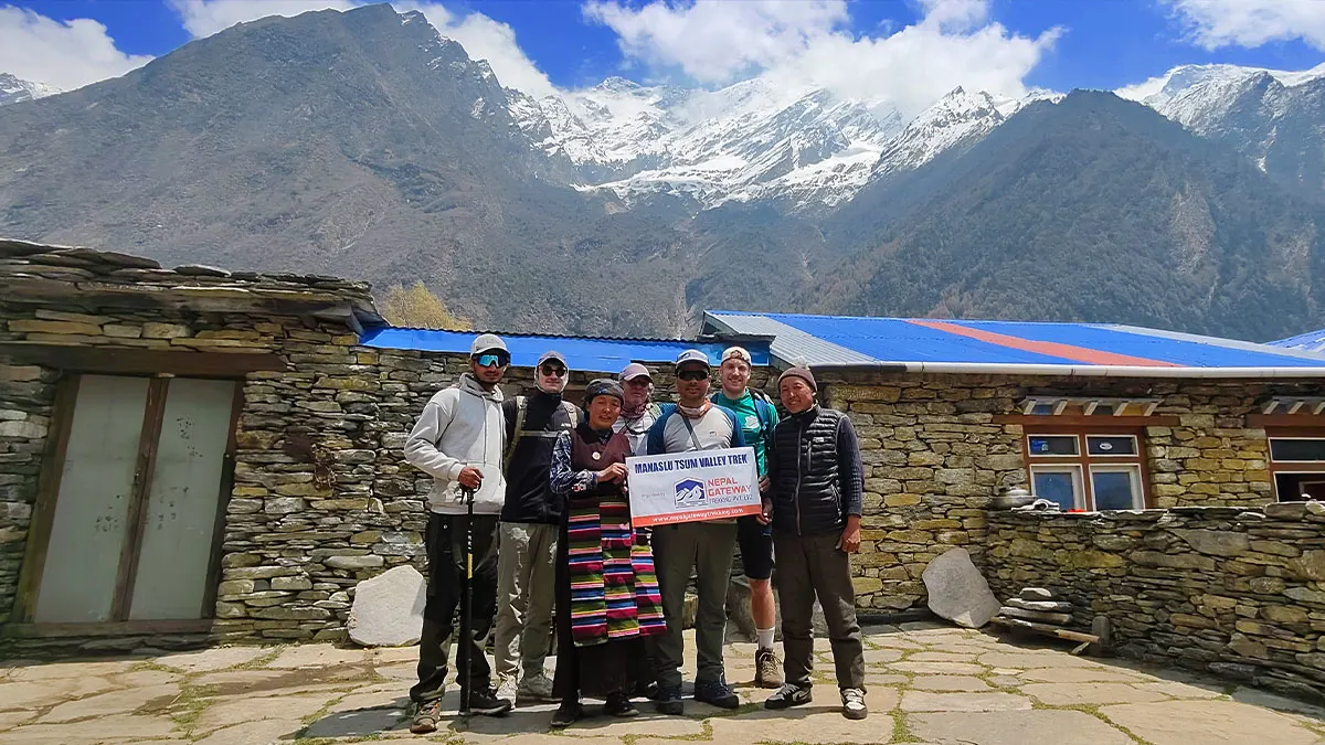
If you are searching for a proper Manaslu Circuit Tsum Valley Trek map, you are in the right place. This guide is not just a list of place names. It walks you through the full route, tells you what each section looks like on the ground, how high you go, how long each stage takes, and what to expect along the way. Whether you are still in the planning stage or already packing your bag, this guide is the map breakdown you actually need.
Talk to Nepal Gateway Trekking expert about this route. Plan your trip with us.
Full Route Overview of Manaslu Circuit Tsum Valley Trek Map
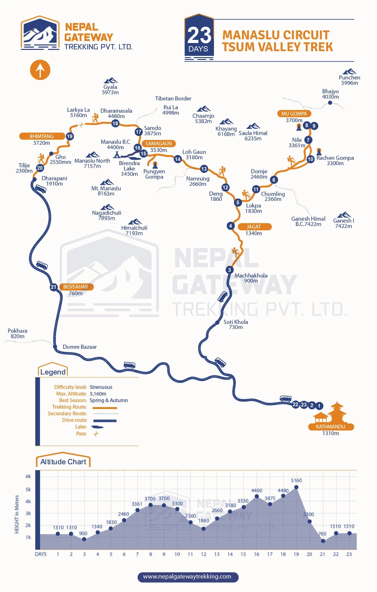
The trek starts in Soti Khola at 930 meters or Besisahar at around 760 meters. Both connect to the main Manaslu trail within a day or two. From there, the route heads north along Budhi. The Gandaki River climbs through subtropical forest, terraced farmland, and deep gorges before reaching the high alpine terrain near the Tibetan Plateau.
The Tsum Valley loop branches off near Jagat and Ekle Bhatti, heading northeast through the Shiar Khola valley. After the Tsum section, trekkers rejoin the main circuit near Namrung and continue clockwise around Manaslu, crossing Larkya La Pass at 5,160 meters before descending toward Dharapani. Total trail distance for the combined route sits between 177 and 210 kilometers. The standard itinerary runs 18 to 22 days.
Kathmandu to Soti Khola (930 m)
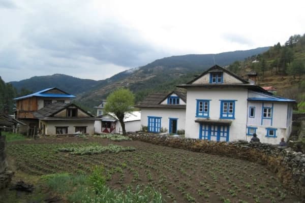
After an 8- to 10-hour drive from Kathmandu, you arrive at Soti Khola in the Gorkha district. It is a small settlement with basic teahouses and marks the exact point where the road ends and the trail begins. The Budhi Gandaki Valley opens directly ahead.
Soti Khola to Machha Khola (930 m)
The first trail day follows the Budhi Gandaki River through suspension bridges, narrow rock faces, and small farming villages. Machha Khola sits at the same elevation as Soti Khola, but the trail undulates considerably through this lower gorge. Allow five to six hours.
Machha Khola to Jagat (1,340 m)
The trail continues upstream through Khorlabesi, Tatopani, and Doban before reaching Jagat at 1,340 meters, the first major permit checkpoint on the map. Plan for five to six hours.
Jagat to Deng Tsum Valley Branch (1,860 m)
Just beyond Jagat, the trail splits. The main circuit continues up the Budhi Gandaki. The Tsum Valley route turns northeast along the Shiar Khola. Ekle Bhatti sits at the junction. Most Tsum Valley trekkers stop here or push to Chumling on day one of the detour.
The Tsum Valley Loop Ekle Bhatti to Mu Gompa and Back
The Tsum Valley runs roughly 40 kilometers north, enclosed by high ridges on both sides. Chumling, at 2,386 meters, is the first major Tsum settlement. Stone houses, Tibetan culture, and a landscape entirely different from the gorge below. The trail north passes through Chokangparo, Nile at 3,361 meters, Chhule, and up to Mu Gompa at approximately 3,700 meters.
Mu Gompa has been active for over 500 years. Monks live here year-round. For most trekkers who do the combined route, this monastery is the moment they remember most. The return leg drops back to rejoin the main circuit near Namrung. Allow four to six days for the full Tsum Valley detour.
Back on the Circuit Namrung (2,660 m)
Back on the main circuit at Namrung, the valley widens, vegetation thins, and Himalayan peaks appear clearly above the ridgeline. Views of Sringi Himal open to the north. From here, the trail enters its most dramatic section.
Namrung to Shyala (3,330 m)
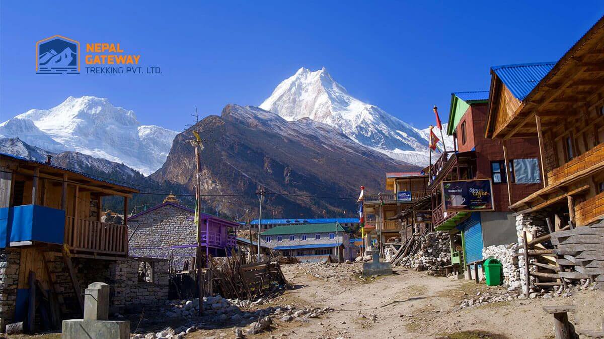
The climb passes through Lihi, Sho, and Lho, each with teahouses and improving views. The monastery at Lho is a worthwhile stop. Shyala, at 3,330 meters, sits in an open valley where Manaslu starts dominating the skyline properly.
Shyala to Sama Gaun (3,390 m)
Sama Gaun is one of the key map points on the Manaslu Circuit. At 3,390 meters below Manaslu's south face has a large monastery, decent teahouses, and the best base camp mountain views. A rest day here is not optional it is the foundation for safely crossing Larkya La. The optional Manaslu Base Camp hike at 4,800 meters starts from here and takes a full day.
Sama Gaun to Samdo (3,860 m)
Samdo, at 3,860 meters, is the last real village before high camp. Samdo is situated near the Tibet border and exudes a serene, secluded atmosphere. The stage from Sama Gaun is a short three to four hours, leaving time for an enjoyable afternoon acclimatization walk.
Samdo to Dharamasala Larkya High Camp (4,480 m)
Dharamasala, at 4,480 meters, is a cluster of basic stone teahouses at the foot of the pass. Three to four hours from Samdo. Eat well, rest, stay warm, and get to sleep early. Pass day starts before sunrise.
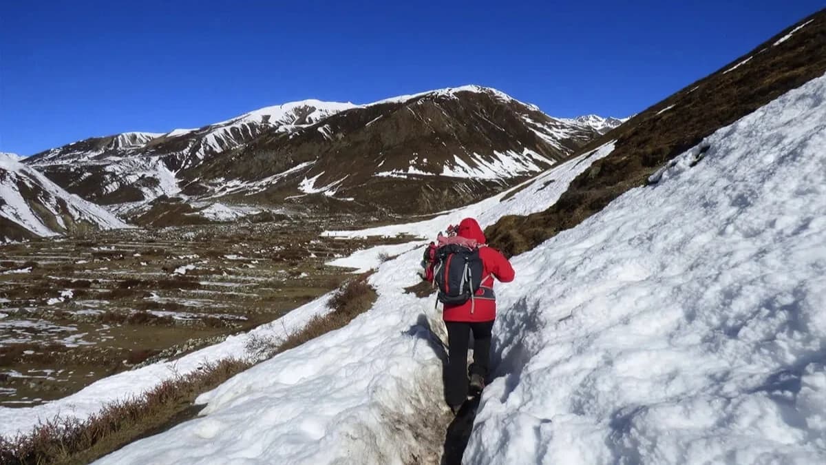
Larkya La Pass (5,160 m) to Bhimtang (3,750 m) The Big Day
Most groups leave at 3 to 4 in the morning. The climb from Dharamasala to Larkya La takes three to four hours on snowfields and boulders. At the top: Himalchuli, at 7,893 meters, directly south, Manaslu behind you and the Ganesh Himal to the west. One of the genuinely outstanding views in Himalayan trekking. The descent to Bhimtang takes another four to five hours and is hard on the knees. But Bhimtang in its wide alpine valley is a proper reward. Total pass day: eight to ten hours. Trekking poles are essential.
Bhimtang to Dharapani and Out (3,750 m to 1,860 m)
The final three days are all descent Bhimtang to Gho at 2,550 meters, then to Dharapani at 1,860 meters, where the trail hits the road again. From Dharapani, a jeep or bus connects to Besisahar and onward to Pokhara or Kathmandu.
Nepal Gateway Trekking provides licensed guides for every stage of this route. Explore full Manaslu Circuit With Tsum Valley Trek itinerary.
Key Elevation Points
|
Location |
Elevation |
|
Soti Khola |
930 m |
|
Jagat |
1,340 m |
|
Deng |
1,860 m |
|
Namrung |
2,660 m |
|
Shyala |
3,330 m |
|
Sama Gaun |
3,390 m |
|
Samdo |
3,860 m |
|
Dharamasala |
4,480 m |
|
Larkya La Pass |
5,160 m |
|
Bhimtang |
3,750 m |
|
Gho |
2,550 m |
|
Dharapani |
1,860 m |
|
Chumling |
2,386 m |
|
Nile |
3,361 m |
|
Mu Gomp |
approximately 3,700 m |
Trail Distances Between Stages
|
Route |
Distance |
|
Soti Khola to Machha Khola |
approximately 14 km |
|
Machha Khola to Jagat |
approximately 22 km |
|
Jagat to Deng |
approximately 18 km |
|
Deng to Namrung on the main circuit |
approximately 30 km |
|
Namrung to Sama Gaun |
approximately 20 km |
|
Sama Gaun to Samdo |
approximately 10 km |
|
Samdo to Dharamasala |
approximately 18 km |
|
Dharamsala to Bhimtang via Larkya La |
approximately 18 km |
|
Bhimtang to Dharapani over two stages |
approximately 30 km |
Permit Checkpoints on the Map
Permit posts sit at Jagat, Namrung, Samdo, and the Tsum Valley entry. You need the Manaslu Restricted Area Permit, Manaslu Conservation Area Permit (MCAP), and Annapurna Conservation Area Permit (ACAP) if exiting via Dharapani. Add the Tsum Valley Restricted Area Permit for the combined route.
All permits require a registered trekking agency. Solo trekking is not permitted, and a licensed guide is legally required. Nepal Gateway Trekking handles every permit for our clients. Missing a permit means you cannot pass the first checkpoint this is the one logistics step that cannot be left to the last minute.
Pro tip: Permit costs update each year. Confirm current fees directly with the Nepal Tourism Board or your agency before booking.
The Tsum Valley in Detail
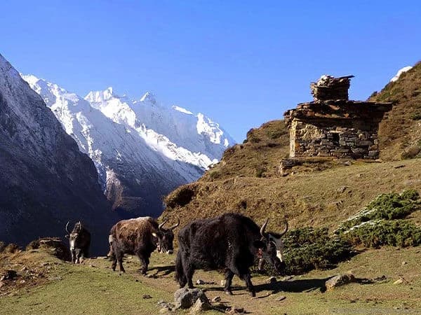
The Tsum Valley runs north to south, enclosed by the Ganesh Himal to the west and the Sringi Himal to the east, and sealed at the northern end by the Tibetan Plateau. The Tsum people are ethnically Tibetan, speak a Tibetan dialect, and follow a way of life that has changed very little over centuries. The valley only opened to trekking in 2008, and it shows no souvenir shops, simple teahouses, or genuine community life.
Mu Gompa at the valley's top is over 500 years old, and monks study here year-round. The Rachen Gompa nunnery below it is also worth a visit. Walking through mani walls and past chortens in the upper valley with ridgelines on both sides is the kind of experience that does not leave you quickly.
Best Time to Trek Manaslu Circuit Tsum Valley
Autumn from September to November is peak season for Manaslu Circuit Tsum Valley Trek. October is the sweet spot post-monsoon clarity gives the best mountain views and most stable weather. Spring from March to May is equally beneficial, particularly for rhododendron forests at lower elevations. March and April are underrated months for this route.
Avoid monsoon months, June through August, unless experienced and flexible. Winter, from December to February, brings a risk of snow closures on Larkya La and at many teahouses. Winter crossings require serious experience and a guide who knows the route in those conditions.
Read Details: Best Time to do Manaslu Circuit Tsum Valley Trek
Map Reading and Planning Tips
The route is a clockwise loop with one major northern detour. Decide whether you are doing the full combined route or the circuit alone before booking the permit sets are different. The elevation profile climbs steadily south to north with one extreme spike at Larkya La before a rapid western descent.
This approach is why nearly all trekkers do the circuit clockwise. The Tsum Valley sits between 2,400 and 3,700 meters. Doing it before the main circuit's high sections helps acclimatization. Rest days at Sama Gaun are part of the safety strategy, not optional extras.
Not sure whether to do the full combined route or circuit alone? Get recommendation from Nepal Gateway Trekking Team.
Final Thought
The map tells you where the trail goes. It does not tell you what it feels like to stand at Larkya La at dawn with the Himalayas in every direction or to sit in the courtyard of Mu Gompa while monks begin their morning practice. You have to go discover those parts yourself.
What the map gives you is the foundation, the scale, the elevation logic, the route shape, and the permit points. Understanding it properly means you arrive with the right itinerary, the right expectations, and enough days to actually enjoy the experience rather than just survive it.
Nepal Gateway Trekking has guided trekkers through this route in every season, every kind of weather, and every experience level. If you want to talk through the map, ask about current forecasts. Please get in touch with us directly to discuss terms or to begin scheduling your dates. This route rewards the people who take it seriously.
START PLANNING NOW
Ready to book the Manaslu Circuit Tsum Valley Trek? Nepal Gateway Trekking handles everything permits, guides, itinerary, and logistics. Contact us today!
FAQs
Where does the Manaslu Circuit Tsum Valley Trek start and end?
It most commonly starts at Soti Khola or Machha Khola after a drive from Kathmandu via Besisahar. The trek concludes at Dharapani, where it connects to Besisahar before reaching either Pokhara or Kathmandu. Some itineraries start with Arughat.
How long is the full combined route?
The distance is approximately 177 to 210 kilometers, depending on the paths taken and any side trips. The standard combined itinerary takes 18 to 22 days of trekking plus travel days.
Is the Tsum Valley shown on standard trekking maps?
The Himalayan Map House and National Geographic both cover this region. Trail conditions change seasonally, so treat printed maps as orientation tools and rely on your guide for current paths.
Can I trek the Tsum Valley without the full Manaslu Circuit?
Tsum Valley can be done standalone, entering and exiting near Arughat or Machha Khola. Most trekkers do both because Larkya La is a core part of what makes this region special.
What is the highest point on the map?
Larkya La Pass at 5,160 meters. The high camp at Dharamshala is at 4,480 meters and is the last overnight stop before the crossing.
Do I need a guide for this trek?
legally. The Manaslu region requires a licensed guide, and solo trekking permits are not issued. Nepal Gateway Trekking provides NTB-registered licensed guides for every trip we operate on this route.
How accurate are published maps versus the real trail?
Published maps are a solid orientation tool but not a precision navigation guide. Trail sections reroute after landslides and conditions change seasonally. Your guide always knows the current best route.
What permits do I need?
Obtain the Manaslu Restricted Area Permit (MRAP), Manaslu Conservation Area Permit (MCAP), and Annapurna Conservation Area Permit (ACAP) if exiting via Dharapani. Add Tsum Valley Restricted Area Permit for the combined route. Nepal Gateway Trekking handles all of these permits for our clients.