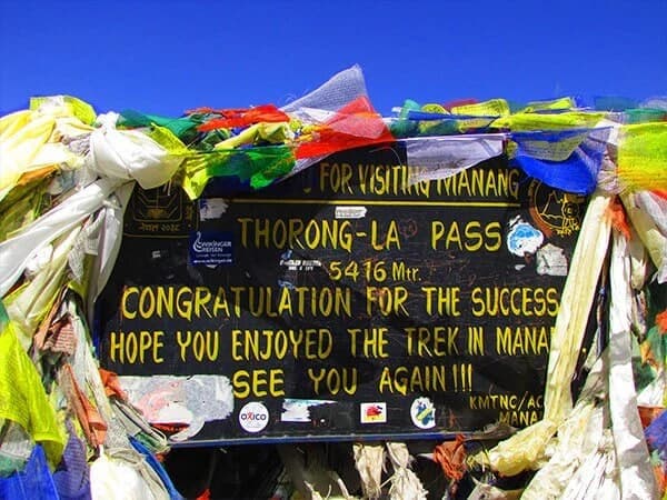
The Annapurna Circuit Trek takes you from the warm river valleys near Kathmandu all the way up to Thorong La Pass at 5,416 meters and then back down toward Muktinath and eventually Pokhara.
The altitude climbs gradually, gives you time to adjust, peaks at one of the highest trekking passes in the world, and then drops fast on the other side.
Understanding that elevation curve before you go makes a real difference in how you plan, how you pace yourself, and how much you enjoy the whole thing.
Plan your Annapurna Circuit Trek with expert guidance from Nepal Gateway Trekking. Start Planning Now
Annapurna Circuit Trek Altitude Overview
The Nepal Gateway Trekking 18-day Annapurna Circuit route starts in Kathmandu at around 1,310 meters. You drive to Chamje at 1,410 meters on Day 2, and from there the trail slowly climbs through lower river valleys, mid-altitude alpine terrain, and eventually high Himalayan passes.
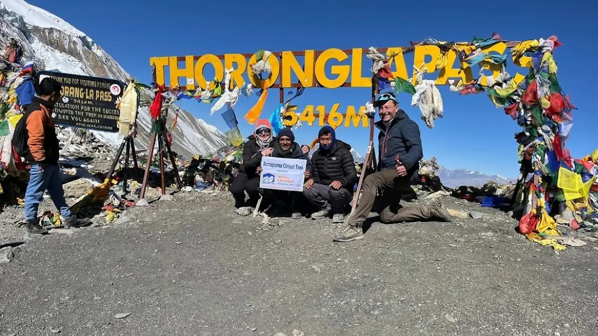
It's basically a long, steady rise, not a sudden jump. That gradual ascent is actually what makes the trek manageable. Your body gets time to adjust at each stage before pushing higher. The highest point is Thorong La Pass at 5,416 meters on Day 10.
After that, it's mostly downhill through Muktinath, Tatopani, and the Ghorepani Poon Hill section before finishing in Pokhara at 820 meters.
Annapurna Circuit Trek Altitude Profile Day by Day
Here's the full elevation breakdown based on Nepal Gateway Trekking's 18-day itinerary:
|
Day |
Place |
Elevation (m) |
|
Day 1 |
Kathmandu |
1,310 m |
|
Day 2 |
Chamje (via Besisahar) |
1,410 m |
|
Day 3 |
Dharapani |
1,860 m |
|
Day 4 |
Chame |
2,670 m |
|
Day 5 |
Upper Pisang |
3,300 m |
|
Day 6 |
Manang |
3,540 m |
|
Day 7 |
Manang (Acclimatization Day) |
3,540 m |
|
Day 8 |
Yak Kharka |
4,050 m |
|
Day 9 |
Thorong Phedi |
4,450 m |
|
Day 10 |
Thorong La Pass → Muktinath |
5,416 m → 3,710 m |
|
Day 11 |
Muktinath to Tatopani (Drive) |
3,710 m → 1,190 m |
|
Day 12 |
Shikha |
2,130 m |
|
Day 13 |
Ghorepani |
2,860 m |
|
Day 14 |
Poon Hill → Tadapani |
3,210 m → 2,630 m |
|
Day 15 |
Ghandruk |
1,950 m |
|
Day 16 |
Nayapul → Pokhara |
820 m |
|
Day 17 |
Pokhara → Kathmandu |
1,310 m |
|
Day 18 |
Departure |
— |
Get the complete 18-day Annapurna Circuit itinerary with altitude details from Nepal Gateway Trekking. View Full Map.
Where the Elevation Gets Serious: Annapurna Circuit Trek altitude profile
The climb feels pretty comfortable until Manang. Most trekkers feel fine up to that point, maybe a bit breathless on steeper sections, but nothing major. After Manang, things change.
From Yak Kharka up to Thorong Phedi and then the pass, the altitude gain is steep and the air is noticeably thinner. Simple things, walking uphill, sleeping, and eating, suddenly feel harder than they should. That's your body working overtime on less oxygen. Totally normal. Just slow down.
Altitude Changes Along the Annapurna Circuit
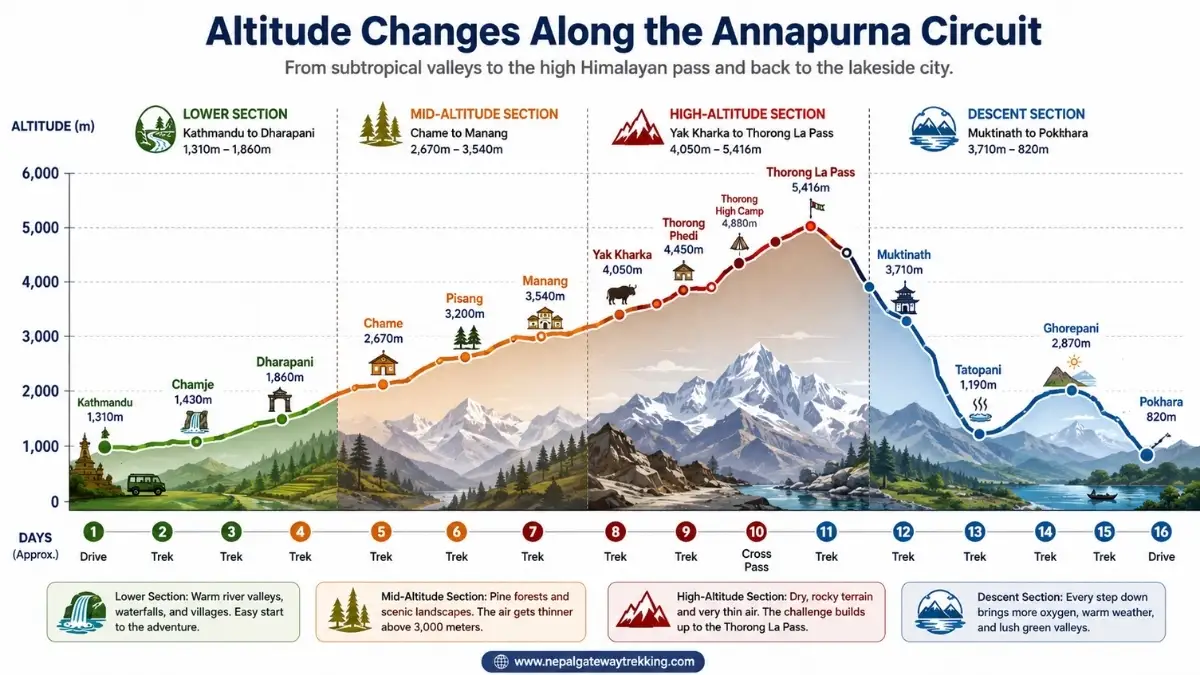
The Annapurna Circuit Trek is not just about reaching Thorong La Pass. It is a journey through changing altitude zones that completely transform the landscape, weather, and trekking experience day by day.
The trek begins in warm river valleys and gradually climbs into the alpine. The terrain reaches the high Himalayan pass at 5,416 meters and then descends into lower valleys again. Understanding these altitude changes helps trekkers prepare mentally and physically for each stage of the adventure.
Lower Section: Kathmandu to Dharapani (1,310m to 1,860m)
This part is mostly a long jeep drive from Kathmandu to Chamje, followed by your first day of actual trekking to Dharapani. It's warm, green, and easy on the lungs. You're walking through river valleys along the Marsyangdi River, passing waterfalls and small villages. Altitude isn't even a thought here.
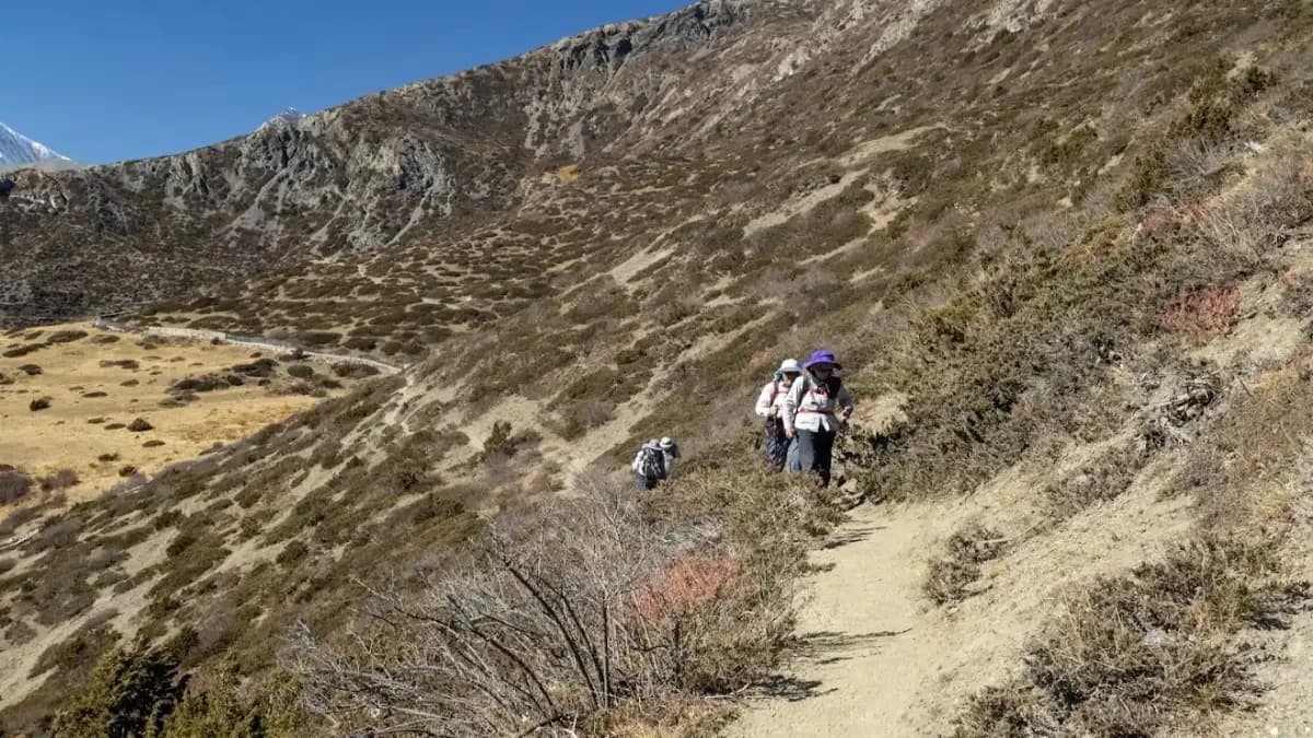
Mid-Altitude Section: Chame to Manang (2,670m to 3,540m)
From Day 4 onwards the scenery shifts completely. Pine forests, snow-capped peaks in the distance, and colder mornings. The air starts feeling a bit thinner above 3,000 meters. You'll notice it on uphills. This is the stage where trekkers start understanding why pace matters. Push too hard here and you'll pay for it later.
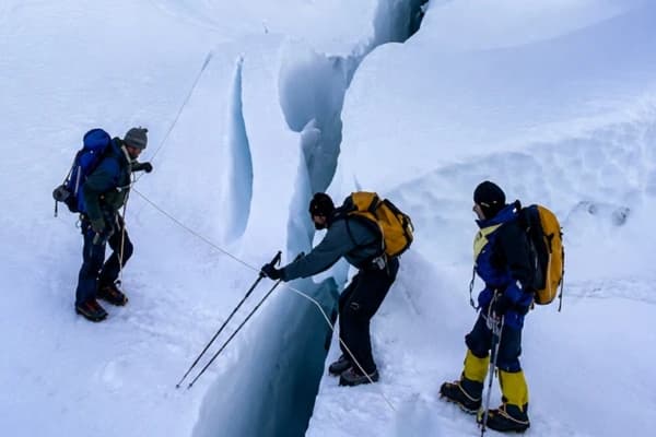
High-Altitude Section: Yak Kharka to Thorong La Pass (4,050m to 5,416m)
This section is the genuine article. Dry scrubland, rocky terrain, and yaks grazing in the distance, with freezing nights. By Thorong Phedi you're at 4,450 meters, and the air is seriously thin.
Some trekkers do an optional hike up to Thorong High Camp at 4,880 meters in the afternoon it's a smart acclimatization move before the big crossing. The pass crossing itself is a pre-dawn start, a steep climb, and an incredible reward at the top.
Descent Section: Muktinath to Pokhara (3,710m to 820m)
After crossing the pass, the descent to Muktinath feels easier. Every step down adds a little more oxygen back into your lungs. From Tatopani onward, there are hot springs, warm weather, and lush green trails again. The Ghorepani Poon Hill section adds a beautiful sunrise finale before the trek wraps up in Pokhara.
Altitude Sickness on the Annapurna Circuit Trek
Altitude sickness happens when your body doesn't get enough time to adjust to lower oxygen levels as you go higher. At sea level, your blood is well oxygenated. At 5,416 meters on Thorong La Pass, you're breathing air with roughly half the oxygen.
Your heart works harder, your breathing gets faster, and your body is basically playing catch-up.
Most trekkers start feeling effects somewhere above 3,000 meters around the Pisang to Manang section. Some feel it earlier. Some barely feel it at all. There's no predicting it based on fitness level, so everyone needs to pay attention.
CommonSymptoms of Altitude Sicknessare as follows:
- Persistent headache the most common first sign
- Nausea or vomiting
- Dizziness
- Feeling exhausted even after rest
- No appetite
- Shortness of breath even when you're sitting still
- Trouble sleeping
Don't brush these off. A mild headache is one thing. But if symptoms are stacking up or getting worse overnight, that's when you need to stop ascending or descend.
When Altitude Sickness Usually Starts in Annapurna Circuit Trek?
Most trekkers start noticing symptoms above 3,000 meters, particularly around Manang and the section toward Yak Kharka. The stretch from Thorong Phedi to the pass is where things get most demanding, so reaching that point without being properly adjusted is a real risk.
Learn how to trek safely at high altitude with Nepal Gateway Trekking's expert guides. Read Altitude Sickness Prevention Guide
Acclimatization Tips for the Annapurna Circuit Trek
The Annapurna Circuit Trek is not only about walking long distances. It is also about giving your body enough time to adjust to high altitudes. As you climb above 3,000 meters, oxygen levels begin to drop, and your body starts working harder even while resting. Proper acclimatization helps reduce the risk of altitude sickness and makes the trek safer and more enjoyable.
Simple habits like resting in Manang, drinking enough water, walking slowly, and understanding how medications like Diamox work can make a huge difference during the trek to Thorong La Pass.
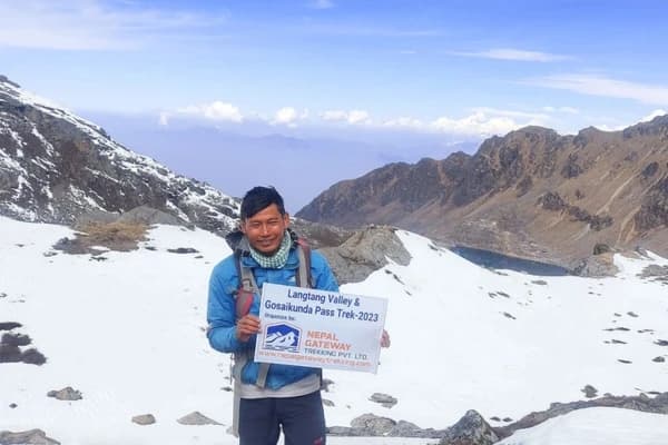
Why Manang Is So Important?
Manang, at 3,540 meters, is your last proper rest stop before the high-altitude push. Nepal Gateway Trekking builds a full acclimatization day here, Day 7, and it matters. You can trek to Gangapurna Lake, Ice Lake (Kicho Tal), Parken Gompa, or Braga Monastery.
These acclimatization treks take you higher during the day but bring you back to sleep at Manang's altitude. That's precisely what your body needs before pushing to Yak Kharka, Thorong Phedi, and eventually the pass. Skip the rest day and you're gambling with your health above 4,000 meters.
Drink Water and Walk Slowly
Three to four liters of water a day is the minimum. Altitude dehydrates you faster than you'd expect, and dehydration makes altitude symptoms worse. Keep sipping constantly, not just when you're thirsty.
And honestly, speed is your enemy above 3,500 meters. Our guides use the "Nepali flat" pace, a slow, steady shuffle that looks almost too effortless but gets you there without wrecking yourself. Fast walkers feel it more, not less.
Diamox and Altitude Sickness Prevention
Diamox (acetazolamide) helps your body produce more red blood cells faster, which basically speeds up acclimatization. Many trekkers use it, especially those who've had altitude sickness before.
But it's not for everyone it has side effects, such as increased urination and tingling in the hands and feet, and it doesn't work for people with certain allergies. Talk to a doctor before your trek, not when you're already at Thorong Phedi wondering what to do.
Final Thoughts
The Annapurna Circuit altitude profile is a long, gradual climb from Kathmandu through lush river valleys and alpine terrain to one of the highest trekking passes in the Himalayas and then a satisfying drop back down to warmth, more oxygen, and hot springs.
Nepal Gateway Trekking's 18-day itinerary builds in proper acclimatization time, especially the rest day in Manang, which genuinely makes the Thorong La crossing safer and more enjoyable.
At the end of the day, the altitude is manageable if you respect it. Go slow. Drink water. Rest in Manang. And if something feels off, say something.
Planning the Annapurna Circuit Trek? Contact Nepal Gateway Trekking for expert guidance, safe high-altitude trekking support, and a team that actually knows these mountains.
FAQs
What is the highest point on the Annapurna Circuit Trek?
Thorong La Pass at 5,416 meters (17,769 feet). It's the hardest day on the trek a pre-dawn start, a steep climb, and thin air all the way to the top.
At what altitude does altitude sickness start on the Annapurna Circuit?
Most trekkers start noticing effects above 3,000 meters, especially around Manang and the sections above it toward the pass.
Why is Manang important during the trek?
Manang, at 3,540 meters, is the main acclimatization stop. Nepal Gateway Trekking builds a full rest day here with optional hikes to Ice Lake and Gangapurna Lake so your body can adjust before the high-altitude push to Thorong La.
How difficult is Thorong La Pass?
It's tough. You're starting at 3–4am in freezing temperatures, climbing steeply for several hours above 5,000 meters with seriously thin air. But with proper acclimatization and a slow pace, most fit trekkers make it across.
What are common symptoms of altitude sickness?
Headache, dizziness, nausea, fatigue, poor sleep, and shortness of breath at rest. Don't ignore them, especially if they're getting worse overnight.
Does descending after Thorong La help recovery?
Yes, noticeably. The drop from the pass to Muktinath at 3,710 meters brings more oxygen, warmer air, and real relief for your body. By the time you reach Tatopani's hot springs, you'll feel like a different person.