When you search for trekking in Nepal, the same routes show up again and again: Annapurna Base Camp (ABC), the Annapurna Circuit, Poon Hill, Mardi Himal, Khopra Ridge, and Tilicho Lake.
What you might not realize at first is that most of these trails sit inside one massive protected region, the Annapurna Conservation Area managed through the Annapurna Conservation Area Project (ACAP) under the National Trust for Nature Conservation (NTNC).
That’s not just a technical detail. It affects the stuff you’ll feel on the ground: where you’ll show your ACAP permit, know why teahouses are so widespread, how villages handle tourism, and why the region has rules about things like drones.
ACAP also explains why Annapurna is one of the easiest places to do teahouse trekking without complicated logistics, especially if this is your first big Himalayan trip.
What is the Annapurna Conservation Area (ACAP)?
Here’s the clean way to think about it while you plan:
- Annapurna Conservation Area (ACA) = The protected area
- Annapurna Conservation Area Project (ACAP) = The program managing it, led by NTNC
In simple terms, the Annapurna Conservation Area is the protected region itself, while the Annapurna Conservation Area Project (ACAP) is the management program that runs it under the National Trust for Nature Conservation (NTNC). Together, they protect landscapes while supporting the people who live and farm inside the region.
Where is ACAP Located?
ACAP is located in north-central Nepal in Gandaki province, and covers a large part of the Annapurna mountain range. It stretches across several districts, including Kaski, Lamjung, Manang, Mustang, and Myagdi. The area spans from low subtropical valleys to high Himalayan terrain, making it one of the most geographically diverse protected regions in Nepal.
Quick Overview of Annapurna Conservation Area
|
Feature |
Details |
|
Established |
1986 (Pilot Project), 1992 (Officially Gazetted) |
|
Governing Body |
National Trust for Nature Conservation (NTNC) |
|
Total Area |
7,629 sq. km (Nepal's largest protected area) |
|
Location / Major Districts |
Annapurna range, North-central Nepal (Kaski, Lamjung, Manang, Mustang, Myagdi) |
|
Altitude Range |
790 m to 8,091 m (Annapurna I Summit) |
|
Flora Diversity |
1,226 species of flowering plants, including 9 species of rhododendron |
|
Fauna Diversity |
105 mammals (e.g., snow leopard, musk deer), 518+ birds, 40 reptiles |
|
Human Population |
Over 100,000 residents from 10+ ethnic groups (e.g., Gurung, Magar, Thakali, Manangi) |
|
Landscape Types |
Subtropical forests, terraced hillsides, rhododendron forests, alpine meadows, high mountain deserts, glaciers |
|
Major Trekking Region |
Annapurna Base Camp, Ghorepani–Poon Hill, Mardi Himal, Manang, Upper Mustang (restricted area) |
|
Major Landmarks |
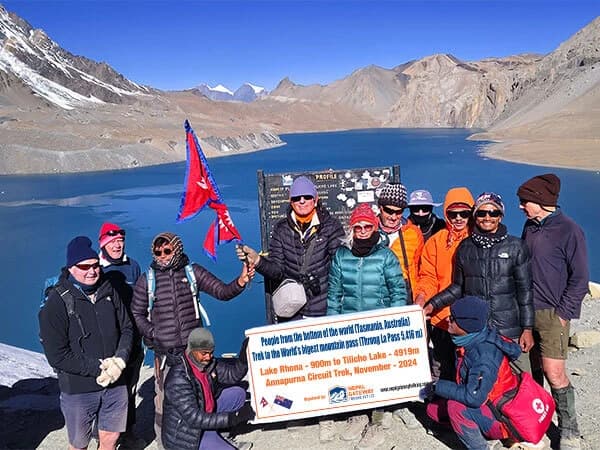
Kali Gandaki Gorge (world's deepest), Tilicho Lake (world's highest), Annapurna Massif |
|
Cultural Highlights |
Buddhist monasteries, Hindu pilgrimage paths, prayer wheels, chortens, local festivals, homestays |
|
HQ Office |
Ghorepani (Field HQ); Pokhara and Kathmandu for permits |
What Makes ACAP Different?
ACAP is different because you can pick your difficulty level without leaving the same conversation area.
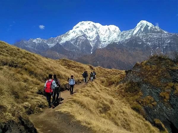
- If you want something shorter and more reliable, you’ll lean toward Poon Hill or a village-based trek near Pokhara.
- If you want quieter ridge scenery with big views, Mardi Himal or Khopra Ridge usually gives you the “Annapurna feel” with less of the main-trail crowd.
- If you want a famous, satisfying finish, Annapurna Base Camp does exactly what people say it does.
- And if you want a real journey, one that forces you to respect altitude and pacing, the Annapurna Circuit is still the long classic, with Thorong La as the headline day.
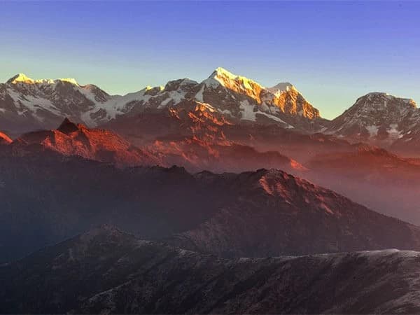
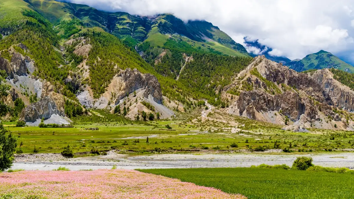
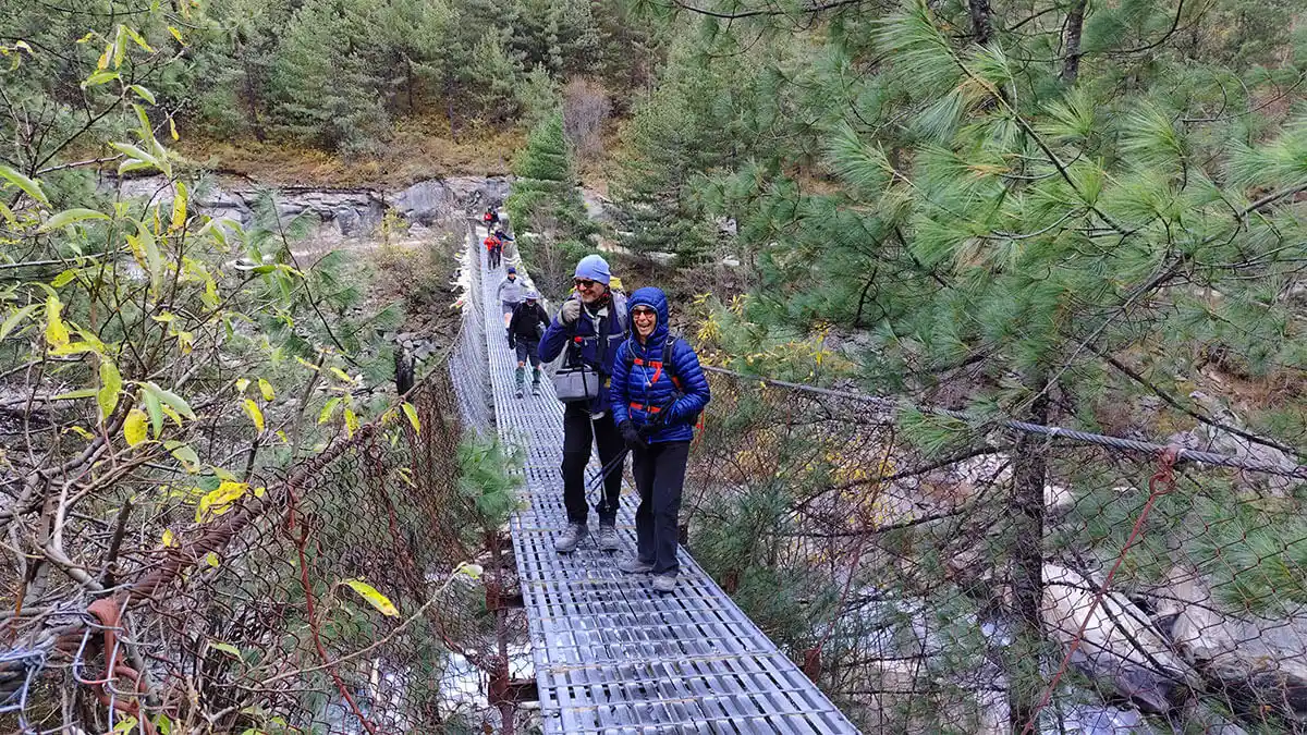
What you’ll probably notice as you move through ACAP is how fast the landscape changes. One week can include green terraces, deep forest, river gorges, high villages, and then dry Mustang-side terrain because the Annapurna range sits between major river systems like the Marsyangdi and Kali Gandaki, and the trekking map follows those natural corridors.
And then there’s the teahouse network. NTNC has noted how extensive lodge/teahouse infrastructure is across ACAP, which is a big reason you can trek here without camping gear on many routes. That’s why Annapurna is often the best place to build confidence in Nepal trekking: you get big terrain, but you’re rarely far from a warm meal and a roof.
Biodiversity: Wildlife and Plants in the ACAP
The Annapurna Conservation Area (ACAP) is way more than just a place for great trekking photos; it’s a massive global hotspot for biodiversity. Because the elevation goes all the way from a low 790m to the peak of Annapurna I at 8,091m, the variety of life here is actually insane. Honestly, it’s one of the most ecologically diverse spots in all of Nepal.
Flora: The Plants of ACAP
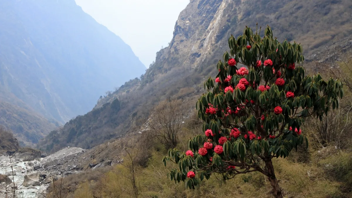
ACAP is home to about 1,226 different types of flowering plants and at least 22 distinct forest types. It’s a pretty spectacular show if you're into nature.
- Rhododendrons: The area around Ghorepani actually has the world’s largest rhododendron forest. Depending on the year, you’ll see anywhere from 13 to 40 species, including the bright red Lali Gurans, which is Nepal’s national flower.
- Orchids: If you keep your eyes peeled while trekking, you might spot some of the 200+ species of orchids that grow at different heights along the trail.
- The Different Zones:
- Lowlands (under 2,000m): It’s mostly subtropical stuff like Sal, Pine, and Oak forests.
- Mid-altitudes (2,000–3,500m): This is where you get the Maple, Fir, and Hemlock, usually mixed in with those thick rhododendron forests that bloom in the spring.
- High Alpine (above 4,000m): Everything gets a bit tougher up here. You’ll mostly see hardy shrubs, juniper, and medicinal herbs like Yarsagumba (that famous "Himalayan Viagra").
Fauna: The Animals of ACAP
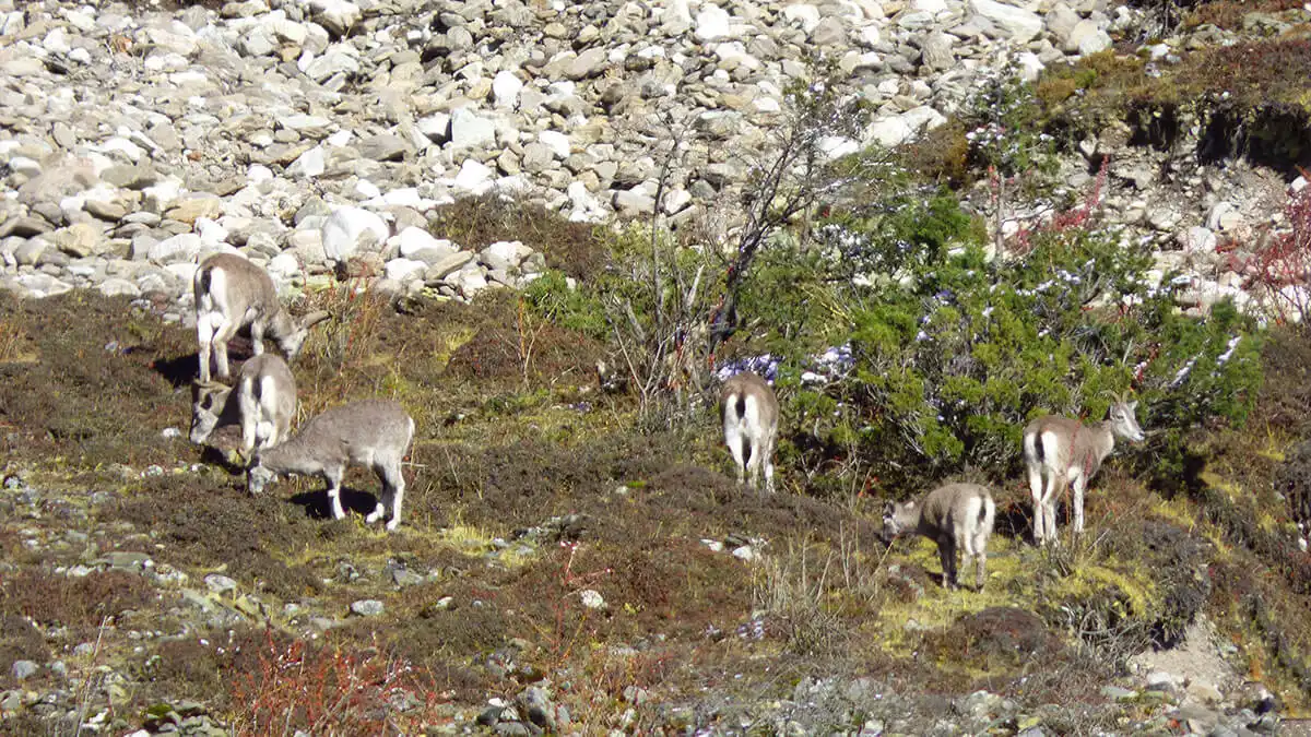
There are over 1,162 species of wild animals living in ACAP, including some that are super rare and endangered.
- Mammals: The Rare Stuff: You’ve got the elusive Snow Leopards, Red Pandas, Musk Deer, and even Clouded Leopards. They’re hard to spot, but they’re out there.
- Common Sightings: You’re much more likely to see Himalayan Tahr, Blue Sheep (Bharal), Gray Langurs, or maybe even a Himalayan Black Bear if you’re "lucky."
- The Locals: The Himalayan Field Mouse is actually unique to this specific region, you won't find it anywhere else on Earth.
- Birds: This is the only place in Nepal where you can find all six types of Himalayan Pheasants. That includes the Himalayan Monal (Danphe), which is Nepal’s national bird and looks like it was painted by an artist.
- Look up, and you’ll see Golden Eagles, Lammergeiers (huge vultures), and the White-rumped Vulture soaring over the peaks.
- Reptiles & Amphibians: There are about 40 types of reptiles and nearly 30 types of amphibians. If you’re really looking, you might find a Himalayan Pit Viper or the rare Himalayan Newt.
Basically, trekking here isn't just about the physical challenge, it’s like walking through a massive, open-air museum of nature. Every turn on the trail puts you closer to some of the rarest plants and animals in the world. You can see the exotic animals of Himalayas in the ACAP.
Culture and Communities in the Annapurna Region
The Annapurna Conservation Area (ACAP) is more than just a place to hike, it’s a massive cultural mix. There are over 100,000 people living here from more than 10 different ethnic groups, so the traditions and festivals change almost as much as the scenery.
What’s really cool is how they run things; it’s a “Community-Based Conservation” model, which basically means the locals are the ones actually managing the forests and trails they live on.
Major Ethnic Groups
The region is kind of split in two. You have the southern slopes, which are lush and green, and the northern side, which sits in a rain shadow and feels much more like Tibet.
- Gurung & Magar: You’ll mostly find them in the southern foothills around places like Ghandruk and Ghorepani. They’re famous for being Gurkha soldiers, and their culture is this interesting mix of Buddhism and an ancient Shamanistic religion called Bon.
- Thakali: These folks are centered in the Thak Khola region of Mustang, like Jomsom and Marpha. They used to be big-time salt traders back in the day, but now they’re famous for running the best mountain lodges and making the legendary Thakali Thali (the meal you’ll probably eat every day).
- Manangi: These are the high-altitude residents of the Manang Valley. Their culture is super tied to Tibet, and you’ll see it in their ancient monasteries and those cool, flat-roofed stone houses.
- Loba: These are the indigenous people of Upper Mustang, who used to be the Kingdom of Lo. They’ve done an amazing job of keeping their traditional Tibetan Buddhist culture alive, almost like a time capsule.
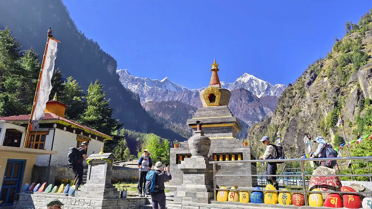
Cultural Highlights
- Monasteries (Gumbas): The trail is dotted with these. Check out the Braga Monastery in Manang or the Lo Gekar Monastery in Mustang, it’s actually the oldest one in the whole region.
- Muktinath Temple: This is a big deal for both Hindus and Buddhists. It’s got 108 water sprouts and a "natural" eternal flame that’s actually fueled by natural gas seeping out of the ground.
- Architecture: It changes fast. In the south, you’ll see stone houses with slate roofs, but once you get into the dry north, everything shifts to white-washed homes with flat roofs.
- Tiji Festival: A massive three-day ritual in Upper Mustang meant to chase away demons.
- Lhosar: The Tibetan New Year. Think traditional dances, lots of energy, and plenty of butter tea.
Sustainable Tourism in ACAP: Teahouse Trekking
ACAP basically invented the "Teahouse Trekking" idea. Instead of bringing tents and camping, you stay in locally-run lodges. This is great because your money goes directly to the families living there, which helps pay for things like local schools, better trails, and even micro-hydroelectric plants.
Accommodation in Teahouses
- Rooms: Usually just simple twin rooms. You get a foam mattress, a pillow, and a blanket, but honestly, bring a good sleeping bag. At high altitudes, the rooms aren't heated and it gets freezing.
- Bathrooms: Down low, you might get a Western flush toilet and a hot shower. Up high, it’s usually a shared squat-style toilet and hot water is a luxury you have to pay extra for.
- Common Areas: The dining hall is the heart of the lodge. It’s got a big stove in the middle where everyone hangs out, eats, and charges their phones.
Meals
ACAP keeps the menus pretty standard, so things stay affordable and easy to manage. Some menu also have famous Nepali foods and drinks.
- Dal Bhat: This is the fuel of the Himalayas. You get lentil soup, rice, and veggie curry. The best part? Free refills on everything but the meat.
- Other Stuff: You can get pancakes or eggs for breakfast, and things like pasta, momos (dumplings), or noodle soup (Thukpa) for dinner.
- Drinks: Plenty of tea and coffee. If you’re feeling adventurous, try the local rice beer (Chhyang) or the local spirit (Raksi).
Cost and Logistics
- Prices go up with the altitude: Remember, everything, even your toilet paper, has to be carried up by a porter or a mule, so expect to pay more the higher you go.
- Eat where you sleep: It’s kind of an unwritten rule (and sometimes a written one). Lodge owners don't make much on the rooms, so they rely on you buying your meals there.
- Water Safety: Don't drink the tap water. Most lodges sell boiled water or have purification stations. It’s better for you and way better for the environment than buying plastic bottles.
How to Reach ACAP?
To get to the Annapurna Conservation Area Project (ACAP), you basically have to head to Pokhara first. It’s the main jumping-off point for almost everything in that region. Once you’re in Pokhara, you just hop in a local ride to the trailhead and start walking.
Step 1: Getting to Pokhara
Most people start in Kathmandu and then make their way over. You’ve got a few ways to do it, depending on your budget and how much time you want to spend on the road.
- By Flight: This is definitely the fastest way. It only takes about 25 or 30 minutes, and if you sit on the right side of the plane, the mountain views are incredible. There are plenty of flights every day, but honestly, try to book one for the morning. Afternoon flights in Nepal get delayed bythe weather all the time.
- By Tourist Bus: This is the go-to for most travelers because it’s cheap. Just be prepared for a long day, it’s supposed to take maybe 8 hours, but with the road work and traffic these days, it can easily turn into 12. Most of these buses leave from Sorhakhutte (near Thamel) around 7:00 AM.
- By Private Car or Jeep: If you want to be comfortable and stop whenever you feel like it, hiring your own ride is the way to go. It’s faster than the bus, usually around 6 hours, but obviously, it’s going to cost you a lot more.
Step 2: From Pokhara to the Trailheads
After you've had a coffee by the lake in Pokhara, you'll need to get to where the actual dirt starts. You can grab a local bus, a micro-van, or just hire a jeep.
- Nayapul: If you’re doing Poon Hill or Annapurna Base Camp, you’ll likely start here. It’s about an hour and a half to two hours from Pokhara.
- Besisahar or Bhulbhule: These are the classic starts for the Annapurna Circuit. It’s roughly a 3-hour drive to get there.
- Ghandruk / Siwai / Jhinu Danda: These spots are great if you’re looking for a shortcut or a shorter trek. You’ll usually want a private jeep to reach these higher points.
- Jomsom: You can actually fly here from Pokhara in about 20 minutes if you’re trekking the northern side, which saves you a massive, bumpy drive.
Step 3: Heading into the Park
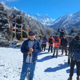
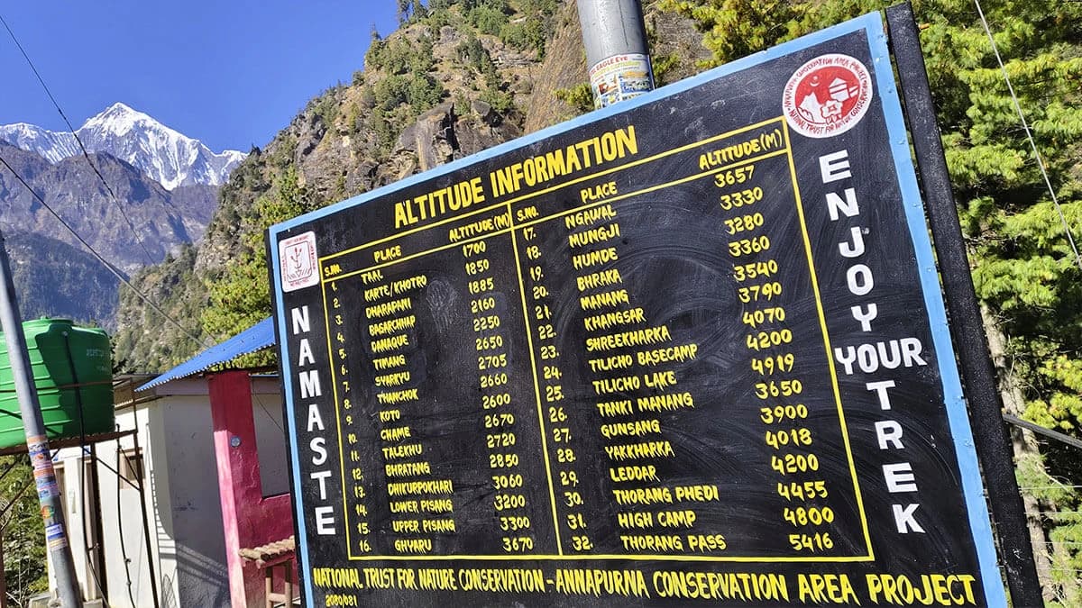
Once you hit the trail, you’re officially on foot. Just don’t forget to keep your ACAP permit and your TIMS card handy. You’ll run into checkpoints pretty quickly, and they will definitely ask to see your papers before they let you pass.
If you trek through Nepal Gateway Trekking, your permits are handled by our team.
Best Treks in the Annapurna Region
The Annapurna Conservation Area (ACAP) is basically the holy grail of trekking. It’s got everything, huge mountain views, deep forests, and these awesome little Gurung and Magar villages where you can really see how people live.
Whether you want something that’ll kick your butt or just a nice walk with a killer sunrise, there’s a trail here for you.
Iconic and Challenging Treks
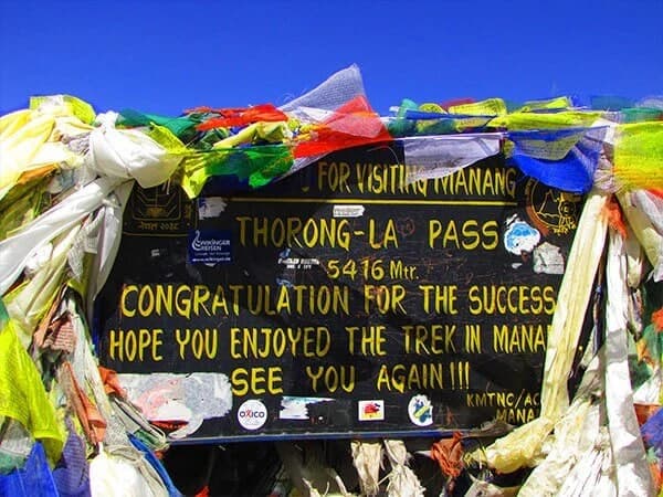
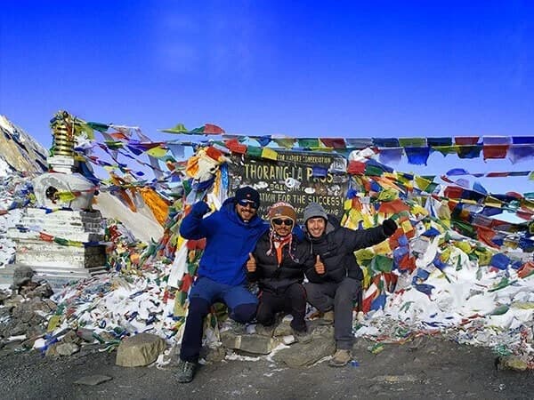
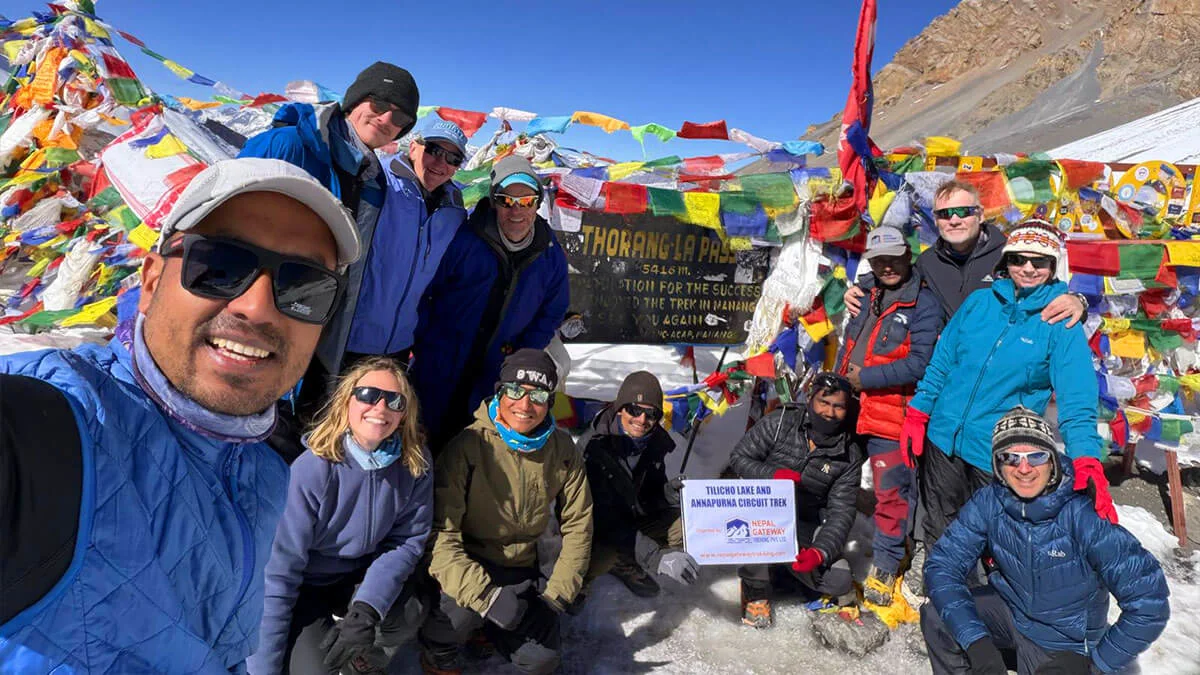
- Annapurna Circuit Trek: This is the big one. It circles the whole Annapurna massif, and honestly, the landscape changes so much it feels like you're in three different countries. You’ll cross high passes like Thorong La (which is no joke at 5,416m) and visit the Muktinath Temple. Highlights definitely include the Kali Gandaki Gorge and the weirdly beautiful alpine deserts of Manang.
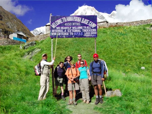
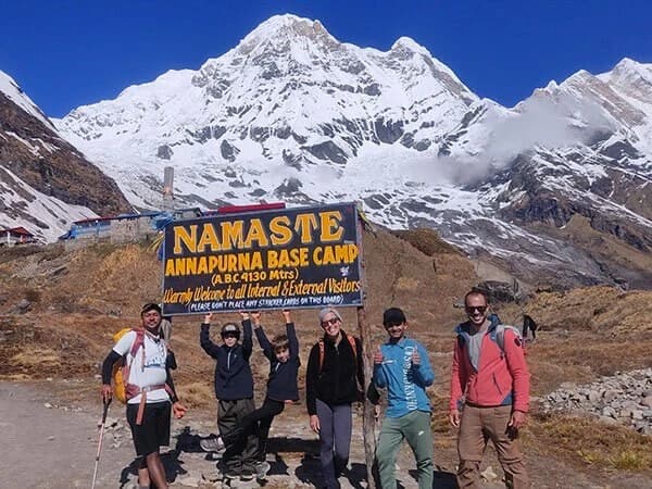
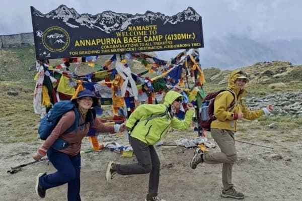
- Annapurna Base Camp (ABC) Trek: If you want to stand right in the middle of a "sanctuary" of giant peaks, this is it. You get panoramic views of Annapurna I and the famous Machhapuchhre (Fishtail). Plus, there’s a natural hot spring at Jhinu Danda near the end, which is basically heaven for your sore legs.
Shorter and Scenic Treks
- Ghorepani Poon Hill Trek: This is the classic "short" trek. It’s famous for the sunrise over the Annapurna and Dhaulagiri ranges. You’ll hike through massive rhododendron forests, if you go in the spring, the whole mountain is basically pink and red.
- Mardi Himal Trek: This one has become super popular lately because it’s a bit quieter. It’s a ridge trek, so you’re walking along a high spine with the mountains right in your face. It gives you a really intimate view of Machhapuchhre that you can't get anywhere else.
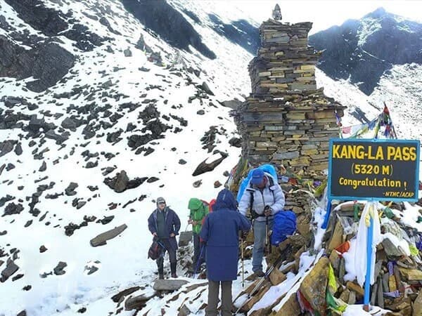
- Khopra Ridge Trek: If you’re over the crowds, go to Khopra. It’s more remote, the views of Dhaulagiri are insane, and you stay in community-run lodges. If you’re feeling brave, you can even do the side hike up to the sacred Khayer Lake at 4,660m.
ACAP Treks at a Glance
|
Trek Name |
Altitude Range |
Highlights |
Difficulty |
|
Annapurna Circuit |
760 m – 5,416 m |
Thorong La Pass, Muktinath, Kali Gandaki |
Moderate to Strenuous |
|
Annapurna Base Camp |
1,070 m – 4,130 m |
Annapurna Sanctuary, Jhinu Hot Springs |
Moderate |
|
Ghorepani Poon Hill |
1,070 m – 3,210 m |
Poon Hill Sunrise, Rhododendron forests |
Easy |
|
Mardi Himal |
1,000 m – 4,500 m |
Ridge trail, close-up Fishtail views |
Moderate |
|
Khopra Ridge |
Khopra Ridge |
Dhaulagiri views, Khayer Lake, quiet trails |
Moderate |
ACAP Permit & TIMS
To trek through the Annapurna Conservation Area, you must carry a TIMS card(Trekker’s Information Management System Card) and an ACAP permit. These permits are issued in Kathmandu, Pokhara, or you can also contact a trekking agency like Nepal Gateway Trekking for easy permit issuance.
ACAP permit (Annapurna Conservation Area Project Entry Permit)
According to NTNC and Nepal Tourism Board (NTB) guidelines, all foreign trekkers entering the Annapurna Conservation Area must carry a valid ACAP permit, and certain routes also fall under revised TIMS regulations.
Here’s what NTNC’s official permit portal lists right now:
- NPR 3,000 for foreigners
- NPR 1,000 for SAARC nationals (tax included)
- Kids under 10: no permit required
- 2.9% payment gateway charge for online payment
- Double fees if your permit is issued at a check-post
- Drones prohibited unless you have prior approval
Tip: Get the permit before you’re “on the clock.” If you’re starting from Pokhara and heading into the hills, it’s easy to leave this too late and turn a smooth start into admin stress.
The Trekkers' Information Management System (TIMS) Card
So, the Trekkers' Information Management System (TIMS) Card is basically a mandatory permit you’re going to need for most of the popular trails in Nepal.
It’s mostly there for safety, which sounds a bit official, but it actually helps the government keep tabs on where you are in case something goes sideways, like a bad storm or an emergency. Also, because of those 2023 rule changes, this card is tied into the whole thing, where foreign trekkers now have to have a licensed guide with them.
Since April 1, 2023, the rules have been a lot stricter. They don't give TIMS cards to "Free Individual Trekkers" anymore. Now, if you're a foreigner, you have to book through a registered trekking company and have a licensed guide walking with you.
- Validity: The card only works for one trip in the specific area you're visiting. Once you're done with that trek or the time runs out, that's it.
- Carrying the Card: Make sure you keep this thing on you at all times. You’ll run into different checkpoints along the trail, and the officers there will definitely want to see it.
Cost
The price for a TIMS card changes depending on where you’re from. You usually pay in Nepalese Rupees (NPR), but some of the agencies might let you pay in USD if you ask.
|
Nationality |
Cost per Person (with a guide) |
|
Foreign National |
NPR 2,000 (roughly $15-20 USD) |
|
SAARC National |
NPR 1,000 |
Note on 2026 Regulations
Just a heads-up, even though the TIMS card has been the "standard" for a long time, things are shifting. Some places, like the Everest/Khumbu region, have started doing their own local permits instead. There’s a lot of talk about making the whole system simpler this year, so honestly, just check in with your agency a few days before you fly out to see if anything has changed at the last minute.
Best Time to Visit ACAP
You’ll hear two seasons again and again for Annapurna trekking, and honestly, the crowd is right. For most trekkers, the best time to trek Annapurna is Autumn (September–November) for clear skies, or Spring (March–May) for warmer days and forest colour. Winter works on lower routes, while monsoon suits experienced trekkers seeking solitude.
Autumn (September–November)
This is the classic window: more stable weather after the monsoon and generally the best mountain visibility. It’s also the busiest season on popular corridors like ABC and the Circuit.
Spring (March–May)
Spring is warmer, and lower trails can be beautiful with forest color (especially rhododendron zones). Visibility can still be great, though you may get occasional haze depending on weather patterns.
Winter (December–February)
If you stick to lower routes, winter can be quiet and crisp. But if you’re aiming for high points like Thorong La, you need flexibility: snow and storms can shut things down fast.
Monsoon (June–August)
You’ll get lush hills and fewer trekkers, but also more clouds, rain, leeches on lower trails, and fewer “perfect view” mornings. Monsoon can be great if you’re experienced and you want solitude, but it’s not the easiest first-time choice.
Planning Your ACAP Trek
Planning a trek in the Annapurna region isn’t exactly rocket science, but honestly, doing a little bit of homework ahead of time makes a massive difference. If you prepare the right way, your trip will be way smoother and a lot less stressful. Here are some basic, practical tips to help you get everything sorted.
- Get the Right Permits Early: You’re going to need an ACAP permit and, usually, a TIMS card, which your trekking agency will handle for you. Just a heads-up: keep these papers somewhere safe but easy to reach. You'll hit plenty of checkpoints along the trail where the officers are going to want to see them.
- Follow the Guide Rule: If you’re a foreign trekker, you actually have to have a licensed guide with you now; it’s mandatory. Besides following the law, having a guide is just smarter. They’re great for safety, they know exactly where they’re going, and they make sure you’re sticking to the local rules.
- Choose the Best Season: Spring (March to May) is awesome because all the flowers are blooming and the mountain views are super clear. Autumn (September to November) is also great since the weather is usually solid and the trails are pretty lively. Winter gets freezing, and the monsoon season is just wet and messy, so definitely pick your dates carefully.
- Pack Smart, Not Heavy: Layers are your best friend. Mountain weather changes its mind constantly, so you need to be ready. Spend the money on good trekking shoes, warm clothes, and some actually waterproof rain gear. If you try to save money here, you're probably going to be pretty miserable on the trail.
- Acclimatize Properly: Don't try to be a hero, just walk at a steady pace and actually take those acclimatization days. If you rush, you're way more likely to deal with altitude sickness, and that'll turn a fun adventure into a serious problem real fast.
- Carry Enough Cash: Don’t count on finding an ATM once you start hiking because they’re basically non-existent. Make sure you have enough Nepali rupees on you to pay for your food, your room, and all those little snacks or drinks you'll want along the way.
- Respect Local Culture: It’s the little things that matter. Dress modestly, always ask before you start snapping photos of people, and just be nice to the locals. A friendly attitude and a bit of respect go a long way up there.
- Don’t Rely on “Trail Luck”: You might hear people say the rules are flexible or that nobody checks permits in certain spots, but don’t listen to that. Checkpoints can happen anywhere, at any time. It's much better to stick to the official regulations instead of following some random advice you heard at a bar.
Bottom line: if you plan things out, keep a steady pace, and show some respect for nature and the people living there, the Annapurna region is going to give you some pretty unforgettable memories.
If You’re Not into Trekking Much
You don’t have to commit to a full Annapurna Circuit trek to feel the Annapurna region. If your time is short, your fitness is average, or you’re travelling with family, you can still get an “ACAP experience” that feels real.
Base yourself in Pokhara
Pokhara is the easiest launch point for the Annapurna Conservation Area. From here, you can do short hikes, village stays, and sunrise viewpoints without a big logistical build-up.
Do a “village + views” day (or 2–3 days)
- Ghandruk is the classic: culture, stone villages, and that first “wow” moment when the Annapurna range opens up.
- Australian Camp / Dhampus style routes (if you want gentle walking) are great for a light Annapurna taste.
- If you want something that still feels like trekking, a short Poon Hill-style itinerary works even for beginners.
Your Goal on a Short Plan
You’re basically chasing three things: mountain views, village life, and a few hours on real trails. That’s enough for most people to understand why the Annapurna Conservation Area Project (ACAP) matters and why this region keeps pulling people back.
Final Thoughts: Why ACAP Still Sets the Standard for Trekking in Nepal
The Annapurna Conservation Area Project is more than a permit system or a protected boundary. It’s a working model of how conservation, tourism, and mountain communities coexist. Whether you’re watching the sunrise from Poon Hill, walking into the Annapurna Sanctuary, or crossing Thorong La, you’re moving through a landscape shaped by both nature and people.
Plan well, respect altitude, trek responsibly, and give yourself time. ACAP rewards patience, and for many trekkers, it becomes the place they measure every future Himalayan journey against. Contact Nepal Gateway Trekking to handle your ACAP experience.
Frequently Asked Questions
What’s the biggest conservation area in Nepal?
The biggest conservation area in Nepal is Annapurna Conservation Area (ACAP). It’s massive, covering about 7,629 sq. km. To give you an idea of the scale, it spreads across five districts: Kaski, Lamjung, Manang, Mustang, and Myagdi.
What exactly is a Category 6 protected area?
It might sound like legal jargon, but Category VI is simply a label used by conservation organizations. It means the area isn’t just a “look but don’t touch” zone. Locals can live, farm, and use natural resources responsibly, striking a balance between people and nature.
What does "ACAP permit" actually stand for?
It stands for the Annapurna Conservation Area Project Permit. You need this permit if you’re planning to trek in the region. It helps fund trail maintenance and supports the local communities you’ll be visiting.
When did the Annapurna Conservation Area start?
ACAP began as a pilot project in 1986. It worked so well that the government officially recognized it in 1992, and it has been managed by the National Trust for Nature Conservation (NTNC) ever since.
How many conservation areas are in Nepal?
Nepal currently has 6 conservation areas, along with 12 national parks. Each one is designed to protect wildlife while ensuring that the people living there can continue their livelihoods.
Where does the name "Annapurna" come from?
The name comes from Sanskrit and translates to “Goddess of Harvest and Food.” For locals, the mountains aren’t just scenery, they’re sacred symbols of abundance and nourishment.
Is trekking in the Annapurna region dangerous?
Like any high-mountain adventure, there are risks. While the media often highlights accidents on the peaks, trekking is generally safe if you’re prepared.