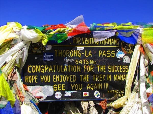
Thorong La Pass is the highest point on the Annapurna Circuit at 5,416 meters (17,769 ft). It connects the village of Manang with the sacred Muktinath Temple in central Nepal. All trekkers must hire a licensed guide. The best months to cross are March–May and October–November. Crossing requires a 4:00 AM start and takes 8–10 hours of strenuous hiking.
Thorong La Pass at a Glance
Here's what you need to know at a glance:
- Elevation: 5,416m / 17,769 ft
- Oxygen Level: ~50% of Sea Level
- Pass Day Distance: 15 km (Phedi → Muktinath)
- Difficulty: Strenuous (Grade 4/5)
- Permits: ACAP (3,000 NPR) + TIMS (2,000 NPR)
- Mandatory Requirement: Licensed Trekking Guide (NTB Rule)
Where is Thorong La Pass Located?
Thorong La sits in central Nepal, smack in the middle of the Damodar Himal range. Honestly, the location is what makes it so special.
The pass acts as a natural bridge between two completely different worlds. On the eastern side, you've got Manang village at 3,540 meters, surrounded by lush Marsyangdi Valley greenery. On the western side? You drop down into Muktinath and the arid, windswept landscape of Lower Mustang.
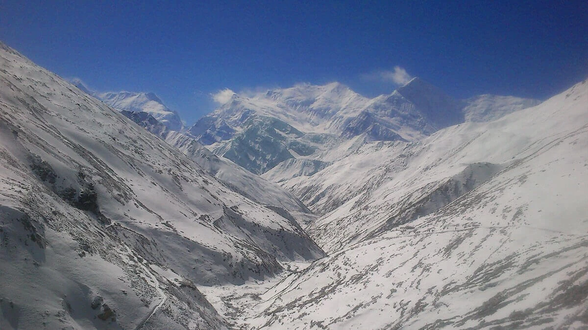
The geographic context is pretty wild. You're basically crossing from the wet side of the Himalayas to the rain shadow side. Behind you, the Marsyangdi River carves through deep valleys. Ahead, the Kali Gandaki Gorge, the world's deepest gorge, waits on the other side of the pass.
The coordinates, if you're into that sort of thing, are roughly 28.8020° N, 83.9410° E. But honestly, when you're up there gasping for air at 5,416 meters, coordinates are the last thing on your mind.
Why is Thorong La Pass the Major Highlight of the Annapurna Circuit?
Crossing Thorong La Pass isn’t just another high-altitude trek. It’s the kind of climb that tests your legs, lungs, and patience, but rewards you with views and experiences you won’t forget. From extreme elevation to dramatic landscape changes and spiritual landmarks, it’s the heart of the Annapurna Circuit.
The Geographical Apex: Higher than Everest Base Camp (5,364m)
Yeah, you read that right. At 5,416 meters, Thorong La Pass is actually 52 meters higher than Everest Base Camp. Most people don't realize this, but you're reaching extreme altitude without needing any technical climbing skills.
The pass touches the edge of the Tibetan plateau. You're literally standing on the threshold between two massive geographic zones.
The "Two-World" Shift: From lush Marsyangdi valley to arid Mustang landscape
This is what gets people. The landscape transformation is borderline surreal.
You spend days hiking through the Marsyangdi valley, green forests, terraced fields, and rhododendron blooms in spring. Then you cross Thorong La, and suddenly you're in a completely different climate zone.
The Mustang side is dry, windy, and barren. It looks like you've been teleported to Tibet. Basically, you have the rain shadow side of the Himalayas. The Annapurna massif blocks all the monsoon moisture, creating this high-altitude desert.
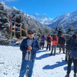
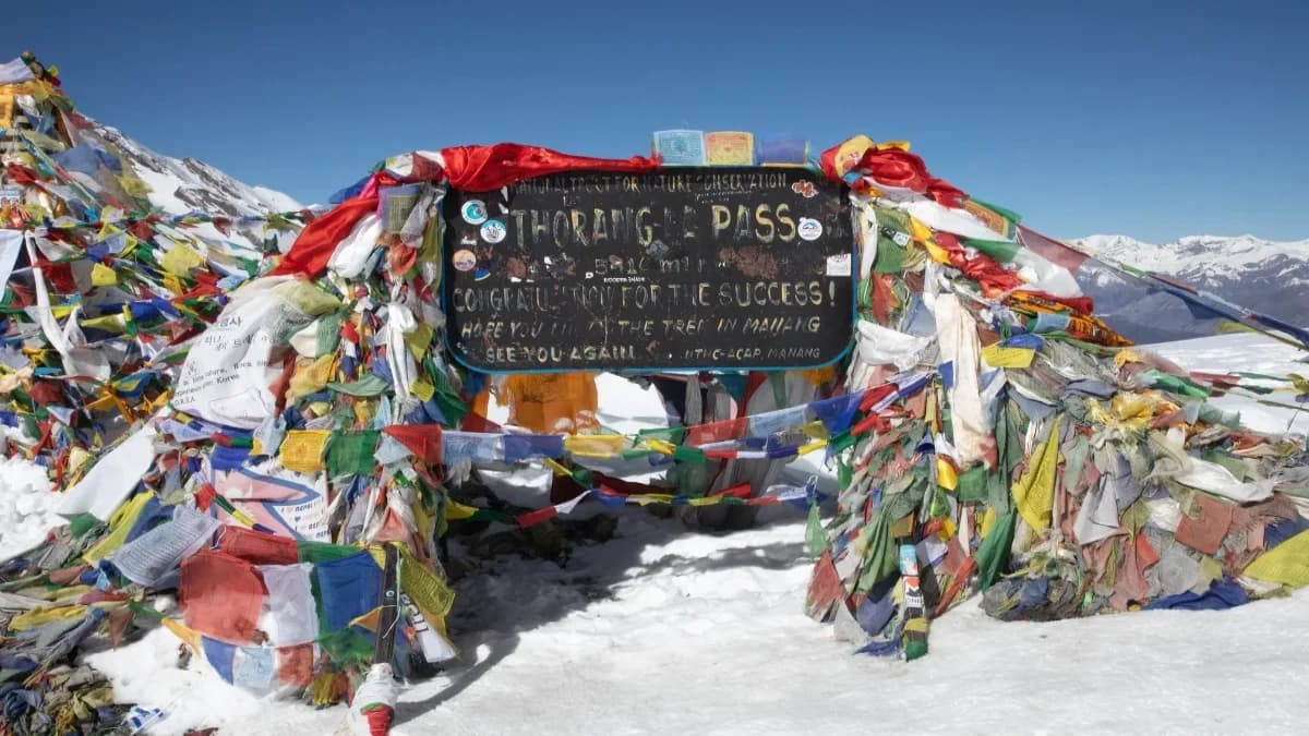
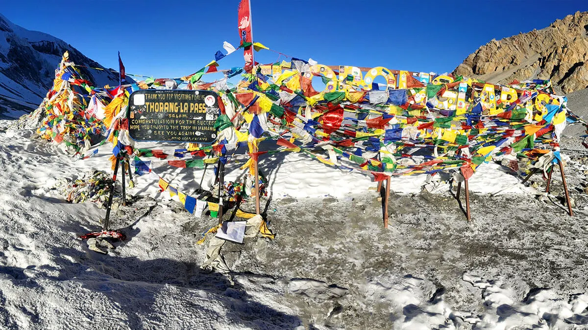
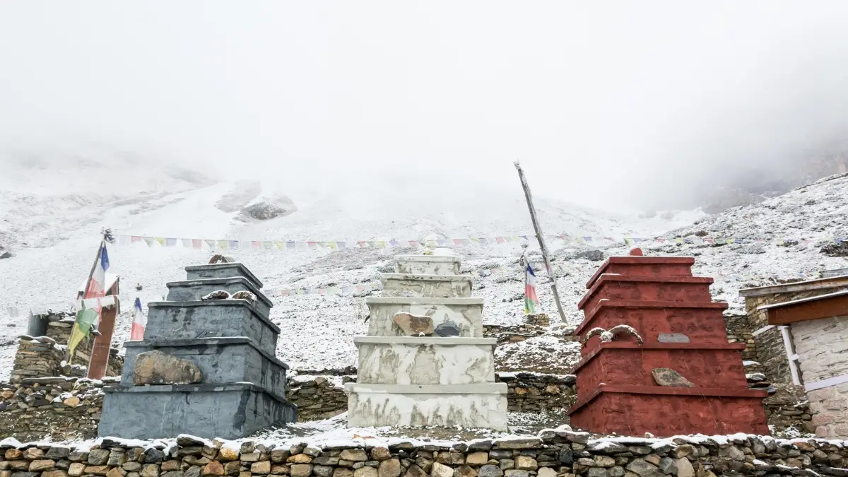
Spiritual Milestone: Summit prayer flags and descent to 108 waterspouts of Muktinath
The summit itself is marked by thousands of prayer flags snapping in the wind. There's a chorten (Buddhist shrine) and usually a crowd of exhausted, elated trekkers taking photos.
But the spiritual payoff comes when you descend to Muktinath. This sacred site has 108 water spouts (representing the 108 desires in Buddhism) and is holy to both Hindus and Buddhists. After the brutal pass day, reaching Muktinath feels like arriving at an oasis.
Top 10 Highlights Along the Thorong La Trail
Along the Thorong La trail, it’s not just the summit that sticks in your memory. There are small moments, sights, and experiences along the way that make the trek truly unforgettable.
1. Gangapurna Lake, Manang – A glacial lake with mirror-like reflections of Gangapurna peak. Perfect acclimatization day trip.
2. HRA Altitude Lecture – The Himalayan Rescue Association gives free lectures in Manang about altitude sickness. Boring but potentially life-saving.
3. Ice Lake (Kicho Tal) side trip – Optional day hike from Manang. Turquoise alpine lake at 4,600m that'll blow your mind.
4. Suspension bridges of the Marsyangdi River – Wobbly bridges hundreds of meters above roaring white water. Not for the faint of heart.
5. Zig-Zag climb to High Camp – That relentless switchback climb from Thorong Phedi. Your legs will hate you.
6. Prayer Flag Summit – The moment you crest the pass and see the explosion of colorful flags. Pure relief mixed with euphoria.
7. Dhaulagiri (8,167m) viewpoint – On a clear day from the pass, you can see Dhaulagiri, the world's seventh-highest mountain, in all its glory.
8. The 108 spouts of Muktinath – Sacred water flowing from 108 bronze taps. Pilgrims bathe here. You'll just want to collapse.
9. Apple Brandy in Marpha – After crossing the pass, the apple orchards of Marpha produce some surprisingly good brandy.
10. Star-gazing at 4,500m – At Thorong Phedi or High Camp, the night sky is absolutely insane. Zero light pollution, crystal-clear mountain air.
Want to experience all these highlights yourself? Nepal Gateway Trekking can arrange guides, teahouses, and your full Annapurna Circuit itinerary. Get your trek plan now.
Is the Thorong La Pass Difficult?
Yes, Thorong La Pass is challenging, but not because it’s technical. The difficulty comes from high altitude, steep climbs, and the physical demands of a long, strenuous trek.
Physical Demands
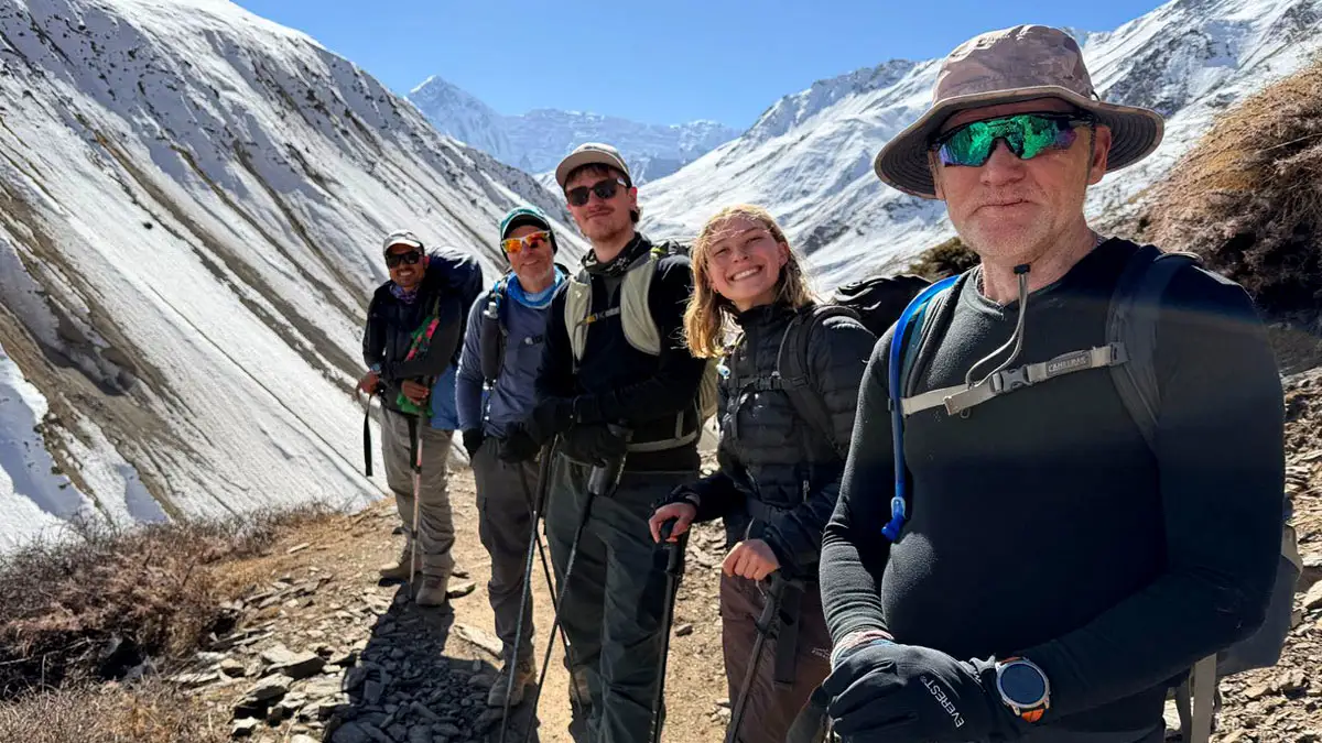
The Thorong La Pass difficulty for beginners is real; this is not a casual weekend hike. It's a non-technical trek, meaning you don't need ropes or ice axes, but you absolutely need high endurance.
Daily distances range from 7–10 km, which doesn't sound like much. But when you're climbing from 4,450m to 5,416m, every step feels like you're dragging a piano.
The terrain is rocky, sometimes icy, always steep. Your heart will pound. Your lungs will burn. This is normal at altitude.
Altitude & Thin Air
At the summit, oxygen levels are roughly 50% of sea level. Let that sink in. You're breathing half the oxygen you're used to.
Understanding hypoxia is crucial. Your body can't get enough oxygen to function normally. This leads to AMS (Acute Mountain Sickness) headaches, nausea, dizziness, and the works.
Even super-fit marathon runners can get altitude sickness. It's not about fitness; it's about blood chemistry and how your body adapts.
Descent Challenges
Here's what nobody warns you about: the descent is brutal.
From the summit to Muktinath, you drop 1,600 meters in about 4 hours. That's a knee-destroying, quad-burning slog down loose scree and potentially black ice.
Most injuries happen on the descent. Your legs are already exhausted from the climb, and now you're asking them to control your body weight down a steep, slippery slope.
Trekking poles aren't optional; they're mandatory. Your knees will thank you.
Challenges and Risks at Thorong La: What Every Trekker Must Respect
Crossing Thorong La isn't a technical climb, but it's absolutely a high-altitude endurance event. Preparation isn't just recommended, it's critical.
1. The Invisible Threat: Altitude Sickness (AMS, HAPE, HACE)
At 5,416 meters, you're in the danger zone.
Oxygen at the summit is only ~50% of sea level. Even incredibly fit trekkers can suffer because altitude sickness isn't about fitness, it's about how your blood adapts to low oxygen.
The real danger zones are Thorong Phedi (4,450m) and High Camp (4,880m). You're sleeping at these altitudes the night before your crossing, which means your body is already stressed before you even start.
Warning Signs to watch for:
- Headache that won't go away, even with water and ibuprofen
- Complete loss of appetite (not just "I'm tired of dal bhat" but genuine nausea)
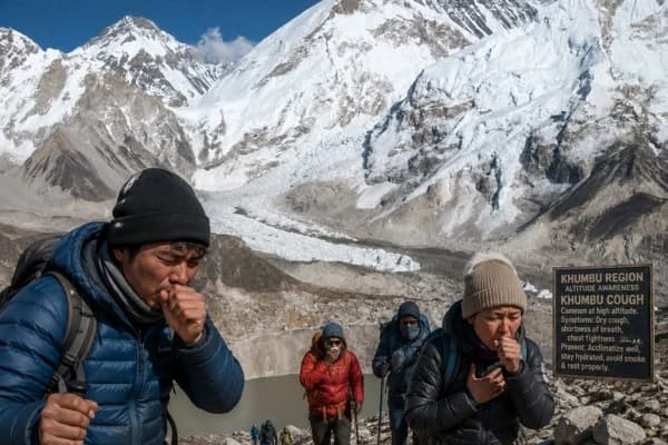
- The infamous Khumbu Cough is a rattling, hacking cough that won't stop
- Feeling drunk or dizzy when you're stone-cold sober
The red line is loss of coordination. If you can't walk a straight line, if you're stumbling over nothing, that's HACE (High Altitude Cerebral Edema). You need to descend immediately. Not tomorrow. Not in an hour. Now.
HAPE (High Altitude Pulmonary Edema) is equally dangerous as fluid in your lungs. You'll feel like you're drowning on dry land. Gurgling sounds when you breathe. Descend immediately.
2. The "Wind Tunnel" & Harsh Weather Extremes
Thorong La sits in a natural wind tunnel between Khatung Kang and Yakawa Kang peaks. The geography funnels wind straight through the pass.
There's this unspoken rule: the 10:00 AM cutoff. After 10 AM, winds pick up dramatically. Wind chill can drop temperatures to -20°C (-4°F) or worse. What feels manageable at dawn becomes genuinely dangerous by mid-morning.
This is why everyone starts hiking at 4:00 AM. You're not just racing daylight, you're racing the wind.
Snow blindness is a real risk. The sun at 5,400 meters is intense, and when it reflects off snow, it can literally burn your corneas. Category 4 glacier goggles are essential, not optional.
3. The 2014 Legacy: Unpredictable Storms
October 2014. Cyclone Hudhud.
In just 12 hours, 1.8 meters of snow fell on Thorong La. Forty-three people died: trekkers, guides, and locals. Some froze to death. Others were buried in avalanches. The storm came during what's supposed to be the "safe season."
The lesson? Peak trekking season does not equal safe season. Mountain weather is fundamentally unpredictable.
Updates: Things have improved. Many lodges now have Starlink satellite internet. Weather forecasting is better. There's real-time tracking of wind patterns. But the mountains don't care about technology.
If your guide in Manang says, "We're waiting another day," you wait. Period. Local knowledge beats your trekking schedule every single time.
4. Physical & Mental Exhaustion (The "Big Day" Burnout)
The day is long. Really long.
You start at 4:00 AM in the freezing dark. You climb for 5-6 hours. Your body is running on fumes because you couldn't sleep well at 4,500 meters. You reach the summit. And then, and this is the killer, you still have that 1,600m descent.
Loose screen on the western side. Black ice in the morning. Your legs are rubbery. Your brain is foggy from altitude. This is when people make mistakes.
The mental side is sneaky. You'll hit false summits thinking you're almost there, only to realize you've got another hour of climbing. It's demoralizing. You start questioning why you even attempted this.
Energy drain at 5,000m is exponential. Every step takes conscious effort. Your body is screaming for oxygen that isn't there.
You might be interested: Symptoms of Altitude Sickness
5. Navigation & Trail Risks (Mandatory Guide Rule)
A licensed guide is mandatory for Thorong La Pass. This isn't the government being bureaucratic; it's a safety measure that actually makes sense.
Guides prevent people from getting lost in whiteout conditions. They know which sections are avalanche-prone. They have GPS, internal maps downloaded offline, and most importantly, local knowledge.
In good weather, the trail is obvious. But the weather changes fast. Clouds roll in. Visibility drops to ten meters. Suddenly, you're guessing where the trail goes. This is how people die.
Plus, if you get AMS, you're not thinking clearly. You might insist you're fine when you're objectively not. A good guide will recognize symptoms before you do.
Summary Table: Risk vs Mitigation
|
Risk |
Mitigation Strategy |
|
AMS / HACE |
Spend at least 2 nights in Manang; drink 4+ liters of water daily; ascend slowly |
|
Frostbite |
Start at 4:00 AM; wear high-quality liner gloves + insulated mittens |
|
Knee Injury |
Use trekking poles on the 1,600m descent; go slow, control every step |
|
Getting Lost |
Mandatory licensed guide; carry offline GPS maps as backup |
|
Snow Blindness |
Category 4 UV protection sunglasses or glacier goggles |
The key insight: every risk on Thorong La is manageable with proper preparation. But skip one precaution, and things can go sideways fast.
Recommended Read: Altitude Sickness Prevention
How to Reach Thorong La Pass: Route Details & Access Points
Getting to Thorong La starts long before you hit the trail.
The Starting Point: Kathmandu to the Trailhead
Everything begins in Kathmandu. From there, you've got options:
- Option 1: The classic route – Take a 5–7 hour bus or 4WD to Besisahar. This is the traditional starting point.
- Option 2: The jeep head-start – Road construction has changed everything. You can now take a jeep from Besisahar all the way to Chame (2,670m) or even Dharapani (1,860m). This cuts several days off the trek.
Honestly? The jeep rides are dusty, uncomfortable, and kind of ruin the gradual immersion into mountain life. But if you're short on time, they exist.
One non-negotiable rule: you must approach Thorong La from the east (Manang side). West-to-east crossings (Muktinath to Manang) are dangerous because you don't get proper acclimatization time.
Strategic Access Points
- East Side (Ascent): The standard route goes Chame → Pisang → Manang → Yak Kharka → Thorong Phedi/High Camp → Summit
- West Side (Descent): After crossing, you descend to Muktinath → Jomsom. From Jomsom, you can either trek to Pokhara (another week) or take a 20-minute flight.
Most people take the flight. After Thorong La, you're pretty much done with high-altitude suffering.
Daily Distances & Trail Insights: Thorong La Pass Section
Here's the reality of the final push to the pass:
Acclimatization Buffer (Manang to Thorong Phedi & High Camp)
|
Day |
Route Segment |
Elevation (m) |
Distance (km) |
Walking Time |
|
01 |
Manang → Yak Kharka |
3,540 → 4,050 |
9.5 |
4–5 hrs |
|
02 |
Yak Kharka → Thorong Phedi |
4,050 → 4,450 |
7 |
3–4 hrs |
|
03 |
Thorong Phedi → High Camp |
4,450 → 4,880 |
1.5 |
1–2 hrs |
These distances look short on paper. In reality, they feel endless.
The day from Manang to Yak Kharka is relatively gentle, gradual climbing through alpine meadows with yaks grazing. Views of Annapurna IV and Gangapurna keep you motivated.
Yak Kharka to Thorong Phedi gets steeper. Vegetation disappears. The air gets noticeably thinner. By the time you reach Phedi, you're at 4,450m and probably feeling it.
That last push from Phedi to High Camp is brutal. Only 1.5 kilometers, but it's straight uphill. Some people opt to stay at Phedi instead because sleeping at 4,880m can be rough. Cheyne-Stokes breathing (that weird stop-start breathing pattern at altitude) keeps you awake.
Crossing Thorong La Pass: Famous Treks
Thorong La Pass features in several trekking routes, from classic loops to adventurous peak climbs. Each trek offers a different mix of scenery, challenge, and cultural experiences, so choosing the right one depends on your time, fitness, and interests.
Thorong La isn't just one trek; it's the centerpiece of several routes:
- Classic Annapurna Circuit Trek – The full loop, 12–18 days depending on where you start and finish. This is the gold standard.
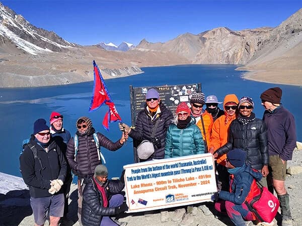
- Annapurna Circuit with Tilicho Lake – Add a detour to Tilicho Lake (4,919m), one of the world's highest lakes. Adds 3–4 days, but worth it if you've got time.
- Short Annapurna Circuit – Jeep-assisted version. Skip the lower sections, start from Chame, and finish at Jomsom. Can be done in 8–10 days, but feels rushed.
- Nar Phu Valley with Thorong La – This restricted valley trek combines remoteness with the classic pass crossing. Cultural immersion is next level.
- Annapurna Circuit Trek with Poon Hill – Extend the trek to include the Ghorepani Poon Hill sunrise viewpoint. Popular but crowded.
- Annapurna Circuit & Jomsom Muktinath Trek – Pilgrimage-focused version. Less about the adventure, more about the spiritual side.
- Pisang Peak Climbing with Thorong La – For people who want both a trekking peak summit (Pisang Peak, 6,091m) and the pass crossing.
- Chulu West/East Peak Climbing – Advanced mountaineering. Requires technical skills. You return via Thorong La after summiting.
Each variation has its appeal. But if it's your first time, stick with the classic circuit.
When is the Best Time to Cross Thorong La Pass?
The best time to cross Thorong La Pass is spring (March–May) for blooming rhododendrons and lingering snow, or autumn (September–November) for clear skies and stunning mountain views. Avoid winter and monsoon due to extreme weather risks.
- Spring (March–May): This is when rhododendrons bloom at lower elevations, the hillsides explode in red and pink. Beautiful, But there's a catch: lingering snow. March can still have significant snow on the pass. Micro-spikes (lightweight crampons) are highly recommended. April and early May are the sweet spot for warmer temps and mostly clear trails.
- Autumn (September–November): The gold standard season. Post-monsoon clarity means crystal-clear mountain views. Temperatures are cold but manageable. October is peak season, which means crowded trails and fully-booked teahouses.
- Winter & Monsoon Warning: December–February is technically possible, but extremely cold. Temperatures at the pass can hit -25°C or lower. Only for hardcore winter trekkers.
- Monsoon (June–August) is a hard no. Not just because of rain, but because of leeches at lower elevations and the risk of landslides. Plus, cloud cover kills the views.
Remember Cyclone Hudhud (October 2014)? That storm was during "peak season." The weather in the Himalayas doesn't follow rules. Even in the best months, storms can hit. Always have flexibility in your schedule.
The "Big Day" Survival Timeline: Thorong Phedi to Muktinath
Here's how pass day actually unfolds:
03:30 AM: Oatmeal Hour at 4,500m: Wake-up call. You probably didn't sleep well. The teahouse is freezing. You force down breakfast—oatmeal, maybe some eggs if you're lucky. Hot tea becomes liquid gold.
04:30 AM: Departure with headlamps: You start hiking in complete darkness. Headlamp beams bob up the trail ahead of you. It's cold—probably -10°C or colder. Your breath forms ice crystals on your face mask.
The first hour is steep. You're still half-asleep. Your body is wondering what fresh hell this is.
07:30 AM: Tea Shop stop at 5,100m: There's a small teahouse partway up. Most people stop for tea and a snack. You need the break. You're above 5,000m now. Every step is deliberate.
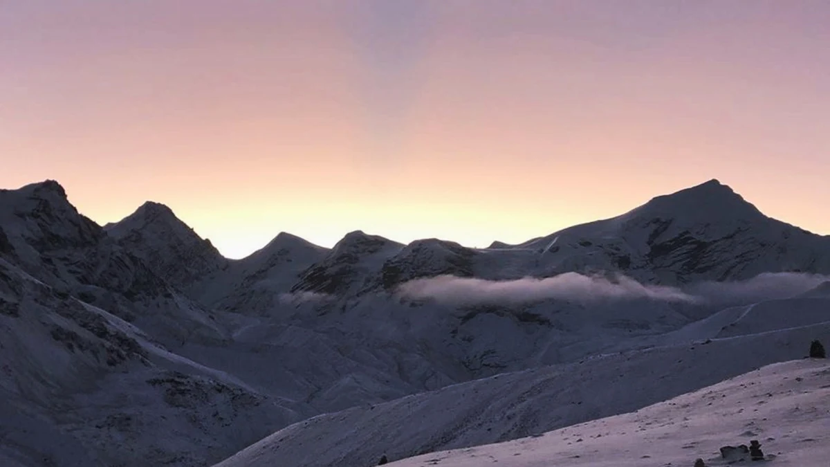
The sun starts hitting the peaks. If you're lucky, you'll catch alpenglow on the surrounding mountains.
09:30 AM: Summit at 5,416m (15-minute wind-chill photo rule): You crest the final rise and see the prayer flags. Relief floods through you. People are crying. People are cheering. People are just sitting there, staring.
But don't linger. You've got about 15 minutes before the cold becomes dangerous. Take your photos, touch the chorten, then start descending.
01:30 PM: Arrival in Muktinath, celebration & recovery: The descent feels endless. Your knees are screaming. Your toes are jammed into the front of your boots.
But then you see Muktinath in the valley below. Civilization. Warmth. Rest.
By the time you arrive, you've been hiking for 9 hours. You're destroyed. But you did it.
That night, you'll celebrate with other trekkers. Everyone bonds over the shared suffering and triumph of crossing Thorong La Pass.
Recommended Blog: Best Spring Treks in Nepal
Thorong Phedi vs. High Camp: Where Should You Sleep?
- Thorong Phedi (4,450m): Better for sleep quality. At 4,450m, you're less likely to suffer from severe altitude symptoms. More teahouse options, which means a better chance of getting a room during peak season. Lower risk of Cheyne-Stokes breathing keeps you awake.
- High Camp (4,880m): Shorter ascent on pass day. You're already at 4,880m, so you "only" need to climb 536 vertical meters to the summit. Means you can start a bit later, around 5:00 AM instead of 4:30 AM.
Pro Tip: If this is your first night above 4,800m, stay at Phedi. Better sleep means better performance on pass day. The extra climbing time is worth it.
Safety & the 2014 Disaster Legacy of Thorong La
October 14–15, 2014, Cyclone Hudhud dumped 1.8 meters of snow on Thorong La, trapping trekkers and claiming 43 lives. Avalanches, freezing, and zero rescue options made it one of the deadliest events on the circuit.
Since then, safety has improved: lodges now have satellite weather, emergency shelters exist along the trail, and licensed guides know when to call off a crossing.
The 10:00 AM cutoff rule is vital if you haven’t submitted by then, turn back. High winds, snow, and darkness make the descent dangerous, so waiting a day is far safer.
Thorong La Pass Logistics: Permits, Guides, and Road Updates
You need two permits to trek Thorong La: ACAP (3,000 NPR) and TIMS (2,000 NPR). These can be obtained in Kathmandu or Pokhara, and processing is quick if you have your passport, photos, and cash.
Solo trekking isn’t allowed; you must hire a licensed guide. Guides handle logistics, know the best teahouses, and watch for altitude sickness, making them worth every penny.
To avoid dusty jeep roads, many trekkers take the NATT trail, a quieter, greener alternative. Some teahouses at Thorong Phedi and High Camp have Starlink, but mobile signal is limited past Manang, and there’s none at the pass.
Don’t stress about permits or finding a licensed guide. Let Nepal Gateway Trekking handle everything so you can focus on the mountains. Book your trek today.
Essential Packing Checklist for Thorong La Pass
Packing right for Thorong La Pass can make or break your trek. At 5,416 meters, the conditions are harsh, so you need gear, clothing, and health supplies that keep you safe, warm, and ready for anything.
- Technical Gear: Micro-spikes for snow and ice, trekking poles for steep descents, Category 4 sunglasses to prevent snow blindness, and a headlamp with extra batteries for early starts.
- Clothing: Use the 4-layer system: merino base, fleece mid-layer, down jacket, and Gore-Tex shell. Don’t forget a warm hat, insulated mittens, and a buff or face mask for wind protection.
- Health & Extras: Diamox if prescribed, UV water purifier, high-SPF sunscreen, plus snacks, insulated bottles, and a basic first-aid kit.
Final Thoughts
Thorong La Pass is tough. Your body will ache, your lungs will burn, and that 4:30 AM wake-up feels like punishment. But the high-altitude silence at 5,416 meters, standing among fluttering prayer flags with mountains all around, is unforgettable.
Despite roads, jeeps, and WiFi at some teahouses, the trek still demands respect. The spiritual and physical challenge is real, whether you’re religious or not, crossing from one world into another leaves a lasting impression.
If you prepare properly acclimatize, hire a guide, and follow weather advice, the success rate of crossing Thorong La is high. And when you finally reach Muktinath, exhausted and triumphant, you’ll see why this trek remains one of the world’s great adventures.
Feeling ready for Thorong La Pass? Start your adventure safely and comfortably with Nepal Gateway Trekking. Plan your trek now.
Frequently Asked Questions (FAQ)
How much does it cost to cross Thorong La?
Permits (ACAP + TIMS) cost 5,000 NPR ($37 USD). Daily guide fees are $25–35. Budget $800–1,200 for a full circuit including food, accommodation, guide, and permits.
Can beginners cross Thorong La?
Technically yes, but you need good fitness. Fitness training for Annapurna Circuit should start 2–3 months before: cardio (running, cycling), leg strength training, and practice hikes with a weighted pack. Complete beginners should build experience with lower-altitude treks first.
Is there mobile signal at the top?
No. Mobile signal cuts out before Thorong Phedi. Some lodges have WiFi via Starlink, but on the pass itself, you're completely off-grid.
Do I need a horse for Thorong La?
No. Horses and mules carry gear for porters, not trekkers. The trail is too steep and narrow in sections for riding. You walk the entire way.
How cold is it at 5,416m?
Morning temperatures on pass day range from -10°C to -20°C (14°F to -4°F). Wind chill makes it feel colder. In winter, it can drop below -25°C. Layer properly and start early to avoid the worst of the afternoon winds.
Can I trek without a guide?
No. A licensed guide is mandatory for all Annapurna Circuit trekkers. This is enforced at checkpoints.
Which direction is better, Manang to Muktinath or Muktinath to Manang?
Always go east-to-west (Manang to Muktinath). This direction allows proper acclimatization. West-to-east forces you to gain 1,600m in one day without acclimatization, which is dangerous.
Is Diamox necessary?
Not mandatory, but recommended. Diamox helps prevent altitude sickness. Consult your doctor before the trek. Standard dose is 125mg twice daily.
How many days from Manang to the Pass?
Plan 3–4 days: Manang → Yak Kharka (1 day) → Thorong Phedi (1 day) → optional rest or move to High Camp → Summit day. Rushing this section increases altitude sickness risk.
What is the NATT trail?
The Nepal Alternative Trekking Trail bypasses jeep roads between Jagat and Chame. It follows the original trekking route—quieter and more scenic than walking on dusty roads. Ask your guide to use the NATT trail for a better experience.