The Everest Panorama View Trek is a short and fun trip that’s perfect for families. You get to see incredible mountain views, learn about Sherpa culture, and adjust to the altitude without doing a challenging, long trek. Having a detailed trek map makes it easier to follow the path for the Everest Panorama View. You can plan your days and enjoy every excellent viewpoint along the way.
Whether you are trekking for the first time or planning a relaxed Himalayan experience, this trek combines panoramic mountain views, cultural stops, and manageable elevations for an unforgettable journey.
Secure your spot now for the Everest Panorama Trek with Nepal Gateway Trekking. Limited seats are filling fast this peak season!
Overview of the Everest Panorama View Trek
The Everest Panorama View Trek is perfect for beginners and families who are looking for a short and scenic adventure. Spanning roughly 10 days, the trek starts and ends in Kathmandu and takes you through iconic Sherpa villages, monasteries, and stunning Himalayan landscapes.
- Duration: 10 days (Kathmandu → Lukla → Namche Bazaar → Tengboche → Khumjung → Monjo → Lukla → Kathmandu)
- Difficulty: Medium but suitable for beginners.
- Highest Point: 3,860 meters.
- Best Time to Go: Spring and autumn.
- Why People Love It: It’s short, offers fantastic mountain views, allows you to experience local culture, and helps you get used to the height gradually.
This trek is ideal for those who wish to explore the Everest region and see Mount Everest without the challenge and more demanding Everest Base Camp trek.
Everest Panorama View Trek Route Map

The Everest Panorama Trek map starts with a beautiful flight from Kathmandu to Lukla, and then you hike through the main part of the Khumbu region. Here’s a simple breakdown of the main trekking route:
- Flight: Kathmandu → Lukla
- Trekking Route: Lukla → Phakding → Namche Bazaar → Tengboche → Khumjung → Monjo → Lukla
Key Checkpoints with Elevations:
|
Trek Segment |
Altitude (meters) |
Description / Notes |
|---|---|---|
|
Kathmandu (Flight Start) |
1,400 |
Starting point for the flight to Lukla |
|
Lukla |
2,860 |
Gateway to the Everest region, a small airstrip |
|
Phakding |
2,610 |
First stop after Lukla, riverside village |
|
Namche Bazaar |
3,440 |
Major Sherpa town, acclimatization stop |
|
Tengboche |
3,860 |
Famous for Tengboche Monastery and views |
|
Khumjung |
3,780 |
Traditional Sherpa village, Everest views |
A detailed Everest Panorama Trek map guide helps trekkers track their daily progress, monitor elevation gain, and plan acclimatization stops effectively.
Turn your dream of seeing Everest up close into reality - book your Everest Panorama Trek today!
Why You Need the Everest Panorama View Trek Map?
A trek map is helpful for the Everest Panorama View Trek for many things. It helps you stay on the right path and keeps you safe. It also lets you enjoy the amazing Himalayan views even more. Here’s why having a map is important.
- Safety & Finding Your Way: Helps you stay on the right path and find teahouses or emergency routes easily.
- Planning Your Days: Lets you figure out how far you’ll walk each day and manage your time better.
- Altitude Check: Tracks your height to help you avoid altitude sickness.
- Cool Spots to See: Shows you the best viewpoints, cultural places, and photo-worthy stops along the trail.
Even with a guide, having your own map enhances your understanding of the terrain and makes your Everest Panorama Trek more immersive.
Short Day-to-Day Itinerary
The Everest Panorama View Trek itinerary is a short trek compared to the regular EBC treks. Here, we have a clear day-by-day plan to help you manage energy, acclimatize properly, and enjoy every highlight.
Day 1 - Arrival in Kathmandu (1,310 m)
As soon as you get to Kathmandu, check into your lodging. Get ready for your journey into the Himalayas, explore the surroundings, and take a quick snooze.
Day 2 - Fly to Lukla, Trek to Phakding (2,660 m)
Take an early flight to Lukla and begin your journey to Phakding on foot. As you stroll through tiny villages, take in views of the Dudh Koshi River and the surrounding highlands.
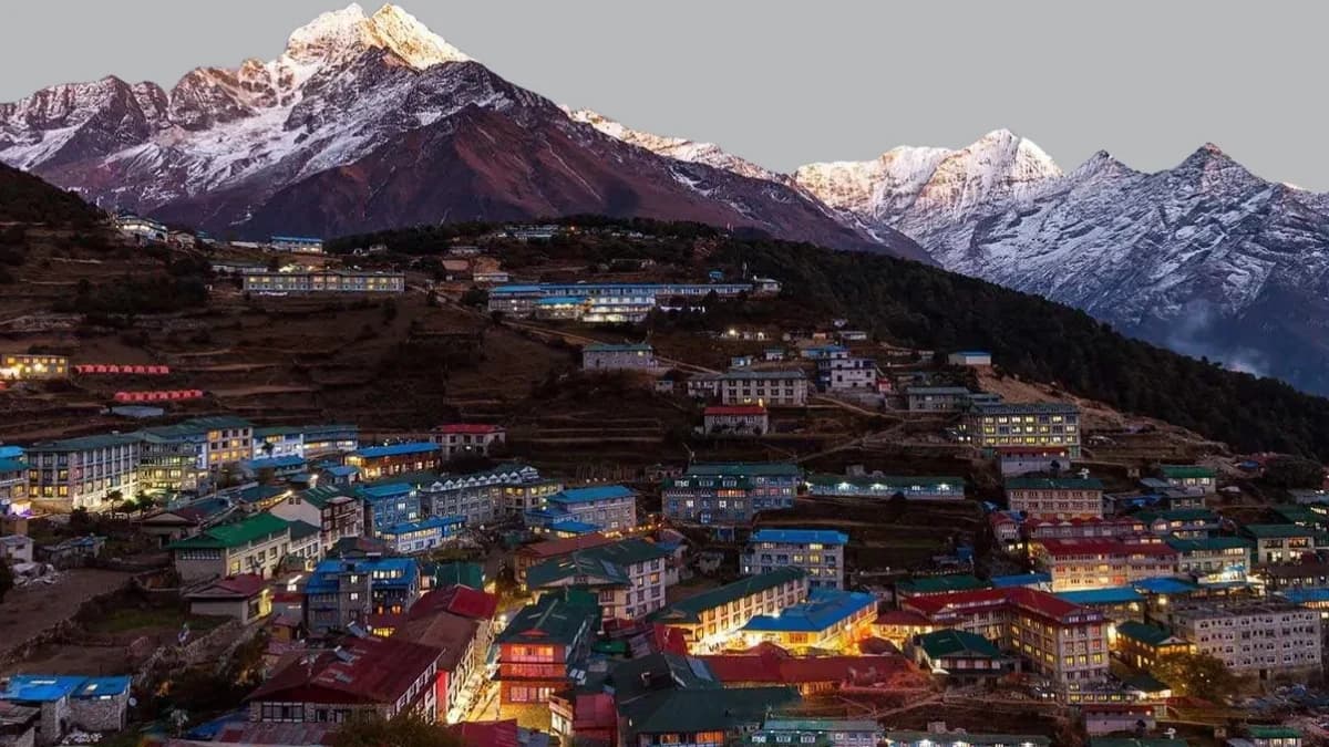
Day 3 - Trek to Namche Bazaar (3,441 m)
Trek through rhododendron forests and cross suspension bridges before reaching Namche Bazaar, the central hub of the Khumbu region. Take in your first close-up views of Everest.
Day 4 - Acclimatization Day in Namche (Everest View Hotel hike) (3,441 m)
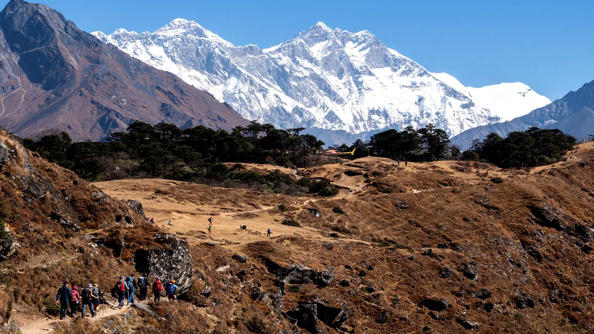
Trek to the Everest View Hotel to spend the day getting used to the surroundings. As you get used to the elevation, take in expansive views of Ama Dablam, Lhotse, and Everest.
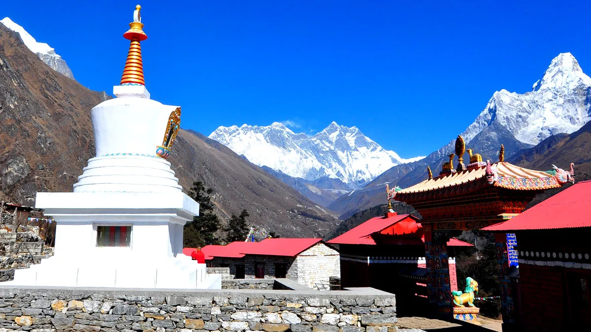
Day 5 - Trek to Tengboche (3,860 m)
Trek past pine forests and Mani walls to reach Tengboche Monastery. The monastery offers beautiful views of the Himalayas and a glimpse into local Buddhist culture.
Day 6 - Trek to Khumjung (3,790 m)
Make a slight descent to the settlement of Khumjung. Discover the nearby Sherpa hamlet, pay a visit to the monastery or school, and take in the scenery of the surrounding peaks.
Day 7 - Trek to Monjo (2,835 m)
Begin your return journey, trekking through pine forests and picturesque villages. Reach Monjo, a small village known as the gateway to Sagarmatha National Park.
Day 8 - Trek to Lukla (2,840 m)
Complete your trek back to Lukla. Relish the final views of the mountains and villages you passed on the way up.
Day 9 - Flight back to Kathmandu (1,310 m)
Fly back to Kathmandu and enjoy the rest of the day at leisure. You can shop, explore the city, or relax after your trek.
Day 10 - Departure
Depart from Kathmandu for your onward journey, taking memories of the stunning Everest panorama view with you to your next destination.
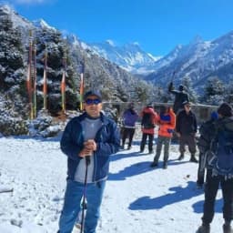
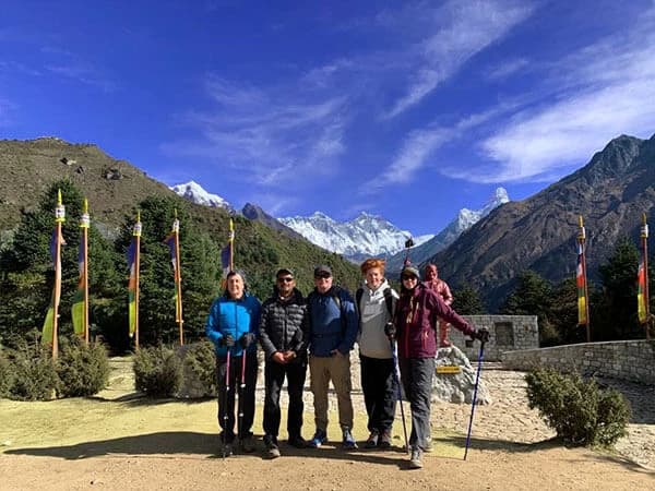
Major Highlights on the Everest Panorama View Trek
The Everest Panorama View Trek offers breathtaking views and fascinating cultural experiences. Along the way, you pass through old Sherpa villages, quiet forests, and famous Himalayan spots, making every stop really special.
- Everest View Hotel: Offers panoramic vistas of Everest and surrounding peaks.
- Tengboche Monastery: An Iconic cultural and spiritual landmark in the Khumbu.
- Namche Bazaar & Khumjung Villages: Experience Sherpa culture, local markets, and traditional architecture.
- Scenic Trails: Forested paths, suspension bridges, and riverside walks.
Explore Sherpa culture, scenic trails, and Himalayan people with panoramas - reserve your Everest Panorama Trek package now!
Mountains Visible in the Everest Panorama Trek
The Everest Panorama View Trek offers stunning views of some of the world’s highest and most iconic peaks. Knowing what mountains you can see along the route makes it easier to plan viewpoints and capture unforgettable photos.
- Mount Everest (8,848 m): The highest mountain on Earth, visible from Namche Bazaar and Everest View Hotel. Its majestic summit dominates the horizon and is a highlight for every trekker.
- Lhotse (8,481 m): Everest’s neighbor, known for its huge south face. People often admire it along with Everest from the trek’s viewpoints.
- Nuptse (7,879 m): A sharp-looking ridge just west of Everest, famous for its cool shape and challenging climbing routes.
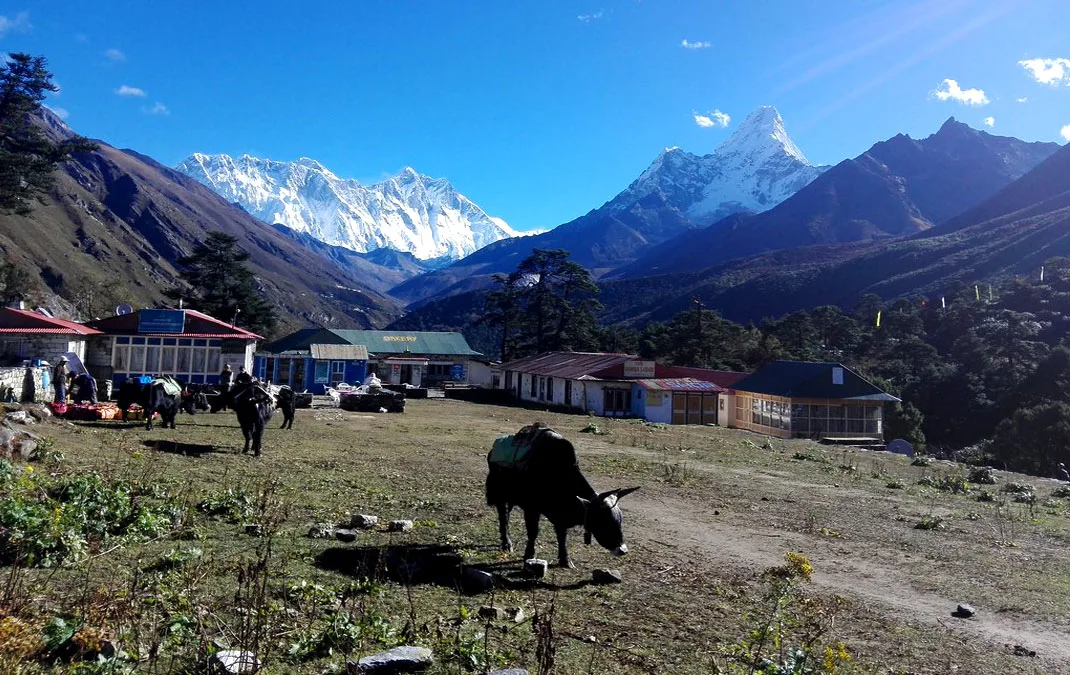
- Ama Dablam (6,856 m): Called the “Matterhorn of the Himalayas,” it’s famous for its pretty, pyramid-like shape.
- Thamserku (6,608 m): A big peak near Namche Bazaar that you can see most of the trek from, perfect for photos.
- Other Peaks (Pumori, Island Peak, Lobuche): These mountains around Everest make the views even more amazing and are great for trekking photos.
Everest Panorama Trek Altitude Profile
Knowing the altitude profile of the Everest Panorama Trek helps trekkers get ready and avoid problems from the height. It shows how the trail goes up and down, so you can plan rest stops and save your energy.
- Kathmandu: 1,310 m
- Lukla: 2,840 m
- Namche Bazaar: 3,441 m
- Tengboche: 3,860 m
Note: Acclimatization days in Namche Bazaar allow your body to adjust, reducing the risk of altitude sickness. Your map also highlights elevation changes between trekking segments.
Permits Required for the Trek
Before starting the Everest Panorama Trek, make sure you have the required permits. These ensure smooth access and safety in the Everest region.
- Sagarmatha National Park Entry Permit: Required for all trekkers entering the park. It helps protect the nature and culture of the area.
- TIMS Card (Trekkers’ Information Management System): Every trekker needs this for emergencies. The TIMS card is used for keeping track of trekkers and makes sure everyone stays safe on the trails.
Final Takeaway
The Everest Panorama View Trek map is super helpful for planning a short and scenic Everest adventure. From amazing Himalayan views to visiting Sherpa villages, this trek gives a fun and rewarding experience for beginners and families.
We at Nepal Gateway Trekking handle permits & logistics so you can just enjoy the trek. Our team planning with a detailed trek map ensures safety, efficient itinerary management, and enhanced enjoyment of every Everest Panorama Trek highlight along the way.
A once-in-a-lifetime Himalayan experience awaits - Contact Nepal Gateway Trekking to book your trek now!
FAQs on Everest Panorama View Trek Map
What is the highest point shown on the Everest Panorama Trek map?
Tengboche at 3,860 meters is the trek’s highest point, offering stunning Himalayan views.
How many days does the Everest Panorama View Trek take?
The trek usually takes 10 days, including flights to and from Lukla. However, it can increase if you add side trips or decide on an extra rest day.
Which mountains are visible along the trek route?
Peaks like Everest, Lhotse, Nuptse, Ama Dablam, Thamserku, Pumori, Island Peak, and Lobuche can be seen along the way.
Do I need a guide if I use the trek map?
A guide has become mandatory for safety and cultural insights. Though the map allows independent navigation, you won't be able to make heads or tails of it without a licensed guide to explain it in detail.
What permits are required for the trek?
You need a Sagarmatha National Park Entry Permit and a TIMS card to trek in the Everest region.
Is the Everest Panorama Trek suitable for beginners?
Yes, with proper acclimatization, it is moderate in difficulty and beginner-friendly.
Can families and children follow this trek map?
Yes, the trek is family-friendly with manageable daily distances and moderate elevations.
What is the best time to follow the Everest Panorama Trek map?
Spring (March-May) and autumn (September-November) offer clear skies and comfortable temperatures.
How accurate are offline/GPX maps for this trek?
Most offline or GPX maps are reliable, but it’s best to cross-check with your trek map and guide.