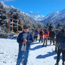
Travel to the far west of Nepal, and you enter Upper Dolpo, one of the most remote and culturally preserved regions in the Himalayas.
Tucked away in the country's midwestern corner, this isolated trans-Himalayan kingdom has remained largely untouched by modern development, allowing centuries-old Tibetan traditions, monasteries, and ways of life to endure.
Its dramatic landscapes of high passes, barren plateaus, and hidden valleys create an experience unlike any other trekking destination in Nepal.
Unlike popular trekking routes, Upper Dolpo Trek offers no network of teahouses, reliable cell coverage, or clearly marked trails. Expeditions here pass through vast stretches of wilderness where navigation, logistics, and preparation are critical.
In such a remote environment, an accurate Upper Dolpo trek map is not simply a useful reference it is an essential tool for route planning, altitude management, and safe travel through one of the world's last true trekking frontiers.
Quick Overview
- Upper Dolpo is one of Nepal's most remote and restricted trekking regions.
- The trek follows a 27-day loop starting and ending at Juphal.
- The route passes through Phoksundo Lake, Shey Gompa, Saldang, and Dho Tarap Valley.
- Phoksundo Lake is Nepal's deepest and most famous alpine lake.
- Shey Gompa is an 800-year-old monastery and cultural highlight of the trek.
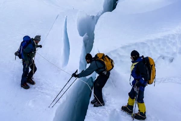
- The trek crosses major high passes above 5,000 meters, including Nagdalo-La Pass.
- Trekkers spend nearly two weeks above 4,000 meters.
- Camping is required, as there are no teahouses along most of the route.
- Restricted area permits and a licensed guide are mandatory.
- The trek offers pristine landscapes, Tibetan culture, and true wilderness adventure.
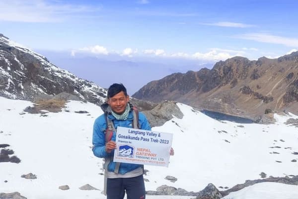
Planning an Upper Dolpo adventure? Get expert guidance on permits, logistics, and route planning before you start your journey. Join Nepal Gateway Trekking, Upper Dolpo Trek Experts
Popular Landmarks Along the Upper Dolpo Trek Route
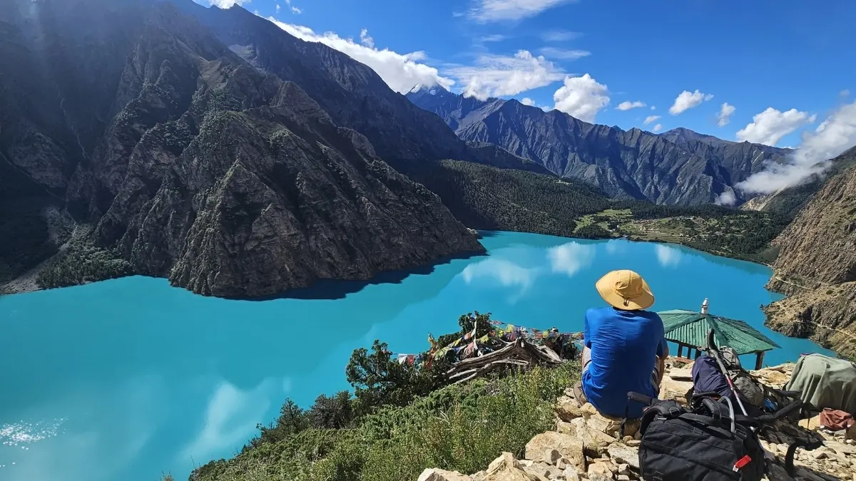 Phoksundo Lake (3,640 m)
Nepal's deepest lake. The turquoise color comes from mineral composition, not algae. No fish, no noise, and sheer cliffs on three sides. The Phoksundo Lake in Upper Dolpo trek map section that brings you here is worth every hard hour of climbing.
Ringmo Village
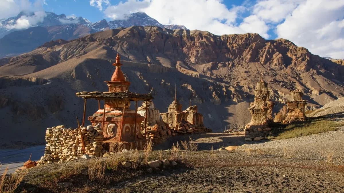
One of the last active Bon-Po communities in Nepal. The pre-Buddhist animistic religion practiced here predates Tibetan Buddhism by centuries. Walk slowly. The chortens, prayer wheels, and monastery architecture carry a visual language you will not see anywhere else on this route.
The Devil's Trail Catwalk
A narrow rock ledge carved into the cliff face along Phoksundo's northern edge. Sheer drop on one side, cliff wall on the other. It is not technical, but it demands full attention for 5 to 6 hours straight.
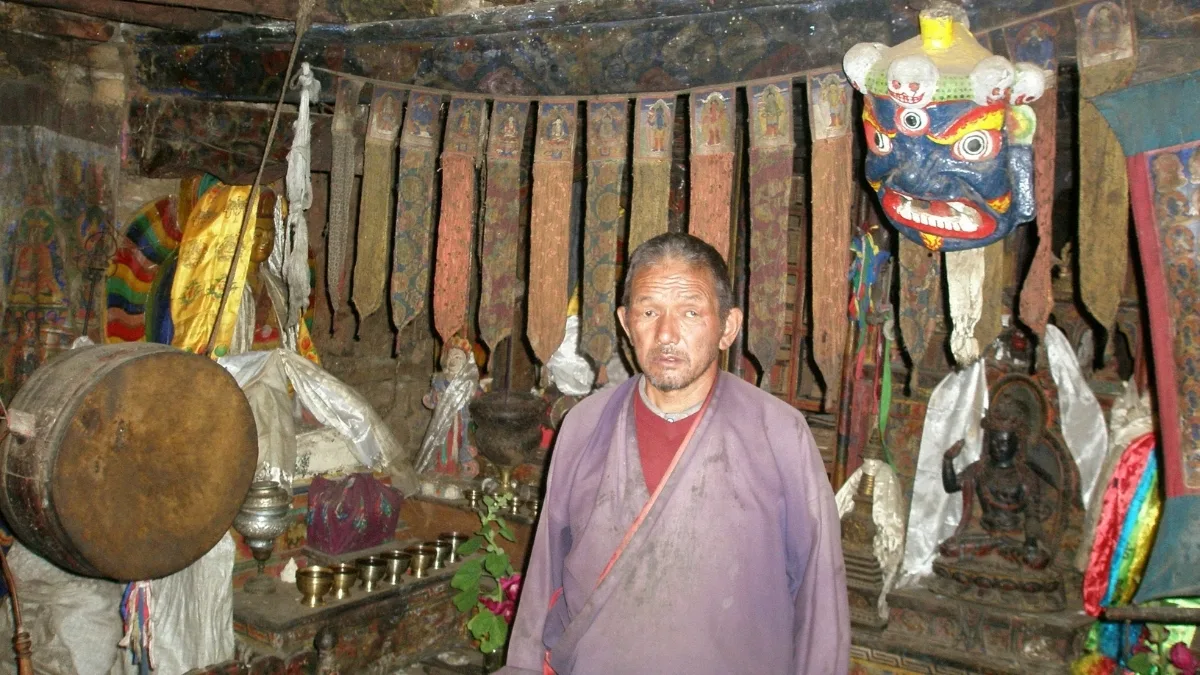
Shey Gompa Monastery (4,360 m)
Is one of the oldest and most remote monasteries in Nepal. Roughly 800 years old. Monks live here year-round. Crystal Mountain rises directly behind it, and the circumambulation path takes 4 hours, built into the Upper Dolpo trek itinerary as your acclimatization day activity.
Saldang Village (3,620 m)
It is the largest clay-brick settlement in Upper Dolpo. Houses are compact and low, built to trap heat through brutal winters. Some households still run on barter. Walk the lanes before the route climbs again.
Yangtze Gompa (4,960 m)
Most trekkers rush through these gompas but you shouldn't. The monastery at 4,960 m commands views north toward the Tibetan plateau that exist nowhere else on this route. The Upper Dolpo height here is serious. Move slowly.
Tokyu Village (4,210 m)
Small, quiet, largely self-sufficient. Sits just below Jeng La Pass and gives you your first full look at the Dhaulagiri massif on descent. You are unlikely to share it with another trekking group.
Dho Tarap Valley (4,040 m)
This is one of the highest permanently inhabited valleys on Earth. The valley floor is wide and flat, a welcome change after days of steep terrain. Salt-traders still pass through on routes that predate any road in Nepal. The rest day here is one of the most valuable in the entire Upper Dolpo trek itinerary.
Need help customizing this 27-day itinerary? Our trekking team can tailor the route, acclimatization schedule, and expedition logistics to match your experience level.
How to Read the Upper Dolpo Trek Map?
 Reading an Upper Dolpo map differs significantly from standard, heavily commercialized routes like the Everest trek or Annapurna trek. Because this area is a remote, protected wilderness, watch for these visual indicators:
The Loop Structure:
Most comprehensive maps trace a massive counter-clockwise loop. You will track your route starting from Juphal, heading north toward Phoksundo Lake, crossing high, technical passes into the isolated northern "Inner Dolpo" valleys (Shey Gompa), and looping back down through the eastern valleys via Saldang and Dho Tarap.
Topographical Color Contrast:
Pay close attention to the green-to-brown shading. The lower regions (Juphal to Phoksundo) are lush, forested river valleys. Once you cross north of the lake, the map transitions abruptly into a barren, high-altitude desert palette, a direct extension of the Tibetan Plateau.
Dotted vs. Solid Lines:
Solid lines usually indicate the main horse and yak caravan routes used by local traders. Dotted lines mark demanding side trails or alternative high passes that unexpected snow can easily block.
Upper Dolpo Trek Route Breakdown by Region
To make an Upper Dolpo map easy to digest, divide the entire loop into three distinct geographical and cultural zones:
Zone 1: The Phoksundo Corridor (Lower Dolpo Transition)
- The Route: Juphal -> Dunai -> Chhepka -> Jharana Hotel -> Ringmo (Phoksundo Lake).
- Landscape: Lush paths tracking the rushing, turquoise waters of the Bheri and Suligad rivers through dense forests of pine, birch, and bamboo.
- Culture: Primarily Hindu and traditional animist influences in the lowest sections, transitioning rapidly into ancient Bon religion practices near Ringmo.
Zone 2: The Inner Dolpo / Trans-Himalayan Heartland
- The Route: Phoksundo Lake, Sallaghari, Kang La Pass, Shey Gompa, Sela Pass, Saldang.
- Landscape: Classic rain-shadow desert. Wide, wind-swept valleys, steep crumbling canyons, and massive exposed rock formations.
- Culture: Pure Tibetan Buddhist and Bon-po cultures. This isolated pocket is the setting of Peter Matthiessen's book The Snow Leopard.
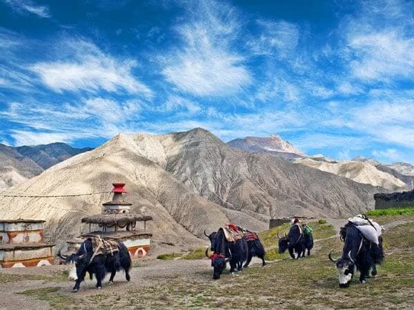
Zone 3: The High Trading Valleys and Descent
- The Route: Saldang -> Komash -> Tinje -> Rapha -> Jyanta La -> Dho Tarap -> Khanigaon -> Dunai -> Juphal.
- Landscape: Open alpine highlands populated by domestic yak caravans. The trail eventually channels back into steep, narrow river gorges as you track south, re-entering the tree line.
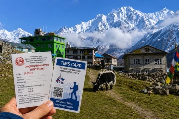
Major Checkpoints on the Upper Dolpo Trek Map
Upper Dolpo has an open border zone with Tibet and is located within a highly protected national park, so you will encounter multiple mandatory checkpoints. Your licensed guide must present your Lower/Upper Dolpo Restricted Area Permits (RAP) and National Park Entry Permits at each of these stops: Juphal Airport
1. Dunai Police Checkpost (Security & Registration)
- Where it is: Dunai Town (the administrative center of the Dolpa district).
- Purpose: This is your first formal safety stop. The local police force registers all foreign trekkers and their mandatory government-licensed guides. They log passport info and verify that your group meets the legal minimum requirement of at least two traveling trekkers.
2. Sulighat Checkpost (National Park Entrance)
- Where it is: Located just past Dunai, right at the confluence of the Bheri and Suligad rivers.
- Purpose: The official entry gate to Shey Phoksundo National Park (Nepal's largest park). Park rangers inspect, log, and stamp your Shey Phoksundo National Park Entry Permit to keep track of tourism numbers in the ecosystem.
3. Ringmo / Phoksundo Army Post (Border Security Buffer)
- Where it is: Situated right at the southern edge of Ringmo village before the trail moves along the lake cliff.
- Purpose: This is a strict military checkpoint protecting the sensitive border zone. Personnel will thoroughly verify your Upper Dolpo Restricted Area Permit (500 for the first 10 days). Independent, unguided trekking is completely forbidden past this point.
4. Saldang / Northern Community Logs (Border Monitoring)
- Where it is: Saldang Village or northern nomadic outposts.
- Purpose: Because of the proximity to the Tibetan border, local community authorities and occasional border police patrols monitor tracking logs. Your guide registers the group's presence to show you are sticking to the official itinerary submitted to the Department of Immigration.
5. Dho Tarap Police Post (Eastern Exit Registration)
- Where it is: Main trail junction in the Dho Tarap valley floor.
- Purpose: This post marks your safe exit out of the inner northern valleys. Officers log your departure to ensure you have not overstayed the precise number of days allowed on your premium Restricted Area Permit.
Map Safety Tip: Upper Dolpo has vast stretches with absolutely zero cellular service or satellite coverage. These physical paper logbooks at the checkpoints serve as the only official record of your location. Always make sure your guide registers your group properly at every stop.
Detailed 27-Day Upper Dolpo Trek Itinerary & Technical Blueprint
 Three passes above 5,000 meters. Two weeks above 4,000 meters. Every rest day in the Upper Dolpo trek itinerary exists because the altitude demands it.
|
Day |
Route Milestone |
Elevation (Upper Dolpo Height) |
Duration & Terrain |
|
Day 01 |
Arrival in Kathmandu |
1,310 m / 4,297 ft |
Airport pickup, 20-minute drive to hotel. |
|
Day 02 |
Permit Processing & Gear Check |
1,310 m / 4,297 ft |
Rest day. Permits secured. Final gear check. |
|
Day 03 |
Fly Kathmandu to Nepalgunj |
150 m / 492 ft |
1 hr 15 min flight to the Terai plains. |
|
Day 04 |
Fly to Juphal; Trek to Dunai |
2,140 m / 7,020 ft |
Flight to Juphal (2,500m), 3-hour riverside walk to Dunai. |
|
Day 05 |
Trek Dunai to Ankhe |
2,895 m / 9,498 ft |
5 to 6 hours through forested gorges and suspension bridges. |
|
Day 06 |
Trek Ankhe to Sulighat |
3,180 m / 10,433 ft |
5 to 6 hours on steep, rock-carved cliff trails. |
|
Day 07 |
Trek Sulighat to Phoksundo Lake |
3,640 m / 11,942 ft |
4 to 5 hours uphill. The lake appears suddenly at the top. |
|
Day 08 |
Rest Day at Shey Phoksundo Lake |
3,640 m / 11,942 ft |
Walk in Ringmo Village. Visit the Bon-Po monastery. Rest. |
|
Day 09 |
Trek Phoksundo Lake to Phoksundo Khola |
3,750 m / 12,303 ft |
5 to 6 hours on the Devil's Trail catwalk. Watch every step. |
|
Day 10 |
Trek Phoksundo Khola to Nagdala High Camp |
4,700 m / 15,419 ft |
5 to 6 hours up an isolated glacial valley. Camp is cold and exposed. |
|
Day 11 |
Trek to Shey Gompa via Nagdalo La Pass (5,350 m) |
4,360 m / 14,304 ft |
5 to 6 hours. The route involves a hard scree ascent followed by a descent to Shey Gompa. |
|
Day 12 |
Acclimatization Day in Shey Gompa |
4,360 m / 14,304 ft |
Explore the 800-year-old monastery and Crystal Mountain. Move slowly. |
|
Day 13 |
Trek Shey Gompa to Namgung Gaon via Saldang La Pass (5,100 m) |
4,360 m / 14,304 ft |
6 hours. Sweeping views of the Tibetan plateau from the pass. |
|
Day 14 |
Trek Namgung Gaon to Saldang |
3,620 m / 11,876 ft |
A 4-hour descent into Saldang, the largest clay-brick settlement in Upper Dolpo. |
|
Day 15 |
Trek Saldang to Yangze Gompa |
4,960 m / 16,272 ft |
4 to 5 hours along old northern trade routes. |
|
Day 16 |
Trek Yangze Gompa to Sibu |
4,560 m / 14,960 ft |
6 to 7 hours past yak pastures and terraced barley fields. |
|
Day 17 |
Trek Sibu to Jeng-La Phedi |
4,900 m / 16,076 ft |
5 hours climbing to the meadow below the next pass. |
|
Day 18 |
Trek to Tokyu Gaon via Jeng La Pass |
4,210 m / 13,812 ft |
5 to 6 hours. Full Dhaulagiri massif views from the summit. |
|
Day 19 |
Trek Tokyu to Dho Tarap |
4,040 m / 13,254 ft |
5 hours into the wide Dho Tarap valley. |
|
Day 20 |
Rest Day at Dho Tarap |
4,040 m / 13,254 ft |
Meet salt traders. Rest your legs. You have earned it. |
|
Day 21 |
Trek Dho Tarap to Tarap Khola |
3,800 m / 12,467 ft |
5 to 6 hours through narrow gorges following the river. |
|
Day 22 |
Trek Tarap Khola to Khani Gaon |
2,340 m / 7,677 ft |
4 to 5 hours of rapid descent into tree lines and warmer air. |
|
Day 23 |
Trek Khani Gaon to Tarakot |
2,540 m / 8,333 ft |
6 hours along old fort paths and terraced villages. |
|
Day 24 |
Trek Tarakot to Dunai |
2,140 m / 7,020 ft |
6 to 7 hours following the Barbung Khola river. |
|
Day 25. |
Trek Dunai to Juphal |
2,475 m / 8,120 ft |
4 to 5 hours. The loop closes here. |
|
Day 26 |
Fly Juphal to Nepalgunj to Kathmandu |
1,310 m / 4,297 ft |
1 hr 45 min combined flights, 20-minute drive to hotel. |
|
Day 27 |
Departure |
- |
Direct airport transfer. |
Final Thought
The Upper Dolpo Trek is one of Nepal's last true wilderness expeditions, combining high mountain passes, remote camping, ancient monasteries, and a deeply preserved Tibetan culture. Few treks offer the same level of isolation, adventure, and authenticity.
With proper preparation and a clear understanding of the route, altitude, and logistics, this journey becomes an unforgettable experience. For trekkers seeking a genuine off-the-grid Himalayan adventure, Upper Dolpo remains one of Nepal's most rewarding destinations.
Ready to Explore Upper Dolpo? Experience one of Nepal's most remote and rewarding trekking adventures with a fully supported expedition team. Contact Nepal Gateway Trekking now.
FAQs
Can I do the Upper Dolpo Trek independently or solo?
Nepalese law requires you to book through a government-registered agency, travel with a licensed guide, and have a minimum group size of two to obtain Restricted Area Permits. There is no legal workaround.
How difficult is the crossing of Nagdalo La Pass?
Nagdalo La sits at 5,350 meters, the highest point on the Upper Dolpo trek itinerary. The scree is loose and the air is thin. No technical skills needed, but strong fitness, poles, and a controlled pace are non-negotiable.
Is there electricity or mobile network availability on the trail?
Past Dunai, there is no cell signal and no electricity. Bring two power banks (20,000mAh or more) and keep them in your sleeping bag at night to protect them from the cold.
What is the water source during this 27-day camping trek?
Our kitchen crew filters and boils stream water every morning and evening. Carry reusable bottles and personal UV sterilizers or purification tablets as a daily backup while walking.
What happens in case of an acute altitude sickness emergency?
Guides monitor blood oxygen daily with pulse oximeters. Severe AMS triggers an immediate supervised descent. In life-threatening cases, we coordinate helicopter evacuation via satellite phone. Your insurance must cover alpine rescue up to 6,000 meters before you travel.