Most trekkers underestimate how much ground this route actually covers. The Langtang Gosaikunda Lauribina Pass Trek Map brings together three very different landscapes, the glacier-fed Langtang Valley, the sacred alpine lake at Gosaikunda, and the forested ridgelines of Helambu, into one continuous journey on foot.
Before you book flights or rent gear, you need to understand what this trek actually asks of you. The Langtang Gosaikunda Lauribina Pass Trek Map shows exactly where the trail climbs hard, where it flattens out, and where the tea houses thin out fast.
This guide breaks down the full route, a day-by-day itinerary, altitude changes, and the highlights you'll actually see along the way. Whether you're a first-timer booking a guided trip or an independent trekker planning your own days, this Langtang Gosaikunda trek map gives you the details to plan around.
Key Takeaways
- This trek covers Langtang Valley, Gosaikunda Lake, and Helambu.
- Trek duration is 15 days with a distance of 140–150 km.
- Starts from Syabrubesi and ends at Sundarijal.
- Lauribina Pass (4,681 m) is the highest point on the main route.
- Tserko Ri (5,030 m) is the highest optional viewpoint.
- Includes an acclimatization day at Kyanjin Gompa.
- A detailed trek map helps with route and altitude planning.
- Tea houses are limited between Gosaikunda and Ghopte.
- Highlights include Kyanjin Gompa, Gosaikunda Lake, and Lauribina Pass.
- The trek passes through Langtang National Park and Tamang villages.
- Spring and autumn offer the best trekking conditions.
- Download offline maps and start early on pass-crossing days.
Langtang Gosaikunda Lauribina Pass Trek Overview
The Langtang Gosaikunda trek combines a Langtang Valley trek with a high alpine crossing at Lauribina Pass, ending in the Helambu region rather than backtracking the way you came. It's one of the few routes near Kathmandu where you cross three distinct valleys in a single trip.
|
Detail |
Information |
|
Duration |
15 days |
|
Total distance |
Roughly 140–150 km |
|
Maximum altitude |
Tserko Ri, 5,030 m (Lauribina Pass, 4,681 m, on the main route) |
|
Difficulty |
Strenuous |
|
Best season |
Spring and autumn |
|
Starting point |
Kathmandu (drive to Syabrubesi) |
|
Ending point |
Sundarijal / Kathmandu |
|
Regions covered |
Langtang, Gosaikunda, Helambu |
|
National park |
Langtang National Park |
Syabrubesi (1,640 m) is a 7–8 hour drive from Kathmandu, while Sundarijal provides an easy finish just outside the capital. The trail passes through Langtang National Park, home to red pandas, Himalayan tahr, and other Himalayan wildlife. Instead of retracing your steps, the route continues over Lauribina Pass to Gosaikunda and through the forests of Helambu, making it one of the few treks near Kathmandu that covers three distinct regions in a single journey.
Planning your trek? Explore our complete Langtang Gosaikunda Trek itinerary and package.
Langtang Gosaikunda Lauribina Pass Trek Map

The trail runs west to east: you start in the Langtang Valley, swing south to Gosaikunda, cross Lauribina Pass, then descend through Helambu to Sundarijal. Reading a proper Langtang Gosaikunda trek map before you leave home saves you from guessing at junctions later.
A clear Langtang trek route map also shows you where the trail forks near Thulo Syabru, a spot that trips up more independent trekkers than any other junction on the route.
Langtang Gosaikunda Lauribina Pass Trek Route Overview
Here's how the trail actually progresses, stop by stop:
- Kathmandu → Trisuli Bazaar → Ramche → Thare → Dhunche (drive)
- Dhunche → Syabrubesi (1,640 m, drive)
- Syabrubesi → Bamboo (1,970 m) → Rimche (2,399 m) → Lama Hotel (2,470 m)
- Lama Hotel → Ghoratabela (3,030 m) → Langtang Village (3,430 m)
- Langtang Village → Kyanjin Gompa (3,850 m)
- Kyanjin Gompa → Kyanjin Ri (4,773 m) / Tserko Ri (5,030 m), optional side trip
- Kyanjin Gompa → Lama Hotel (retrace)
- Lama Hotel → Thulo Syabru (2,260 m)
- Thulo Syabru → Shin Gompa / Chandanbari (3,330 m)
- Shin Gompa → Gosaikunda (4,460 m)
- Gosaikunda → Lauribina Pass (4,681 m) → Ghopte (3,430 m)
- Ghopte → Thadepati Pass (3,690 m) → Kutumsang (2,470 m)
- Kutumsang → Chisapani (2,165 m)
- Chisapani → Sundarijal (1,460 m) → Kathmandu (drive)
Total walking distance runs close to 145 km over 11–12 actual trekking days, with a couple of buffer days built in for weather and acclimatization. The highest point on the entire Langtang trek route map is Tserko Ri at 5,030 m, an optional side trip from Kyanjin Gompa; Lauribina Pass, at 4,681 m, is the highest point you'll cross on the main trail itself.
Key Stops Along the Langtang Gosaikunda Lauribina Pass Trek Map
- Syabrubesi (1,640 m): The trek's starting point and gateway to Langtang National Park.
- Lama Hotel (2,470 m): A popular overnight stop surrounded by dense forests.
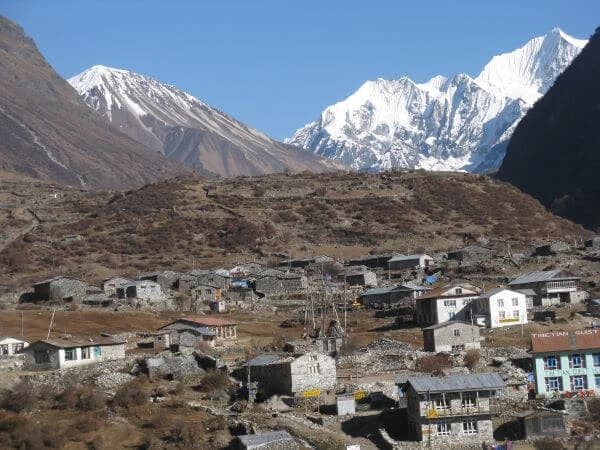
- Langtang Village (3,430 m): A traditional Tamang settlement rebuilt after the 2015 earthquake.
- Kyanjin Gompa (3,850 m): Known for its monastery, cheese factory, and nearby viewpoints.
- Tserko Ri (5,030 m): An optional hike with panoramic Himalayan views.
- Thulo Syabru (2,260 m): A hillside village connecting Langtang Valley with Gosaikunda.
- Shin Gompa (3,330 m): Famous for its monastery and yak cheese production.
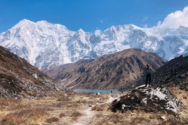
- Gosaikunda Lake (4,460 m): A sacred alpine lake revered by both Hindus and Buddhists.
- Lauribina Pass (4,681 m): The highest point on the main trekking route.
- Ghopte (3,430 m): A quiet stop after crossing the pass with limited tea houses.
- Kutumsang (2,470 m): A Sherpa village surrounded by forests and hills.
- Chisapani (2,165 m): A scenic viewpoint before the final descent.
- Sundarijal (1,460 m): The trek's endpoint, with an easy drive back to Kathmandu.
Not sure when to go? Read our guide to the best time for the Langtang Gosaikunda Trek.
Best Viewpoints on the Map of Langtang Gosaikunda Lauribina Pass Trek
- Kyanjin Ri (4,773 m): Panoramic views of Langtang Lirung and the surrounding peaks.
- Tserko Ri (5,030 m): The highest viewpoint on the trek, offering spectacular Himalayan scenery.
- Gosaikunda Ridge: Stunning views overlooking the turquoise waters of Gosaikunda Lake.
- Lauribina Pass (4,681 m): Clear mornings reveal the Langtang–Jugal Himal range and distant views of Yala Peak.
- Helambu Section: Peaceful forests, fewer trekkers, and a more remote trekking experience after crossing the pass.
Mountains Visible Along the Langtang Gosaikunda Lauribina Pass Trek
- Langtang Lirung (7,245 m): The highest peak in the Langtang region and a constant companion through the valley.
- Langtang II (6,596 m) is visible from Kyanjin Gompa and nearby viewpoints.
- Dorje Lakpa (6,966 m) is seen from higher sections around Gosaikunda and Helambu.
- From Kyanjin Ri and Tserko Ri, Yala Peak (5,732 m) is easily visible.
- Gangchempo (6,388 m): A prominent snow-covered peak overlooking the Langtang Valley.
- Naya Kanga (5,844 m) is visible near Kyanjin Gompa and the surrounding ridges.
- Shishapangma (8,027 m), Tibet's highest mountain, visible on clear days from Lauribina Pass and nearby ridges.
- The Jugal Himal Range was seen while crossing Lauribina Pass and descending toward Helambu.
Note: Mountain visibility depends on weather conditions, with the clearest views typically during spring (March–May) and autumn (September–November).
Why Do You Need a Detailed Langtang Gosaikunda Lauribina Pass Trek Map?
A detailed map is important because tea houses become sparse between Gosaikunda and Ghopte, and taking a wrong turn at high altitude can cost you precious daylight. Knowing the terrain in advance changes how you pack, pace, and plan each day.
A reliable map helps with the following:
- Route planning: Spotting which days are short and which run 6+ hours
- Daily distance estimation so you're not caught out after dark
- Altitude awareness: Knowing exactly where the elevation jumps happen, especially the Ghoratabela–Langtang Village stretch and the Gosaikunda–Lauribina Pass climb
- Emergency planning: Identifying the nearest village if something goes wrong
- Navigation support especially between Gosaikunda and Ghopte, where the trail thins and crosses both Lauribina Pass and Thadepati Pass
- Village locations for resupply, rest, or a warm meal at stops like Bamboo, Rimche, or Ghoratabela
- Water sources critical above Shin Gompa where streams freeze in winter
- Tea houses knowing which stretches have none for hours
- Permit checkpoints: Langtang National Park and TIMS checks
None of this replaces a guide, but a solid Langtang trek route map turns guesswork into planning, especially on the quieter stretches past Gosaikunda.
Langtang Gosaikunda Lauribina Pass Trek Map Itinerary
|
Day |
Route |
Hours |
Elevation |
|
1 |
Arrival in Kathmandu |
— |
1,310 m |
|
2 |
Kathmandu → Syabrubesi (drive via Trisuli Bazaar, Dhunche) |
7–8 (drive) |
1,640 m |
|
3 |
Syabrubesi → Lama Hotel (via Bamboo, Rimche) |
6–7 |
2,470 m |
|
4 |
Lama Hotel → Langtang Village (via Ghoratabela) |
6–7 |
3,430 m |
|
5 |
Langtang Village → Kyanjin Gompa |
3–4 |
3,850 m |
|
6 |
Kyanjin Gompa → Tserko Ri (acclimatization, return to Kyanjin Gompa) |
5–6 |
5,030 m |
|
7 |
Kyanjin Gompa → Lama Hotel |
6–7 |
2,470 m |
|
8 |
Lama Hotel → Thulo Syabru |
5–6 |
2,260 m |
|
9 |
Thulo Syabru → Shin Gompa (Chandanbari) |
4–5 |
3,330 m |
|
10 |
Shin Gompa → Gosaikunda |
5–6 |
4,460 m |
|
11 |
Gosaikunda → Ghopte (via Lauribina Pass) |
7–8 |
4,681 m (pass) |
|
12 |
Ghopte → Kutumsang (via Thadepati Pass) |
5–6 |
2,470 m |
|
13 |
Kutumsang → Chisapani |
5–6 |
2,165 m |
|
14 |
Chisapani → Sundarijal → Kathmandu |
4–5 (+ drive) |
1,310 m |
|
15 |
Departure from Kathmandu |
— |
1,310 m |
This Langtang Gosaikunda trek itinerary builds in a full acclimatization day at Kyanjin Gompa and a spare day on each end for arrival and departure, since the Lauribina Pass day is long and weather-dependent. If you're trekking independently, treat Day 1 and Day 15 as non-negotiable buffer days; plans slip more often on this route than on straight in-and-out valleys.
Guided groups typically follow this Langtang Gosaikunda trek itinerary almost exactly, since the porters and permits are already timed; slips occur. If you're going solo, you can compress a few of the shorter days, but don't touch Day 6 or Day 11; those are the two days altitude actually decides your pace for you.
Langtang Gosaikunda Lauribina Pass Trek Map Highlights
These moments make the extra days worthwhile. The Langtang Gosaikunda trek highlights below aren't ranked by importance; each occurs on a different day, so the next is as important as the one before:
- Trekking through Langtang National Park's rhododendron and bamboo forests
- Visiting Kyanjin Gompa, a working Buddhist monastery with a cheese factory next door
- Hiking to Tserko Ri (5,030 m) or Kyanjin Ri (4,773 m) for a full panorama of Langtang Lirung and Langtang II
- Exploring the Langtang Valley itself, still recovering culturally and physically from the 2015 earthquake
- Crossing Lauribina Pass at 4,681 m, the trek's technical and physical high point
- Visiting Gosaikunda, a lake sacred to both Hindus and Buddhists, especially during Janai Purnima
- Walking through dense rhododendron forests that bloom red and pink from March into April
- Experiencing Tamang culture in villages like Thulo Syabru and Syabrubesi
- Wide-open Himalayan views from the Gosaikunda ridge and both mountain passes on Day 11 and Day 12
- Traditional stone-and-timber villages that barely see traffic outside trekking season
- Wildlife sightings, including langur monkeys and, occasionally, Himalayan tahr
- Suspension bridge crossings over the Langtang Khola near Bamboo and Rimche
- Open alpine meadows between Shin Gompa and Lauribina
These Langtang Gosaikunda trek highlights are spread fairly evenly across the route, so there's no single "best day"; the valley, the lake, and the pass each bring something different. Ask past trekkers about their favorite Langtang Gosaikunda trek highlights and you'll get a different answer depending on which season they walked in.
Langtang Gosaikunda Lauribina Pass Trek Altitude Profile
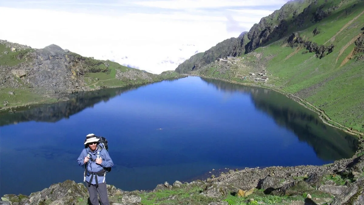
Altitude gain on this trek isn't gradual; it comes in two sharp bursts, once climbing into the Langtang Valley and again crossing into Gosaikunda territory. The complete altitude profile for the Langtang trek below shows every major stop on the route, allowing you to see the two altitude spikes side by side.
|
Location |
Altitude |
|
Kathmandu |
1,310 m |
|
Syabrubesi |
1,640 m |
|
Bamboo |
1,970 m |
|
Rimche |
2,399 m |
|
Lama Hotel |
2,470 m |
|
Ghoratabela |
3,030 m |
|
Langtang Village |
3,430 m |
|
Kyanjin Gompa |
3,850 m |
|
Kyanjin Ri |
4,773 m |
|
Tserko Ri |
5,030 m |
|
Thulo Syabru |
2,260 m |
|
Shin Gompa |
3,330 m |
|
Gosaikunda |
4,460 m |
|
Lauribina Pass |
4,681 m |
|
Ghopte |
3,430 m |
|
Thadepati Pass |
3,690 m |
|
Kutumsang |
2,470 m |
|
Chisapani |
2,165 m |
|
Sundarijal |
1,460 m |
The Lauribina Pass altitude of 4,681 m is the single biggest risk point on the trek, not because the climb is technical, but because you're above 3,800 m for two straight days by the time you reach it. The jump from Langtang Village to Kyanjin Gompa on Day 5 is the other spot where AMS symptoms show up most often.
Guides watch two things closely on this Langtang trek: how well you slept at Gosaikunda and how you're breathing the next morning before the Lauribina Pass altitude climb even starts. Both tell them more than a pulse oximeter reading does.
Worried about high altitude? Learn how to prevent altitude sickness before your trek.
Acclimatization Tip:
Take your acclimatization day at Kyanjin Gompa, stay well hydrated, walk at a steady pace, and avoid alcohol above Langtang Village. Eat carbohydrate-rich meals, watch for early AMS symptoms, and descend immediately if symptoms worsen. You can avoid most altitude-related problems with proper acclimatization.
Final Thoughts
Understanding the route before you go is what makes a smooth 15 days different from a stressful one. This trek demands more from your legs and lungs than a standard valley trek, but the reward of Langtang Valley, Gosaikunda's sacred lake, and Helambu's forests in one trip is difficult to find anywhere else near Kathmandu.
A proper Langtang trek route map isn't optional gear here. It's what tells you where the next tea house is, how far Lauribina Pass really is from Gosaikunda, and where the trail thins out enough to matter. Trekking this Langtang trekking route without one is the single most common regret past guests mention afterward.
Ready to explore one of Nepal's most rewarding trekking routes? Book your Langtang Gosaikunda Lauribina Pass Trek with Nepal Gateway Trekking and let our experienced local guides help you enjoy a safe, well-organized, and unforgettable Himalayan adventure.
FAQs
Where does the Langtang Gosaikunda Lauribina Pass Trek start?
The trek starts in Kathmandu, with a drive to Syabrubesi (1,640 m) via Trisuli Bazaar and Dhunche. Syabrubesi is the gateway into Langtang National Park, where the actual trekking begins.
Where does the Langtang Gosaikunda Lauribina Pass Trek end?
The trek ends in Sundarijal, on the northeastern edge of the Kathmandu Valley. From there, it's a short drive back into the city.
What is the highest point on the trek?
Tserko Ri, an optional side trip from Kyanjin Gompa, tops out at 5,030 m. On the main trekking route itself, Lauribina Pass, at 4,681 m, is the highest point you will cross.
Is the Langtang Gosaikunda Lauribina Pass Trek difficult?
It's rated strenuous. The distance and altitude gain demand solid fitness, and no technical climbing skills are required; the Langtang Gosaikunda trek highlights are still accessible to any reasonably fit trekker.
Can beginners complete this trek?
Yes, with the right pacing and a guide. First-timers should build in extra acclimatization days and avoid rushing the Lauribina Pass crossing.
Which permits are required for the Langtang Gosaikunda Lauribina Pass Trek?
You'll need a Langtang National Park entry permit and a TIMS (Trekkers' Information Management System) card. Both are checked at posts along the route.
What is the best time to trek the Langtang Gosaikunda Lauribina Pass route?
Autumn (September to November) offers the most stable weather and clearest views. Spring is also a good time to see rhododendron blooms.
Can I use Google Maps for the trek?
Google Maps has limited detail for this trail. Offline hiking apps with topographic layers work far better once you're past Syabrubesi.