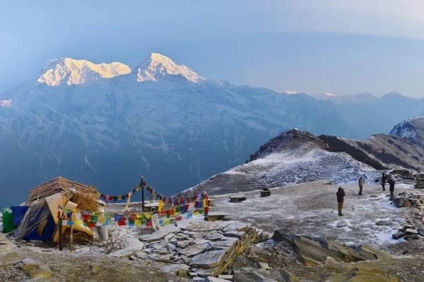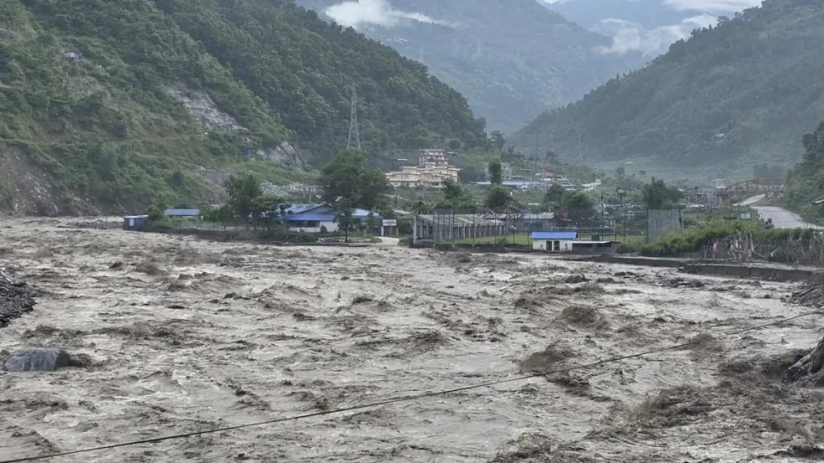
Yes, Nepal remains open for tourism, but travel safety depends entirely on your chosen destination. The August 26, 2026 flash flood began in the Rasuwa–Bhote Koshi corridor and caused severe damage along the downstream Trishuli River system. Major trekking regions, including Everest, Annapurna, Manaslu, Kanchenjunga, and Makalu, were completely unaffected. Flights, trails, teahouses, and permits in those areas are functioning normally.
The normal road access to Langtang and Gosaikunda through the Trishuli–Betambeti corridor is currently closed. The trekking destinations themselves have not been reported as directly damaged by the flood, and TAAN has identified an alternative trekking approach. Travelers should confirm whether that alternative is appropriate for their dates and current trail conditions before departure.
Search, rescue, and road repair efforts are ongoing throughout Rasuwa following extensive damage to access highways, river bridges, and key gateway hubs like Syabrubesi. The Nepal Tourism Board, the Rasuwa District Administration Office, and foreign embassies, including the U.S. Embassy, have advised tourists to avoid all travel into the Rasuwa district until official clearance is given.
Headlines about "Nepal flooding" often lack regional context, making it seem like the entire country is closed. This guide outlines what happened in Rasuwa, which regions are operating normally, and the current status of the Langtang and Gosaikunda corridors.
Quick Answer:
Yes, it is safe to trek in Nepal after the 2026 Rasuwa flood. Nepal has not closed tourism nationwide following the August 2026 Rasuwa flood, but trekking safety depends on the destination and access route. The disaster severely affected the Rasuwa–Bhote Koshi–Trishuli corridor, while the normal road approach to Langtang and Gosaikunda is currently closed.
The trekking destinations themselves have not reported direct flood damage, and the main Everest, Annapurna, Manaslu, Kanchenjunga and Makalu trekking corridors have no reported direct flood damage. Travelers should confirm current route, road, trail, flight and weather conditions before departure.
What Happened in the Rasuwa Flood?
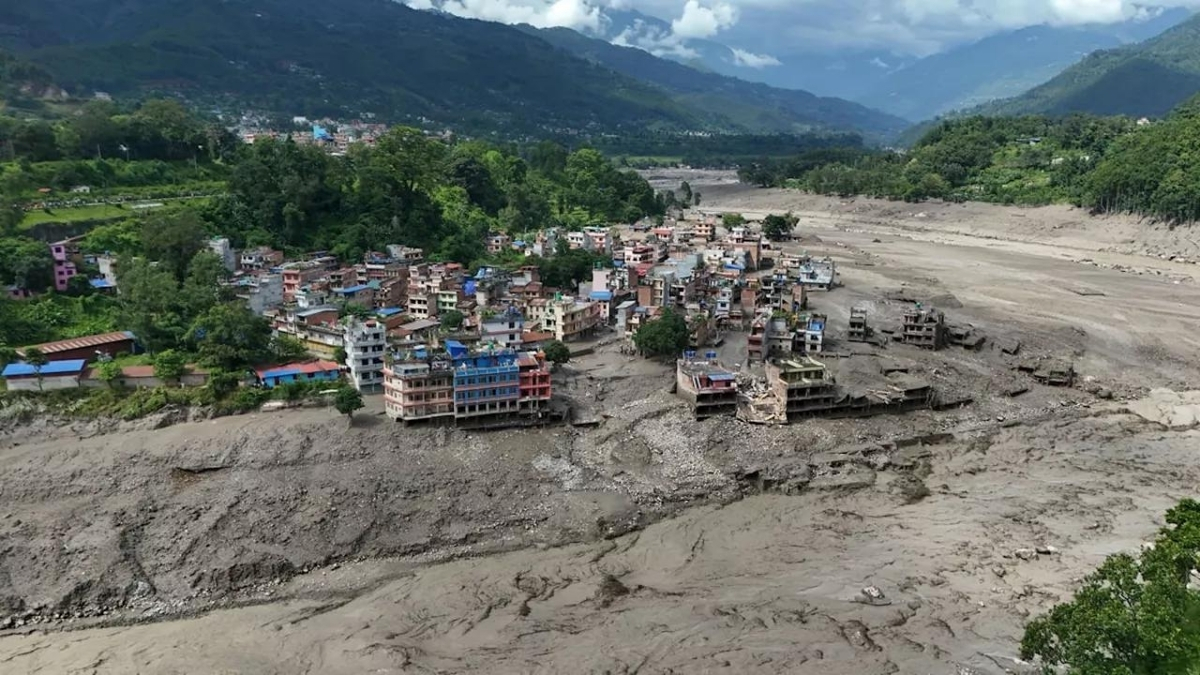
This flash flood is considered one of the deadliest natural disasters the region has faced in recent years.
August 26 Timeline: How the Flood Unfolded
The flood struck between 8:30 and 9:00 a.m. local time on August 26, 2026. Water levels in the Bhote Koshi basin rose so rapidly that the Trishuli River at Galchhi climbed nearly 9 meters close to the height of a four-story building within 30 minutes.
Primary areas hit by the flood surge:
- Timure and Rasuwagadhi: Key settlements near the Nepal-China border.
- Syabrubesi: The primary Langtang trekking gateway town.
- Betrawati and Trishuli Bazar: Low-lying central trading towns along the Trishuli corridor.
- Downstream Districts: Nuwakot, Dhading, Gorkha, Tanahun, Nawalparasi, and Chitwan.
- Gyirong Port: The main trade and tourism crossing between Nepal and Tibet was severely damaged.
What Caused the Rasuwa Flood? An Ice-Rock and Glacier Collapse Triggered the Disaster
Nepal's Department of Hydrology and Meteorology confirmed there was no significant rainfall in the 24 hours prior to the event, ruling out a typical monsoon rain flood.
According to disaster authorities and the Kathmandu-based International Centre for Integrated Mountain Development (ICIMOD), an ice-rock avalanche sheared off near the border, entering the Lhende Khola (a tributary on the Tibetan side). The debris temporarily dammed the river, creating a natural barrier that rapidly breached and sent a destructive wall of water, mud, and boulders down the Bhote Koshi and Trishuli rivers.
Initial scientific assessments indicate that a large ice-and-rock collapse near Langtang Lirung triggered an avalanche and debris flow that entered the Lhende Khola before moving downstream through the Bhote Koshi and Trishuli river systems. Scientists are still investigating the precise sequence of events and the role of broader glacial and climate-related changes.
While Himalayan glaciers are losing mass rapidly, ICIMOD scientists emphasized that it is too early to attribute this specific event directly to climate change.
Death Toll and Missing Persons: The Human Impact
- Nepal: 900+ confirmed deaths, with over 4,700+ people remaining missing (as of 8/31/2026) as search-and-rescue efforts continue in remote pockets.
- China (Tibet Autonomous Region): Official releases from the Chinese side and cross-border situation reports cite 16 confirmed deaths and 546 missing near Gyirong Port. Adjusting this figure prevents overstating the confirmed fatalities on the Tibetan side.
- Rescued: Over 7,500 people evacuated, including more than 200 foreign nationals, tourists, and pilgrims.
- Affected Population: More than 90,000 people directly or indirectly affected across the flood path.
Note: Figures are updated regularly by Nepal's National Disaster Risk Reduction and Management Authority (NDRRMA) and emergency agencies.
A Repeated Threat: Two Disasters in 14 Months
This single river corridor remains acutely vulnerable. Just 14 months earlier, on July 8, 2025, a supraglacial lake outburst flood (GLOF) swept away the Miteri Friendship Bridge, damaged seven hydropower projects, and flattened parts of the Timure dry port.
Rebuilt border infrastructure and customs facilities were destroyed a second time by the August 2026 ice-rock avalanche flood.
Following the 2025 disaster, ICIMOD classified the Lhende Khola–Bhote Koshi basin as a high-risk transboundary flood zone. The 2026 event underscores the urgent need for automated, real-time cross-border early-warning systems between Tibet and downstream Nepalese communities.
Why Only the Langtang Region Was Affected?
The flood traveled along a single channel, the Bhote Koshi, into the Trishuli, affecting Timure, Syabrubesi, Betrawati, and Trishuli Bazar in the Rasuwa and Nuwakot districts, the access corridor for the Langtang region. That single-corridor path is why the rest of Nepal's trekking regions were never touched.
Nepal's major trekking regions rely on completely separate drainage basins with no physical connection to the Bhote Koshi. Everest drains into the Dudh Koshi river basin, Manaslu into the Budhi Gandaki, and Annapurna into the Marsyangdi and Kali Gandaki rivers. Further east, Kanchenjunga and Makalu drain into the Tamor and Arun river networks.
Because these regions were never in the path of the floodwaters, their trails, teahouses, and regional airports remain completely unaffected and open for trekking as scheduled. Langtang is the one exception, and exactly how it was affected is covered next.
Which Trekking Regions Are Open After the Flood?
Nepal has eight major trekking regions, and only one was in the flood's direct path. Here's the current status for each, so you can quickly find the one that matters to your trip.
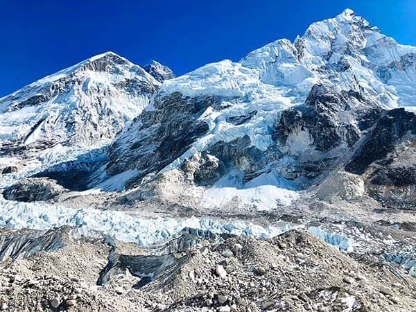
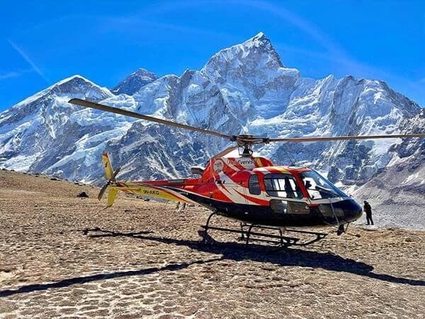
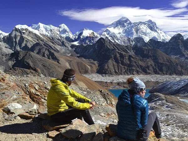
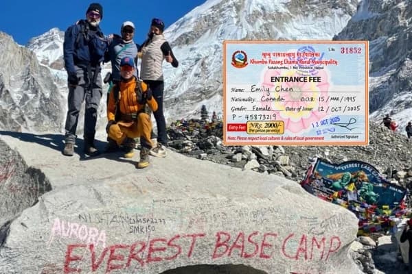
- Everest Region - Fully Open: The Everest Base Camp Trek, Lukla flights, the Gokyo Valley Circuit, and the Everest Three Passes Trek are all running on their regular schedule. Tribhuvan International Airport and domestic flights to Lukla are operating normally.
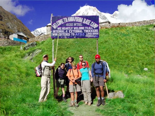
- Annapurna Region - Fully Open: The Annapurna Circuit, Annapurna Base Camp, Mardi Himal, Poon Hill, and Upper Mustang treks are all unaffected. Flights to Pokhara and Jomsom continue as usual. The only related disruption was a brief closure on a stretch of the Prithvi Highway between Kathmandu and Pokhara, which reopened within about 24 hours.
- Manaslu Region - Fully Open: The Manaslu Circuit is accessed via Arughat in the Gorkha district, a different route and river system from the one affected by the flood. Trekking continues without disruption.
- Kanchenjunga and Makalu Regions - Fully Open: The Kanchenjunga Circuit Trek, Kanchenjunga Base Camp Trek, and Makalu Base Camp Trek are all running normally. Both regions sit in Nepal's far east, nowhere near the Bhote Koshi corridor, and have seen zero impact from this event.
- Langtang Region - Affected, But Not Closed: Although the upper Langtang Khola trail above Syabrubesi was not directly hit by the flood surge, commercial trekking to the entire region is currently suspended, and there is no working alternative route. The issue is infrastructure, not the trail itself. The Pasang Lhamu Highway connecting Kathmandu to Syabrubesi suffered severe washouts across 40 to 50 kilometers, and key motorable bridges, along with the main starting point in Syabrubesi, were swept away. The road through Dhunche is currently an emergency-only track reserved for the Nepal Army and rescue agencies, and it is not open for tourist transit.
A trail that cannot be safely reached is closed in practice. Emergency rescue operations and infrastructure repairs currently take priority, and official advisories instruct tourists to avoid all travel into Rasuwa district. The Tamang Heritage Trail is affected even more directly, since it loops through the hardest-hit Bhote Koshi corridor and Timure area, leaving it entirely unavailable for the early autumn season.
Not sure if your Langtang or Gosaikunda booking needs to change? Get in touch with Nepal Gateway Trekking team for the latest route status before you plan further.
What's Restricted, and Is There Any Way to Access Langtang or Gosaikunda?
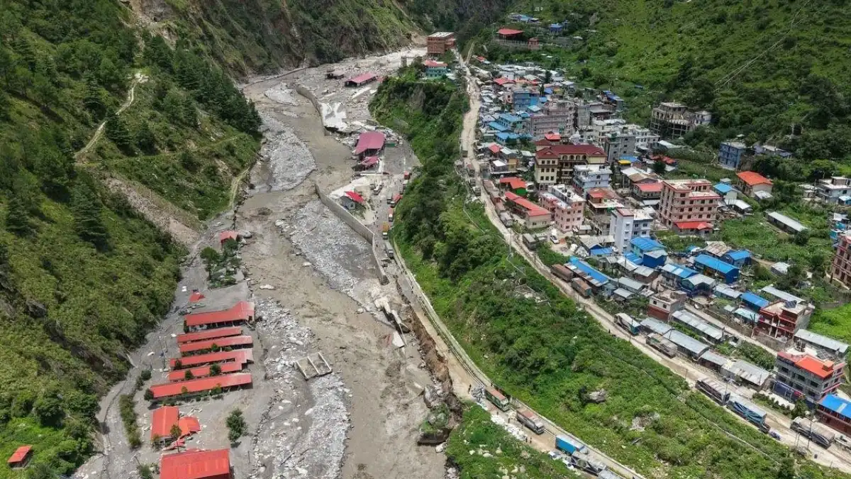
No. There is currently no tourist route into Langtang or Gosaikunda. The Dhunche road is reserved exclusively for the Nepal Army, local authorities, and rescue agencies and is not approved for commercial or tourist transit.
Here's exactly which zones are currently off-limits and which regions have no restrictions at all.
Currently restricted or closed to tourism:
- Rasuwagadhi, Timure, and the Nepal-China border zone
- The entire Langtang and Gosaikunda trekking region, including all routes into Syabrubesi and Dhunche
- All highways in Rasuwa and Nuwakot districts, including sections of the Trishuli-Mailung-Syafrubesi road and the Araniko Highway near Bhotekoshi
Nepal Tourism Board, the Rasuwa District Administration Office, and foreign embassies, including the U.S. Embassy, have advised tourists to avoid all non-essential travel into the Rasuwa district until official clearance is given.
Operating with no restrictions:
- Everest, Annapurna, Manaslu, Kanchenjunga, and Makalu
- Kathmandu Valley and Tribhuvan International Airport
Travelers with a Langtang or Gosaikunda trek booked this season should contact their operator directly about postponing or rebooking to another region. Anyone who was already in the region when the flood struck should rely on their guide, the Nepal Tourism Board, or their embassy for evacuation instructions, not on route information found online.
When Will the Langtang Trek Reopen?
Based on the pace of road repairs so far, trekking operators are estimating the standard route to theLangtang trek via Syabrubesi is unlikely to be usable again before late September 2026, weather and inspections permitting. Nepal's main autumn season peaks between October and November, so travelers with bookings later in the season have reasonable grounds for cautious optimism. Until an official reopening is confirmed, there is no usable route into the region, so treat any date here as an estimate, not a booking guarantee.
Current Safety Risks in the Flood Zone
Rescue operations have priority over tourism logistics right now. Helicopters in the affected districts are currently reserved for emergency evacuations and relief supply transport, not commercial trekking flights or sightseeing.
Authorities are also watching for a possible second flood. A debris blockage reportedly remains lodged upstream near the Nepal-China border, and evacuation orders have been issued for Jilong port on the Chinese side as a precaution. Anyone near the Rasuwa corridor should follow official guidance closely and avoid riverbanks and damaged bridges.
Emergency Contacts for Travelers in Nepal
If you need assistance or are trying to reach someone in an affected area, use these official channels:
- Nepal Tourism Board toll-free emergency line: 1234
- Government emergency hotline: 1144
- Tourist Police: 9851289445
- Ministry of Foreign Affairs Emergency Control Room (7 a.m. to 10 p.m.): +977-9744441227 / +977-9744441228
- Email: [email protected]
Final Thought
Disasters like this tend to make headlines louder than the facts. "Nepal flooding" sounds like the whole country is affected, when the reality is one river corridor in one district. This is a real, serious disaster; hundreds of people have died, and thousands remain missing. At the same time, it's not a reason to write off trekking in Nepal altogether. Everest, Annapurna, Manaslu, Kanchenjunga, and Makalu are running exactly as they were before August 26, and for most travelers with trips booked outside Rasuwa, nothing needs to change.
If your trip touches Langtang or Gosaikunda, patience is the right approach right now, not guesswork. Roads are being repaired, and rescue operations are ongoing, and access will return once it's actually safe, not before. The most useful thing you can do is check the specific status of your specific route before you travel, not the headline you saw last week. We'll keep this page updated as conditions on the ground change.
Planning a trek in Nepal this season? Nepal Gateway Trekking can help you find the right route and plan your trip with confidence.
Frequently Asked Questions
Is it safe to travel to Nepal right now?
Yes. The flood's impact is localized to the Rasuwa district and its immediate downstream neighbors. Kathmandu, Pokhara, and every major trekking region outside Langtang and Gosaikunda are operating normally.
Is the Everest Base Camp trek affected by the flood?
No. The Everest region drains into the Dudh Koshi river system, which has no connection to the flood-affected Bhote Koshi corridor. Lukla flights and the EBC trail are running normally.
Is the Annapurna Circuit or Annapurna Base Camp trek safe right now?
Yes. The Annapurna region drains into the Marsyangdi and Kali Gandaki rivers, entirely separate from the flood zone.
Is the Langtang Valley trek cancelled?
Commercial trekking to Langtang is currently suspended. The main trail follows a different river than the one that flooded and is believed to be structurally intact, but the access route through Syabrubesi is damaged, and the alternative road through Dhunche is reserved for emergency and rescue use only. There is currently no tourist route into the region.
Is Syabrubesi road open?
Not for tourist travel. Sections of the road between Trishuli and Syabrubesi remain damaged, and the limited vehicle access that has resumed is reserved for relief and rescue work, not commercial trekking transit.
Is the Gosaikunda route affected?
Yes. Commercial access to Gosaikunda is currently suspended, along with the rest of the Langtang region. There is no tourist route in via Dhunche or otherwise at this time.
What caused the Rasuwa flood?
An ice-rock avalanche near Langtang Lirung is believed to have dammed the Lhende Khola stream. When that natural dam burst, it sent a flash flood down the Bhote Koshi into the Trishuli River system. It was not caused by monsoon rainfall.
Do I need to cancel my Nepal trekking trip because of the flood?
Not unless your itinerary specifically routes through Rasuwa district, Syabrubesi, Langtang, or Gosaikunda. If you're heading to Everest, Annapurna, Manaslu, Kanchenjunga, or Makalu, no changes are needed. For a Langtang or Gosaikunda trek, contact your operator about postponing or rebooking, since there is currently no usable route into the region.