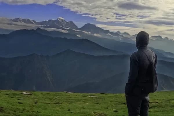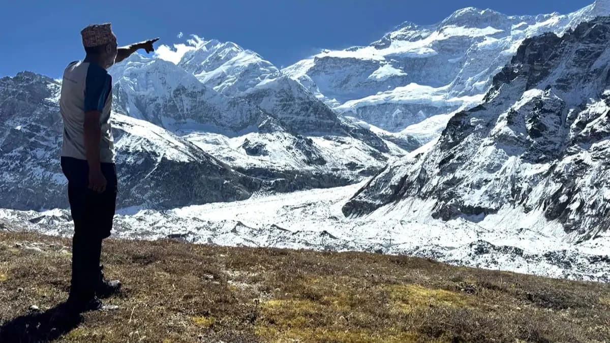
The Kanchenjunga Base Camp Trek map gives you a much clearer idea of what this journey is like than a list of places alone. This 23-day route takes you from Kathmandu into the remote eastern Himalayas, through Sekathum, Ghunsa, Khambachen and Lhonak to Pang Pema, the North Base Camp. From there, you return to Ghunsa, cross the high passes toward Cheram and continue to Ramche and Oktang, the South Base Camp area, before descending through Tortong, Yamphudin and Khebang.
Unlike a simple out-and-back trek, this route takes you to both the northern and southern sides of Mount Kanchenjunga. The map also shows how quickly the altitude changes, from 1,310 m in Kathmandu to 5,143 m at Pang Pema, before dropping and climbing again toward Oktang at 4,730 m.
If you are planning the trek, studying the map beforehand helps you understand where the long walking days, acclimatization stops, high passes and road journeys fit into the 23-day itinerary.
Kanchenjunga Base Camp Trek Map at a Glance
The Kanchenjunga region is a restricted trekking area. Nepal Tourism Board lists the Kanchenjunga Base Camp Trek among the routes where trekkers must be accompanied by a licensed guide and carry an agency-issued TIMS card.
Detail
Route
Duration
23 days
Start/End
Kathmandu
Trailhead
Sekathum
Highest point
Pang Pema, 5,143 m
North Base Camp
Pang Pema
South Base Camp area
Oktang
Difficulty
Strenuous
Main route
Sekathum → Ghunsa → Pang Pema → Ghunsa → Sele Le → Cheram → Ramche → Oktang → Yamphudin → Khebang
Best seasons
Spring & autumn
Trek Highlights
- Shape: a horseshoe circuit joining the North Base Camp (Pang Pema) and South Base Camp (Oktang) across three passes
- Distance: around 200 to 220 km of walking
- Length: 23 days door to door from Kathmandu
- High point: 5,143 m at Pang Pema
- Trailhead: Sekathum (1,660 m), reached via Bhadrapur and Taplejung
- Effort level: strenuous, restricted area, guide required by law
- What sets it apart: two base camps on the world's third highest peak, and a trail that stays quiet even in peak season
Planning to follow the full North and South Base Camp route? Nepal Gateway Trekking's 23-day itinerary includes the transport, permits, guide, accommodation and trekking sections shown on this map.
Kanchenjunga Base Camp Trek Route Map
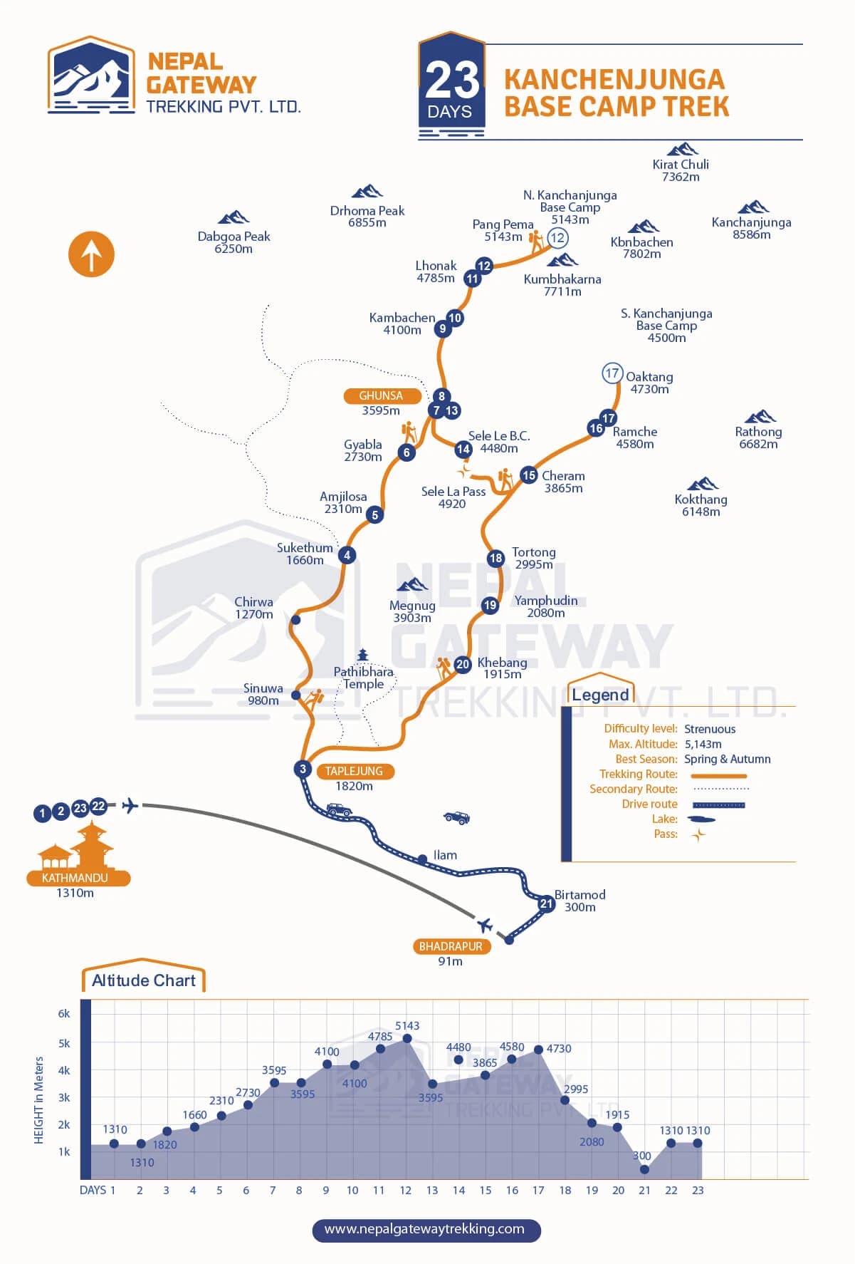
The route can be understood in five main sections:
- Kathmandu to Sekathum: The journey starts with a flight from Kathmandu to Bhadrapur, followed by a long drive through eastern Nepal to Taplejung and then Sekathum, where the trekking section begins.
- Sekathum to Pang Pema: From Sekathum, the trail follows the Ghunsa Khola through Amjilosa, Gyabla and Ghunsa before climbing higher to Khambachen and Lhonak. From Lhonak, a day hike takes you to Pang Pema at 5,143 m, the North Base Camp.
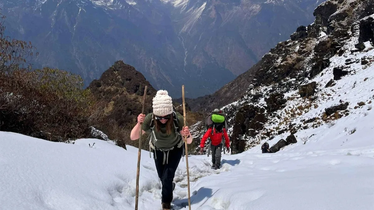
- Pang Pema to Cheram: After returning to Ghunsa, the trail turns south toward Sele Le. From there, you cross the high mountain section over Mirgin La, Sinion La and Sinelapche La before descending to Cheram.
- Cheram to Oktang: The trail follows the Yalung Glacier valley from Cheram to Ramche. From Ramche, you make a day trek to Oktang at 4,730 m, the South Base Camp area, and return to Ramche for the night.
- Oktang to Kathmandu: The return route descends through Tortong, Yamphudin and Khebang before a long jeep journey to Birtamod and a flight from Bhadrapur back to Kathmandu.
Kanchenjunga Base Camp Trek Itinerary on the Map
The following itinerary follows the 23-day Nepal Gateway Trekking route shown on the package map and detailed itinerary.
|
Day |
Route |
Overnight / main altitude |
|
1 |
Arrival in Kathmandu |
Kathmandu, 1,310 m |
|
2 |
Rest, permits and trek preparation in Kathmandu |
Kathmandu, 1,310 m |
|
3 |
Fly Kathmandu to Bhadrapur and drive to Taplejung |
Taplejung, 1,820 m |
|
4 |
Drive Taplejung to Sekathum |
Sekathum, 1,660 m |
|
5 |
Trek Sekathum to Amjilosa |
Amjilosa, 2,310 m |
|
6 |
Trek Amjilosa to Gyabla |
Gyabla, 2,730 m |
|
7 |
Trek Gyabla to Ghunsa |
Ghunsa, 3,595 m |
|
8 |
Acclimatization day in Ghunsa |
Ghunsa, 3,595 m |
|
9 |
Trek Ghunsa to Khambachen |
Khambachen, 4,100 m |
|
10 |
Acclimatization day in Khambachen |
Khambachen, 4,100 m |
|
11 |
Trek Khambachen to Lhonak |
Lhonak, about 4,790 m |
|
12 |
Trek Lhonak to Pang Pema and return |
Pang Pema, 5,143 m |
|
13 |
Trek Lhonak to Ghunsa via Khambachen |
Ghunsa, 3,595 m |
|
14 |
Trek Ghunsa to Sele Le Base Camp |
Sele Le 4,290 m |
|
15 |
Trek Sele Le to Cheram via the high passes |
Cheram, 3,865 m |
|
16 |
Trek Cheram to Ramche |
Ramche, 4,580 m |
|
17 |
Day hike Ramche to Oktang and return |
Oktang, 4,730 m |
|
18 |
Trek Ramche to Tortong |
Tortong, 2,995 m |
|
19 |
Trek Tortong to Yamphudin |
Yamphudin, 2,080 m |
|
20 |
Trek Yamphudin to Khebang |
Khebang, 1,915 m |
|
21 |
Drive Khebang to Birtamod |
Birtamod, 300 m |
|
22 |
Drive to Bhadrapur and fly to Kathmandu |
Kathmandu, 1,310 m |
|
23 |
Final departure |
— |
This itinerary includes two dedicated acclimatization days, one in Ghunsa and another in Khambachen. It also allows you to visit both Pang Pema and Oktang rather than choosing only one side of Kanchenjunga.
Experience the Himalayas in Premium Comfort
Trek to Kanchenjunga with complete peace of mind. Check out the kanchenjunga base camp trek cost and reserve your customized, end-to-end expedition with Nepal Gateway Trekking today!
Kanchenjunga Base Camp Trek Elevation Profile
The elevation profile makes one thing clear: this trek is not a simple steady climb.
You start in Kathmandu at 1,310 m, descend to the lower eastern region during the journey to the trailhead, and begin trekking from Sekathum at 1,660 m. The trail then climbs gradually through Amjilosa, Gyabla and Ghunsa.
After your acclimatization stop in Ghunsa, you climb to Khambachen at 4,100 m and then Lhonak at around 4,790 m. The highest point comes on the following day at Pang Pema, 5,143 m.
The route then drops back to Ghunsa before climbing again toward Sele Le and the high passes. After reaching Cheram and Ramche, the trail rises again to Oktang at 4,730 m.
From Oktang, the elevation drops steadily through Tortong, Yamphudin and Khebang before reaching the lowlands around Birtamod.
This repeated climb-and-descent pattern is one reason the trek is classified as strenuous. The itinerary includes acclimatization days to give your body time to adjust before moving higher.
North vs South Kanchenjunga Base Camp
The full route gives you the chance to see Kanchenjunga from two very different sides.
|
North Base Camp |
South Base Camp Area |
|
|
Location |
Pang Pema |
Oktang |
|
Altitude |
5,143 m |
4,730 m |
|
Approach |
Lhonak valley |
Yalung Glacier valley |
|
Overnight stop |
Lhonak |
Ramche |
|
Main experience |
Views of the northern face |
Views of the southern face and Yalung Glacier |
Pang Pema is reached from Lhonak and is the highest point of the itinerary. Oktang is reached as a day hike from Ramche, so you do not need to spend the night at 4,730 m.
Key Stops on the Kanchenjunga Trek Map
The map includes a long list of villages and mountain points. These are the main stops to understand before following the route.
|
Stop |
Altitude shown on the route map |
Why it matters |
|
Kathmandu |
1,310 m |
Starting and finishing point |
|
Taplejung |
1,820 m |
Eastern Nepal gateway before the trek |
|
Sekathum |
1,660 m |
Main trekking trailhead |
|
Amjilosa |
2,310 m |
First overnight trekking settlement |
|
Gyabla |
2,730 m |
Forested mountain village |
|
Ghunsa |
3,595 m |
Major settlement and acclimatization stop |
|
Khambachen |
4,100 m |
Second acclimatization stop |
|
Lhonak |
~4,790 m |
Final overnight stop before Pang Pema |
|
Pang Pema |
5,143 m |
North Base Camp and highest point |
|
Sele Le |
— |
High staging point before the pass crossing |
|
Cheram |
3,865 m |
Gateway to the southern side |
|
Ramche |
4,580 m |
Overnight stop for the Oktang hike |
|
Oktang |
4,730 m |
South Base Camp area |
|
Tortong |
2,995 m |
First major descent stop after Ramche |
|
Yamphudin |
2,080 m |
Larger settlement on the return route |
|
Khebang |
1,915 m |
Final trekking stop |
|
Birtamod |
300 m |
Lowland stop before the return flight |
The route map also marks several surrounding peaks, including Kanchenjunga, Kumbhakarna/Jannu, Kirat Chuli, Rathong and Kokthang.
Mountains and Views Along the Kanchenjunga Route
Kanchenjunga is the main attraction, but it is far from the only mountain you will see on this route.
- Mount Kanchenjunga — 8,586 m: The third-highest mountain in the world dominates the route. Pang Pema gives you views of its northern side, while Oktang provides a different perspective from the south.
- Kumbhakarna (Jannu) — 7,711 m: This dramatic peak becomes particularly prominent around Khambachen and the northern section of the trek.
- Kirat Chuli — 7,362 m: This peak appears among the high mountains around the Lhonak and Pang Pema area.
- Rathong Peak — 6,682 m: Rathong is one of the prominent peaks visible around the southern section near Ramche and Oktang.
- Kokthang — 6,148 m: This peak forms part of the impressive mountain scenery around the Yalung Glacier and Ramche.
Other peaks shown on the Nepal Gateway route map include Dromma Peak, Dabgoba Peak, Kabru and Talung.
How to Read the Kanchenjunga Base Camp Trek Map?
The Nepal Gateway Trekking map uses different markings to separate the walking route, road transfers and important geographical features.
- The orange line shows the main trekking route. This is the section you travel on foot from Sekathum through the high mountain valleys and back down toward Khebang.
- The dotted line marks secondary routes shown on the map.
- The blue road route shows the vehicle sections. These include the journeys between Bhadrapur, Taplejung, Sekathum and the return through Birtamod.
- The pass symbol identifies the high mountain passes along the route.
- The map also marks major peaks, lakes and settlements so you can match the written itinerary with the terrain around you.
At the bottom, the altitude chart shows how the elevation changes from one day to the next. This is particularly useful for understanding why Ghunsa and Khambachen are used as acclimatization stops.
How Difficult Is the Kanchenjunga Base Camp Trek?
The Kanchenjunga Base Camp Trek is a strenuous trek and is best suited to people who are comfortable with long days of walking in remote mountain terrain.
The biggest challenge is the combination of altitude, distance, rugged trails and limited infrastructure. You climb from 1,660 m at Sekathum to more than 5,000 m at Pang Pema, then descend and climb again toward the southern side of Kanchenjunga.
Some sections include loose rocks, scree, glacial moraine, exposed trails and steep climbs. The pass crossing between Sele Le and Cheram is particularly demanding because it involves several high passes followed by a steep descent.
The good news is that the itinerary does not rush straight to the highest elevations. It includes acclimatization days in Ghunsa and Khambachen before the route moves higher.
Previous trekking experience, good fitness and a steady pace are important for completing this route comfortably. You can learn more about its difficulty from oue blog: How Difficult Is the Kanchenjunga Base Camp Trek?
Final Thoughts
The Kanchenjunga Base Camp Trek map shows why this is such a different Himalayan journey. Instead of following one valley to a single destination, the 23-day route takes you through the northern and southern sides of Kanchenjunga.
You climb from Sekathum to Ghunsa, Khambachen and Pang Pema, return through the high passes toward Cheram, continue to Ramche and Oktang, and then descend through Tortong, Yamphudin and Khebang.
Understanding that route before you leave makes the trek much easier to picture. You can see where the altitude rises, where the acclimatization days fit in, where the difficult pass crossing comes and how the remote trekking section connects with the road journey back to Kathmandu.
Ready to follow the full Kanchenjunga route? Explore the Nepal Gateway Trekking Kanchenjunga Base Camp Trek for the complete itinerary, inclusions, departure dates and booking details. Contact us today!
Frequently Asked Questions
How long is the Kanchenjunga Base Camp Trek?
The full Kanchenjunga Base Camp Trek takes 23 days from Kathmandu and back. That includes the travel to and from the trailhead, acclimatization days, and visits to both Pang Pema and Oktang. The trek itself takes you deep into eastern Nepal, so you need to allow extra time for the long road journeys as well as the walking days.
Is the Kanchenjunga Trek hard?
Yes, it is a tough trek, especially because of the altitude and how remote the trail is. You will eventually reach 5,143 m at Pang Pema, and some days involve steep climbs, rocky trails and high passes. You also won't find facilities as often as you would on the Everest or Annapurna routes. You don't need to be an athlete, but being fit and having some trekking experience will make a big difference.
How do I get to Kanchenjunga Base Camp?
The journey starts with a flight from Kathmandu to Bhadrapur. From Bhadrapur, you take a jeep toward Taplejung and then continue to Sekathum. This is where you leave the road behind and start trekking. From Sekathum, the trail goes through Amjilosa, Gyabla and Ghunsa before climbing higher toward Khambachen, Lhonak and Pang Pema.
What is the highest altitude of the Kanchenjunga Base Camp Trek?
The highest point is Pang Pema at 5,143 m. It is the North Base Camp of Kanchenjunga and is reached from Lhonak. You hike up to Pang Pema and return to Lhonak for the night rather than sleeping at the highest point. Later in the trek, you also reach Oktang at 4,730 m on the southern side.
Can a beginner do the Kanchenjunga Base Camp Trek?
You can, but it isn't the trek we'd suggest for someone who has never trekked before. The route is long, the altitude is high and some sections are physically demanding. If you're new to trekking but are fit, train properly before the trip and have a good guide with you, it can be done. Still, having completed a few multi-day treks beforehand will give you a much better idea of what to expect.
Is Kanchenjunga harder than Everest Base Camp?
For most people, yes, Kanchenjunga is the tougher trek. It's not necessarily because it reaches a much higher altitude. The bigger difference is the remoteness. There are fewer teahouses, fewer people on the trail and longer stretches where you have to rely on what you've carried with you. The route also includes several demanding high-pass sections. Everest Base Camp is busier, but that also means more accommodation and services along the way.
Is a guide mandatory for the Kanchenjunga Base Camp Trek?
Yes. Kanchenjunga is a restricted trekking area, so you cannot simply go there on your own. You need to trek with a licensed guide and have the required permits. A registered trekking agency normally takes care of these arrangements before you enter the region.
What is the best time to trek Kanchenjunga Base Camp?
The best time is generally March to May and September to November. Spring is a great choice if you want to see rhododendrons blooming along the lower sections of the trail. Autumn usually brings clearer skies and good mountain views. Whichever season you choose, remember that the weather can change quickly once you get into the high mountains.
What is the difference between Pang Pema and Oktang?
They are the two base camp areas on opposite sides of Kanchenjunga. Pang Pema is on the northern side at 5,143 m, while Oktang is on the southern side at 4,730 m. You approach them through different valleys, so the scenery changes quite a bit between the two. The full circuit takes you to both, which is one of the main highlights of doing the complete Kanchenjunga trek.