Quick Summary
- Mardi Himal Trek elevation: The standard route reaches 4,200 m (13,780 ft) at the Upper Viewpoint.
- Mardi Himal High Camp altitude: High Camp is 3,580 m (11,745 ft) and is the highest overnight stop on the standard itinerary.
- The trek starts around 820 m (2,690 ft) in Pokhara and climbs through Pothana, Forest Camp, and Low Camp before reaching High Camp.
- The optional Mardi Himal Base Camp section reaches around 4,500 m (14,764 ft).
- The 5,587 m (18,330 ft) Mardi Himal summit is not part of the normal trekking route.
- Altitude becomes more noticeable as you climb above 3,000 m (9,843 ft), especially around High Camp and the Upper Viewpoint.
The Mardi Himal Trek elevation reaches about 4,200 meters (13,780 ft) at the Upper Viewpoint on the standard route. High Camp is lower, at around 3,580 m (11,745 ft), while some itineraries continue to Mardi Himal Base Camp at roughly 4,500 m (14,764 ft).
The mountain itself rises to 5,587 m, but the summit is not part of the normal trekking route. For most trekkers, the 4,200-meter Upper Viewpoint is the main altitude to consider. The exact highest point can change if the itinerary includes the higher Base Camp section.
What Is the Highest Point of the Mardi Himal Trek?
The highest point on the standard trekking route is the Upper Viewpoint at about 4,200 m (13,780 ft). Trekkers normally reach it from High Camp, usually early in the morning, and then return to the lower part of the trail. The climb is short enough to fit into a trekking day, but the altitude makes this section more demanding than the lower forest trails.
Some itineraries continue beyond the Upper Viewpoint toward Mardi Himal Base Camp, around 4,500 m (14,764 ft). So, if your trip includes that extension, your maximum altitude will be higher than 4,200 m (13,780 ft).
The 5,587-meter summit should not be confused with the trekking route. Reaching the summit requires a mountaineering objective rather than a normal teahouse trek.
Mardi Himal Trek Elevation From Start to Highest Point
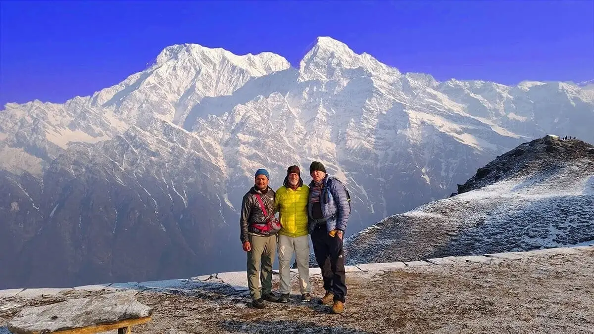
The trail climbs gradually from the lower hills before reaching the high ridge around High Camp. Our 11 Days Mardi Himal Trek itinerary includes these approximate elevations:
|
Day |
Route |
Approx. elevation |
Distance covered |
Net altitude change |
|
Day 1 |
Arrival in Kathmandu |
- |
- |
- |
|
Day 2 |
Kathmandu → Pokhara |
820 m (2,690 ft) |
201 km by road |
- |
|
Day 3 |
Kande → Pothana via Australian Camp |
1,890 m (6,201 ft) |
27 km drive + 6 km trek |
- |
|
Day 4 |
Pothana → Forest Camp via Pitam Deurali |
2,520 m (8,268 ft) |
8 km |
+630 m (+2,067 ft) |
|
Day 5 |
Forest Camp → Low Camp |
3,050 m (10,007 ft) |
10 km |
+530 m (+1,739 ft) |
|
Day 6 |
Low Camp → High Camp |
3,580 m (11,745 ft) |
8 km |
+530 m (+1,739 ft) |
|
Day 7 |
High Camp → Upper Viewpoint → Low Camp |
4,200 m (13,780 ft) |
12 + 8 km |
+620 m (+2,034 ft) to high point |
|
Day 8 |
Low Camp → Lwang Village |
1,550 m (5,085 ft) |
17 km |
−1,500 m (−4,921 ft) |
|
Day 9 |
Lwang → Khora Muk → Pokhara |
820 m (2,690 ft) |
3 km walk + 28 km drive |
−560 m (−1,837 ft) to Pokhara |
|
Day 10 |
Pokhara → Kathmandu |
1,400 m (4,593 ft) |
- |
+490 m (+1,608 ft) |
|
Day 11 |
International Departure |
- |
- |
The biggest change comes after Low Camp. The trail keeps climbing toward High Camp, and the following section to the Upper Viewpoint takes you above 4,000 m (13,123 ft).
This elevation profile also explains why the trek can feel quite different at the top compared with the lower forest sections. You are not simply walking farther; you are also dealing with thinner air as you gain height.
Exact elevations can vary slightly between itineraries because the starting point, overnight stops, and route can differ.
How High Is Mardi Himal High Camp?
Mardi Himal High Camp is around 3,580 m (11,745 ft) above sea level. It is usually the highest place where trekkers spend the night on the standard route. From here, the trail continues higher toward the Upper Viewpoint before dropping back down.
This gives the trek two different altitude figures that are easy to mix up:
- 3,580 m: High Camp, where you normally sleep
- 4,200 m: Upper Viewpoint, the standard route's highest point
So the highest place you sleep is not the highest place you reach.
For anyone researching the Mardi Himal Trek Elevation, this difference is more useful than simply remembering one maximum number.
How Much Elevation Does the Mardi Himal Trek Gain?
Maximum altitude and elevation gain are not the same thing. If you reach 4,200 m (13,780 ft), it does not mean you have climbed 4,200 vertical m (13,780 ft) during the whole trek. Elevation gain is the total amount of uphill climbing added together along the route.
The actual gain depends on where you start and how your itinerary is arranged. A route can include both climbs and descents, so the distance between the lowest and highest points does not tell you the total amount of uphill walking.
The Base Camp extension also adds more climbing because you continue above the Upper Viewpoint.
For this reason, there is no single elevation-gain figure that applies perfectly to every Mardi Himal itinerary. When comparing routes, look at both the maximum altitude and the total ascent.
Is the Mardi Himal Trek Difficult Because of Altitude?
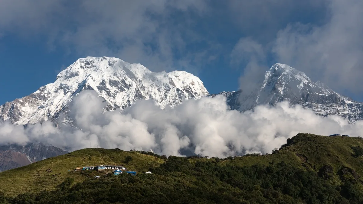
Altitude can make the upper part of the trek harder, but it is not the only factor. Above 3,000 m (9,843 ft), the air contains less oxygen than at lower elevations. The trail also becomes more exposed and includes steeper sections around High Camp and the Upper Viewpoint.
Your experience can depend on several things:
- how quickly you gain altitude
- how much time you spend walking each day
- the steepness of the trail
- weather conditions
- your pace
- how your body responds to altitude
Someone who is fit can still feel the effects of high altitude. Fitness helps with the physical side of trekking, but it does not guarantee that you will avoid altitude-related problems.
Understanding these factors can help you prepare better and know what to expect on the trail. For a closer look at the physical demands, steep sections, and altitude involved, explore Mardi Himal Trek Difficulty.
Mardi Himal Altitude Sickness: What Trekkers Should Know
Yes, altitude sickness is possible on the Mardi Himal Trek. The risk becomes more relevant as the trail rises above 2,500 m (8,202 ft) and the upper viewpoint is above 4,000 m (13,123 ft). People who are not acclimatized can develop Acute Mountain Sickness (AMS) after gaining altitude.
Common symptoms of altitude sickness include:
- headache
- dizziness
- nausea
- unusual tiredness
- loss of appetite
The symptoms should not be treated as something you simply have to tolerate. If you feel unwell, tell your guide or the people travelling with you and avoid continuing higher while significant symptoms are present.
If symptoms become worse or severe, descending to a lower altitude is important. The Wilderness Medical Society recommends stopping further ascent when AMS develops and using descent when symptoms worsen or become serious.
A gradual ascent gives your body more time to adjust. It is also worth remembering that drinking excessive amounts of water does not prevent altitude sickness.
Why Do Mardi Himal Elevation Figures Differ?
You may find different altitude figures when comparing trekking websites. Usually, the difference comes down to which point of the route is being measured.
High Camp is around 3,580 m (11,745 ft). The upper viewpoint is around 4,200 m (13,780 ft). Some longer routes continue toward Base Camp at around 4,500 m (14,764 ft).
There can also be small differences between published figures for the same location. Trail routes change, GPS measurements are not always identical, and trekking companies may describe nearby points differently.
The easiest way to avoid confusion is to look at the location attached to the number. A figure for High Camp should not be compared directly with a figure for Base Camp or the Upper Viewpoint.
Final Thoughts
The Mardi Himal Trek Elevation is easier to understand once the main points are separated. High Camp sits at about 3,580 m (11,745 ft), the standard upper viewpoint reaches around 4,200 m (13,780 ft), and some itineraries continue higher toward Base Camp.
For most trekkers, 4,200 m (13,780 ft) is the figure that matters most. It is high enough that altitude should be taken seriously, even though the trek itself is not a summit expedition.
If you want to check the route or discuss your trekking plans, contact Nepal Gateway Trekking.
FAQs
How high is the Mardi Himal Trek?
The standard route tops out at about 4,200 m at the Upper Viewpoint. Some itineraries go higher, toward Base Camp.
Is 4,200 meters high for the Mardi Himal Trek?
Yes. It's high altitude, and if you haven't acclimatized, you can get altitude symptoms there.
What is the Mardi Himal Base Camp altitude?
Usually around 4,500 m, though the figure changes a bit depending on the source and route.
Does the Mardi Himal Trek have altitude sickness?
It can. The risk goes up as you climb, especially above 2,500 m. Headache, nausea, dizziness, and unusual tiredness can be signs of acute mountain sickness.
Does every Mardi Himal itinerary reach the same highest point?
No. Some stop at the 4,200 m Upper Viewpoint, and others continue toward Base Camp.
Is the Mardi Himal summit part of the normal trek?
No. The 5,587 m summit is a separate climbing objective, and the normal trek doesn't go there.