There's a place in Nepal where two 8,000-meter peaks face each other across a river valley so deep it makes the Grand Canyon look like a small ditch. That is the Kali Gandaki Gorge, and most individuals traveling to Nepal tend to overlook it entirely. The Kali Gandaki gorge's depth is over 5,500 meters of vertical relief.
The Kali Gandaki River running through it is older than the Himalayas themselves. And somewhere along the riverbed, you'll discover saligrams, sacred fossils found absolutely nowhere else on earth. It's not just the deepest gorge in Nepal. It's the deepest gorge in the world.
Trekkers walk through it. Pilgrims have been walking through it for centuries. It's one of those places that's genuinely impossible to describe until you're standing in it. This blog covers everything Kali Gandaki Gorge depth, geology, trekking routes, cultural significance, how to get there, and everything practical you need.
Quick Facts About Kali Gandaki gorge
|
Feature |
Details |
|
Location |
Mustang District, Gandaki Province, Nepal |
|
Vertical Relief |
5,500–5,571 m (18,045–18,278 ft) |
|
Flanking Peaks |
Annapurna I (8,091 m) east / Dhaulagiri (8,167 m) west |
|
River |
Kali Gandaki River (originates in Tibet) |
|
Riverbed Elevation |
2,520 m near Lete village |
|
Best Trekking Season |
March–May and September–November |
|
Main Access Point |
Jomsom (flight or jeep from Pokhara) |
|
Permits Required |
ACAP + TIMS (Upper Mustang needs restricted area permit) |
Story behind the Kali Gandaki Gorge
The Kali Gandaki Gorge, locally called Andha Galchi, is a massive river gorge carved through the Himalayas by the Kali Gandaki River. It sits in the Mustang district, squeezed between Annapurna I to the east and Dhaulagiri to the west.
The name breaks down simply. "Kali" refers to the dark soil the river carries downstream. "Gandaki" is the river's name. The Kali Gandaki River originates in Tibet, enters Nepal through the Mustang Valley, and picks up serious volume at Kagbeni, where the Kag Khola and Mustang Khola merge.
By vertical relief, the Kali Gandaki is the deepest gorge in the world and the deepest gorge in Nepal by a long stretch. The riverbed near Lete sits at around 2,520 m. Annapurna I towers above at 8,091 m. That's roughly 5,571 m of vertical drop. Nothing else on earth is comparable.
Where Is the Kali Gandaki Gorge Located?
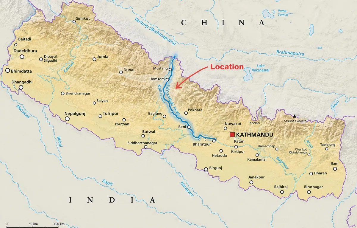
The Kali Gandaki Gorge location is in the Mustang District, Gandaki Province, Nepal, inside the Annapurna Conservation Area. It runs north to south, following the main trekking corridor through this region. Key places to know: Kagbeni sits at the northern end and marks the Upper Mustang boundary.
Jomsom is the district hub with an airstrip and jeep connections. Tatopani is the southern entry point with natural hot springs. Pokhara, about 200 km south, is where most travelers start their journey.
The landscape shifts dramatically as you move north. Subtropical forests in the south and stark high-altitude deserts by Jomsom. That transition alone is worth the trip.
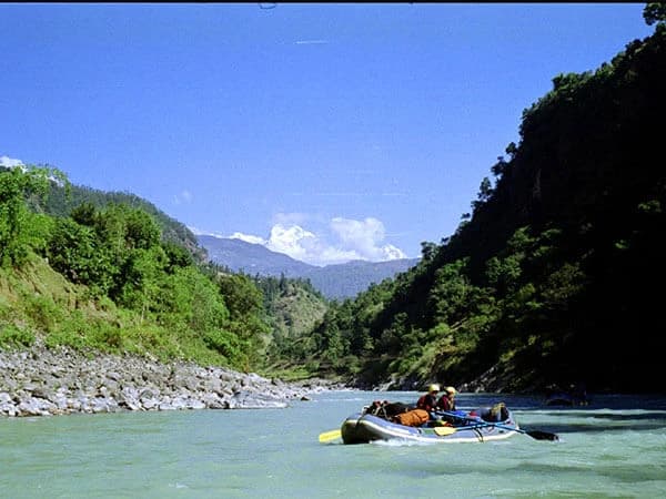
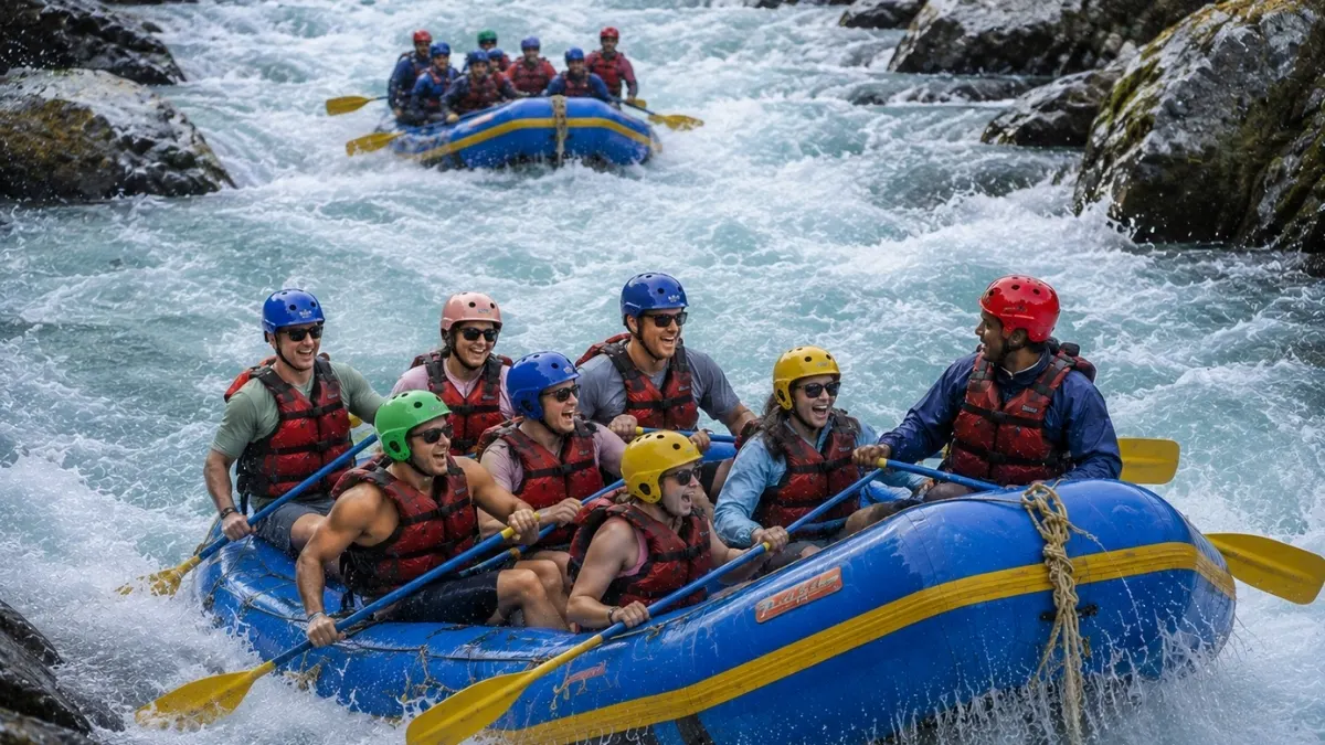
Want to experience the thrill of rafting through the world-famous Kali Gandaki Gorge with roaring rapids, stunning Himalayan views, and unforgettable adventure at every turn? Book your Kali Gandaki River rafting trip with Nepal Gateway Trekking today and make memories that flow like the river itself.
Why Is the Kali Gandaki Gorge Called the Deepest Gorge in the World?
The Kali Gandaki Gorge is the deepest gorge in the world due to the huge vertical distance between the Kali Gandaki River and the surrounding Himalayan peaks. Near Lete Village, the river is at about 2,520 m above sea level, Annapurna I is 8,091 m high, and Dhaulagiri is 8,167 m. This gives a vertical relief of over 5,500 m.
That depth surpasses most famous gorges around the world. For example, the Grand Canyon is about 1600 m deep, while the Yarlung Tsangpo Gorge is about 5300 m deep. The Kali Gandaki Gorge is deeper than even its closest rival.
There is some debate among geographers as to how exactly to measure gorge depth. But the Kali Gandaki Gorge is still the deepest gorge in the world based on vertical relief between the riverbed and nearby mountain summits.
Want to experience this massive Himalayan landscape yourself? The Nepal Gateway Trekking team can help you plan the safest and most scenic Kali Gandaki route based on your fitness, time, and travel style.
How Was the Kali Gandaki Gorge Formed?
The Kali Gandaki River has slowly carved the Kali Gandaki Gorge through the rising Himalayas over millions of years. What makes this gorge special is that people believe the river is older than the Himalayas themselves. The collision of tectonic plates pushed up the Himalayas some 50 million years ago.
The mountains kept rising, and the Kali Gandaki River kept flowing, cutting deeper into the land at almost the same rate. This is called “antecedent drainage” by geologists. Put it in plain language: the river didn't change course. Mountains grew around it instead. The river cut deeper into the landscape.
The natural process formed a giant gorge between two of the world's highest mountains, Annapurna I and Dhaulagiri. That’s why the Kali Gandaki Gorge is called the deepest gorge on Earth based on vertical relief.
Key Depth and Elevation Data
|
Reference Point |
Peak Elevation |
River Elevation |
Vertical Relief |
|
Annapurna I |
8,091 m / 26,545 ft |
2,520 m (Lete) |
5,571 m |
|
Dhaulagiri |
8,167 m / 26,795 ft |
2,520 m (Lete) |
5,647 m |
|
Grand Canyon |
2,997 m (rim) |
730 m (river) |
1,600 m |
|
Yarlung Tsangpo Gorge |
7,782 m (Namcha Barwa) |
2,400 m |
5,300 m |
The gorge floor changes in elevation throughout the route. It sits at around 1,300 m near Tatopani in the south and rises to about 2,600 m near Jomsom in the north. Because of these factors, the depth of the Kali Gandaki Gorge is not a single fixed number but a massive vertical range stretching across the entire valley.
How Did the Kali Gandaki River Carve the Gorge?
Here's the part that genuinely surprises most people. The Kali Gandaki River is older than the Himalayas. As the Himalayan range slowly pushed upward over 50 million years through tectonic movement, the river kept cutting downward at roughly the same rate.
Geologists call this "antecedent drainage basically the river refused to change course, so the mountains rose around it instead. That's why the Kali Gandaki River cuts straight through the Himalayan range rather than flowing around it. The result is the deepest gorge in Nepal and on earth.
Cultural and Religious Significance of the Kali Gandaki gorge
This gorge isn't just a trekking route. It's one of the most sacred river valleys in both Hinduism and Buddhism. Pilgrims have been walking the Kali Gandaki Gorge trek for hundreds of years, long before it became a trekking destination.
Saligrams: Sacred Fossils Found Only in the Kali Gandaki River
Saligrams are fossilized ammonites found exclusively in the Kali Gandaki River. Nowhere else on earth. In Hinduism, they're worshipped as a direct form of Lord Vishnu, one of the only natural objects considered a living deity without any consecration rituals. Pilgrims travel from across South Asia, specifically to collect them from the riverbed.
Why here? The riverbed was once part of the ancient Tethys Sea. As the Himalayas rose, river erosion slowly exposed those ancient marine fossils that had been pushed up. There's even a dedicated Shaligram Museum in Rampur Municipality where rare specimens are on display.
Muktinath Temple and the Pilgrimage Tradition
The Muktinath Temple at 3,710 m is one of the 108 sacred Vishnu shrines in Hindu scripture. For Tibetan Buddhists, the same site is known as Chumig Gyatsa, meaning "Hundred Springs." The temple has 108 water spouts and a natural gas seep that has been burning alongside water for centuries.
Thousands of Hindu and Buddhist pilgrims make this journey every year, many on horseback from Jomsom. A jeep road now reaches Muktinath from Jomsom, which has changed the pilgrimage experience a bit. But the site itself remains one of the most spiritually significant places in the entire Himalayan region.
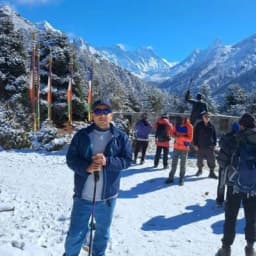
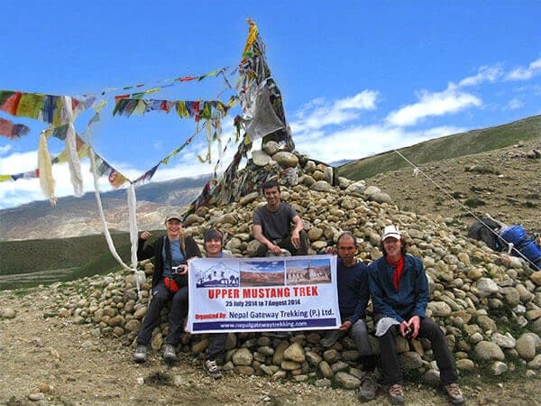
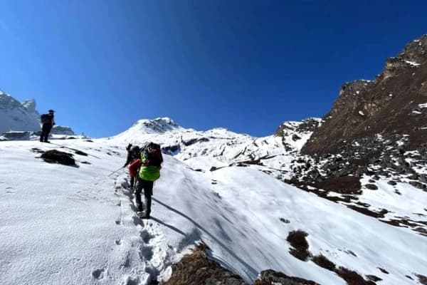
Best Trekking Routes Through the Kali Gandaki gorge
There are three main options for the Kali Gandaki Gorge trek, from a full multi-week adventure to a single easy day walk.
|
Route |
Duration |
Difficulty |
Max Elevation |
Highlights |
|
Annapurna Circuit |
14–21 days |
Moderate–Hard |
5,416 m (Thorong La) |
Full gorge, Muktinath, Manang |
|
Ghorepani–Tatopani |
5–7 days |
Easy–Moderate |
3,210 m (Poon Hill) |
Rhododendrons, hot springs |
|
Jomsom–Kagbeni |
1 day |
Easy |
2,810 m (Kagbeni) |
Desert landscape, medieval village |
Annapurna Circuit Through the Kali Gandaki Valley
This is the classic Kali Gandaki Gorge trek. The Annapurna circuit enters from Beni or Tatopani in the south, climbs through Ghasa, Tukuche, Marpha, and Jomsom, then continues to Muktinath before crossing Thorong La Pass at 5,416 m.
The gorge section from Tatopani to Muktinath takes roughly 4–6 days. Subtropical forest gives way to high-altitude desert as you go further north. Thakali food in Marpha and Tukuche is genuinely excellent. One practical thing afternoon winds in the Jomsom Valley hit hard. Trek in the mornings.
Ghorepani to Tatopani Route
Shorter and more accessible. From Nayapul, trek up to Ghorepani at 2,860 m and then Poon Hill at 3,210 m for the famous predawn panorama of the Annapurna and Dhaulagiri ranges. Descend to Tatopani at 1,190 m, one of the lowest points in the Kali Gandaki Gorge, Nepal.
The hot springs after days of trekking are genuinely one of life's simple pleasures. Rhododendron forests are best from February to April.
Imagine waking up between Annapurna and Dhaulagiri with the sound of the Kali Gandaki River below. Start your Himalayan adventure with a trusted local guide and customized trekking support from our team.
Jomsom to Kagbeni Day Walk
Perfect if you're short on time. Easy, mostly flat walk following the Kali Gandaki River north through a wind-carved desert landscape. Start in early afternoon. Winds here are some of the strongest on any trekking route in Nepal.
Kagbeni is a medieval walled village at the river confluence and marks the Upper Mustang boundary.
Key Villages and Attractions Along the Kali Gandaki gorge
Before you head out, the south-to-north layout helps you plan rest days and understand how the landscape changes as you gain elevation.
Villages Along the Gorge, South to North
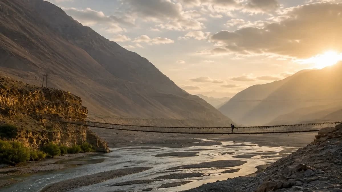
- Tatopani (1,190 m), southern gateway. Natural hot springs, a subtropical climate, and suspension bridges. Great recovery spot after a long descent.
- Ghasa (2,010 m): where the gorge starts narrowing. First signs of Thakali culture and architecture.
- Lete (2,470 m): the reference village for the classic Kali Gandaki Gorge depth measurement. Good acclimatization stop.
- Tukuche (2,590 m): Historic Thakali trading village. Stone houses, apple orchards, and local apple brandy distilleries.
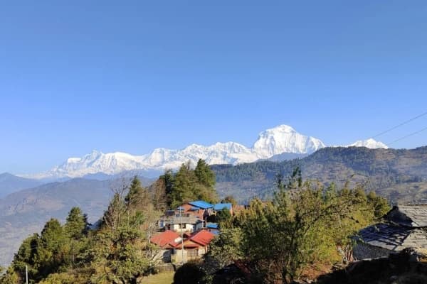
- Marpha (2,670 m): the most charming stop in the gorge. White-walled houses, cobblestone lanes, apple wine, and monasteries. Called the Apple Capital of Nepal.
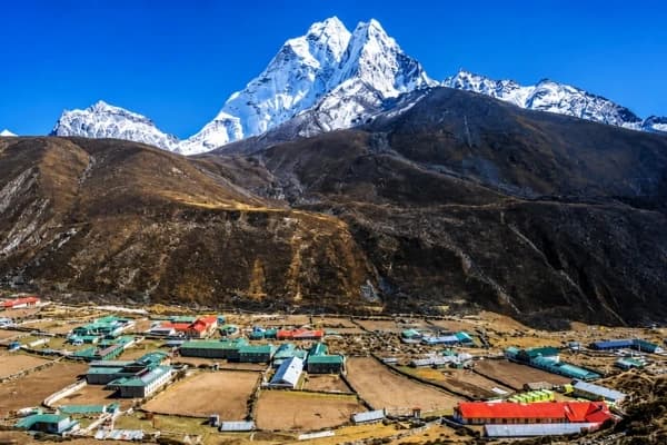
- Jomsom (2,720 m), the district headquarters. Airstrip, jeep road hub, banks, and trekking shops. Main logistics base for the whole region.
- Kagbeni (2,810 m): Medieval walled village. The ancient monastery is located at the confluence of two rivers and is the last stop before entering the restricted Mustang zone.
Famous Attractions Near the Kali Gandaki gorge
- Muktinath Temple (3,710 m) Major Hindu and Buddhist pilgrimage site. 108 water spouts, an eternal flame, and sacred Saligram stones. Reachable by jeep or a 3–4 hour trek from Jomsom.
- Tatopani Hot Springs Natural geothermal pools at the southern gorge entrance. Perfect after multi-day treks.
- Ghorepni Poon Hill (3,210 m), a pre-dawn viewpoint. Annapurna South, Machhapuchhre, and Dhaulagiri are all visible on a clear morning. One of Nepal's most photographed panoramas.
- Shaligram Museum, Rampur Rare Shaligram specimens from the Kali Gandaki River on display. Worth a stop for anyone interested in the gorge's geological and religious story.
How to Reach the Kali Gandaki gorge?
You can reach the Kali Gandaki Gorge by traveling into the Mustang region of central Nepal. The most famous stretch of the gorge lies between the villages of Tatopani, Dana, Ghasa, and Kalopani. Most travelers first travel from Kathmandu to Pokhara and then continue toward Jomsom, which serves as the main gateway to the gorge and Upper Mustang area.
Kathmandu to Pokhara to Jomsom
- Kathmandu to Pokhara: Tourist bus (7–8 hrs, ~USD 10–15), express bus (5–6 hrs), or domestic flight (25 min, ~USD 80–120).
- The flight from Pokhara to Jomsom takes about 20–25 minutes and costs around USD 100–130 one way, with options from Tara Air or Summit Air. Flights leave only early in the morning. Cancellations are common build 1–2 buffer days in.
Traveling from Pokhara to Jomsom by road takes roughly 8–10 hours, whether you choose a shared or private jeep via Beni. Passing through Tatopani and the lower Kali Gandaki Gorge, Nepal, is a wonderful way to see the southern section before reaching Jomsom.
Jeep Travel Through the Kali Gandaki Valley
Shared jeeps run Pokhara–Beni–Tatopani–Jomsom. You can board at any village along the way. Fares run NPR 1,500–2,500. Private jeep hire costs USD 150–250 per vehicle. Jeeps also connect Jomsom–Muktinath (45 min) and Jomsom–Kagbeni (30 min). The road between Tatopani and Ghasa gets risky during monsoon.
Permits, Costs, and Essential Travel Tips
Before visiting the Kali Gandaki Gorge and the Mustang region, you need a few important permits, including the ACAP Permit, TIMS Card, and the Upper Mustang Restricted Area Permit. These permits help protect the environment, manage tourism, and support local communities along the trekking routes.
Police and tourism checkpoints regularly inspect permits, so always carry printed copies along with your passport during the journey.
|
Permit |
Cost & Details |
|
ACAP Permit |
NPR 3,000 (USD 23). Required for all routes. Get it in Kathmandu or Pokhara. |
|
TIMS Card |
NPR 2,000 independent / NPR 1,000 through an agency. Required alongside ACAP. |
|
Upper Mustang Restricted Area Permit |
USD 500 per person for 10 days, then USD 50/day. Required north of Kagbeni. Must book through a registered Nepali agency. |
Checkpoints at Ghasa, Lete, Jomsom, and Kagbeni verify both documents. Carry them at all times.
Confused about permits, jeep routes, or trekking logistics? Nepal Gateway Trekking handles ACAP permits, transportation, accommodations, and local guides so you can enjoy the journey without stress.
Final thoughts
The Kali Gandaki Gorge is not just a place on the map. It is the place where ancient rivers, towering Himalayan peaks, sacred traditions, and remote mountain villages come together for one unforgettable journey.
Walking through the world's deepest gorge is a humbling experience, and that's a good thing. Every path, suspension bridge, monastery, and riverbank reminds you of the power of nature.
If you have the dream of trekking the whole Annapurna Circuit, visiting the holy Muktinath, or simply want to stand next to the roaring Kali Gandaki River, this trip is a mark that stays with you long after the trek is over.
Nepal Gateway Trekking helps you to experience the region safely, comfortably, and like a true local traveler, not just another tourist. You can begin planning your Kali Gandaki Gorge trip today.
Nepal Gateway Trekking offers guided packages through the Kali Gandaki Gorge, from the classic Annapurna Circuit to custom Mustang itineraries. We handle permits, logistics, and local support so you can focus on the trek. Contact us to begin planning.
FAQs
Is it safe to trek the Kali Gandaki Gorge alone?
Solo trekking is fine on main routes during peak season. Trails are well-marked, and teahouses are frequent. For the high-altitude Annapurna Circuit section, a guide is worth it especially for first-timers.
How fit do I need to be for the Kali Gandaki Gorge trek?
Jomsom–Kagbeni needs basic walking fitness. Ghorepani–Tatopani needs a few days of uphill ability. The full Annapurna Circuit involves a 5,416 m pass. Start training 6–8 weeks out if you're not regularly active.
Are there ATMs and phone signals along the gorge?
Jomsom has ATMs, but they run out of cash often. Bring enough rupees from Pokhara. Phone signal exists in most villages but gets patchy above Jomsom. Don't rely on it.
What food and accommodation can I expect?
Teahouses run the full length of all main routes. Dal bhat is the go-to hot, filling, usually unlimited meal. Marpha is known for apple dishes and local apple brandy. Rooms are basic but comfortable in most villages.
Can I combine the Kali Gandaki Gorge trek with Upper Mustang?
Yes, it's one of the best combinations in Nepal. Trek through the gorge, reach Kagbeni, then continue north into Upper Mustang. You'll need the restricted area permit (USD 500 for 10 days) booked through a registered Nepali agency.
Do I need a guide, or can I trek independently?
Independent trekking is fine inside the Annapurna Conservation Area. Upper Mustang is the exception solo trekking is not permitted there and must go through a registered agency.