Many trekkers experience confusion when attempting to link Nar Phu Valley with the Annapurna Circuit. The trails look separate on a map, which makes it feel like two different hikes. But in reality, they all come together to make one long trip. You begin on the Annapurna Circuit, but at Koto you leave the main trail and go into Nar Phu Valley. You go back to the main path after visiting the villages of Nar and Phu and crossing a high pass.
This guide breaks down the Nar Phu Valley Trek with the Annapurna Circuit Map into easy-to-follow steps. You will know the whole route, including the distance, elevation, and important planning details, so you can get ready and not get lost on the trail.
What is the Nar Phu Valley Trek with the Annapurna Circuit Map?
The Nar Phu Valley Trek with Annapurna Circuit Map is a combination of two trekking routes. You leave the main Annapurna Circuit, go to a hidden valley, and then return to the same trail later to finish the trip.
The path at Koto goes toward the faraway Nar Phu Valley. You go through traditional villages, cross a high mountain pass, and then go back to the main circuit to finish the trek.
It lets you have two different experiences on the same trip: the classic Annapurna Himalaya trekking routes and a valley in the Himalayas that is far away and not well-known.
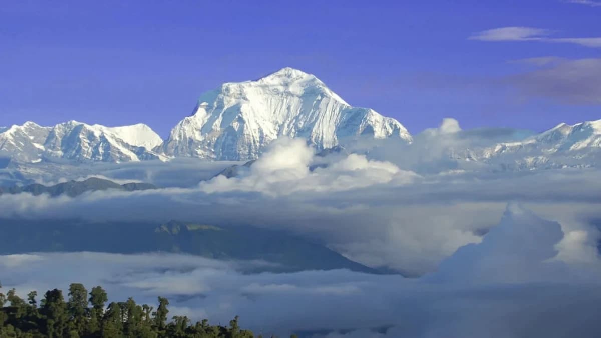
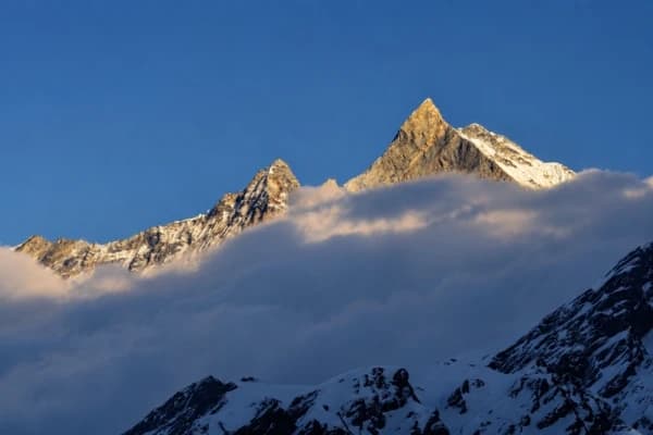
The Annapurna region is renowned for its diverse landscapes and unique trekking routes.
Complete Route Map Overview

It's much easier to understand the Nar Phu Valley Trek with the Annapurna Circuit Map when you break it down into clear steps. Instead of seeing them as two different paths, consider them one trip with a secret loop in the middle.
You begin your journey on the main Annapurna Circuit Trek, venture into a secluded valley, and then return to the main trail to complete the trek.
Annapurna Circuit Trail (Kathmandu to Koto)
The route goes from Kathmandu to Jagat, then to Dharapani, Chame, and Koto. This section follows the Marsyangdi River, which is crucial for acclimatizing to the region.
The well-marked trail ascends gradually, allowing your body to acclimate to the higher altitudes.
You will slowly make your way to the mountains through green hills, waterfalls, and small villages.
Nar Phu Valley Route (Hidden Trail Section)
The Nar Phu Valley Trek with Annapurna Circuit Map takes a turn away from the main trail at Koto and goes into the remote Nar Phu Valley: Koto to Meta to Phu to Nar to Kang La Pass
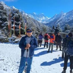
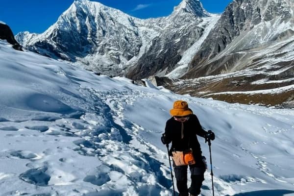
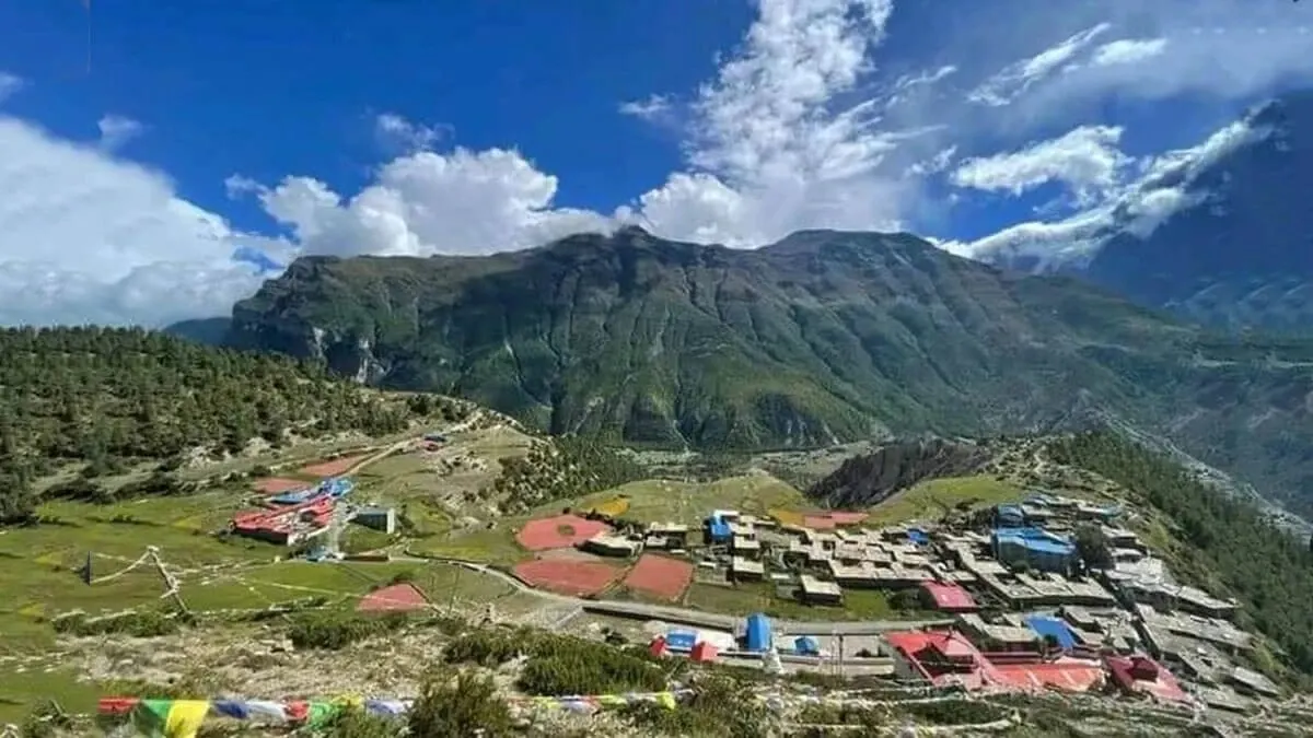
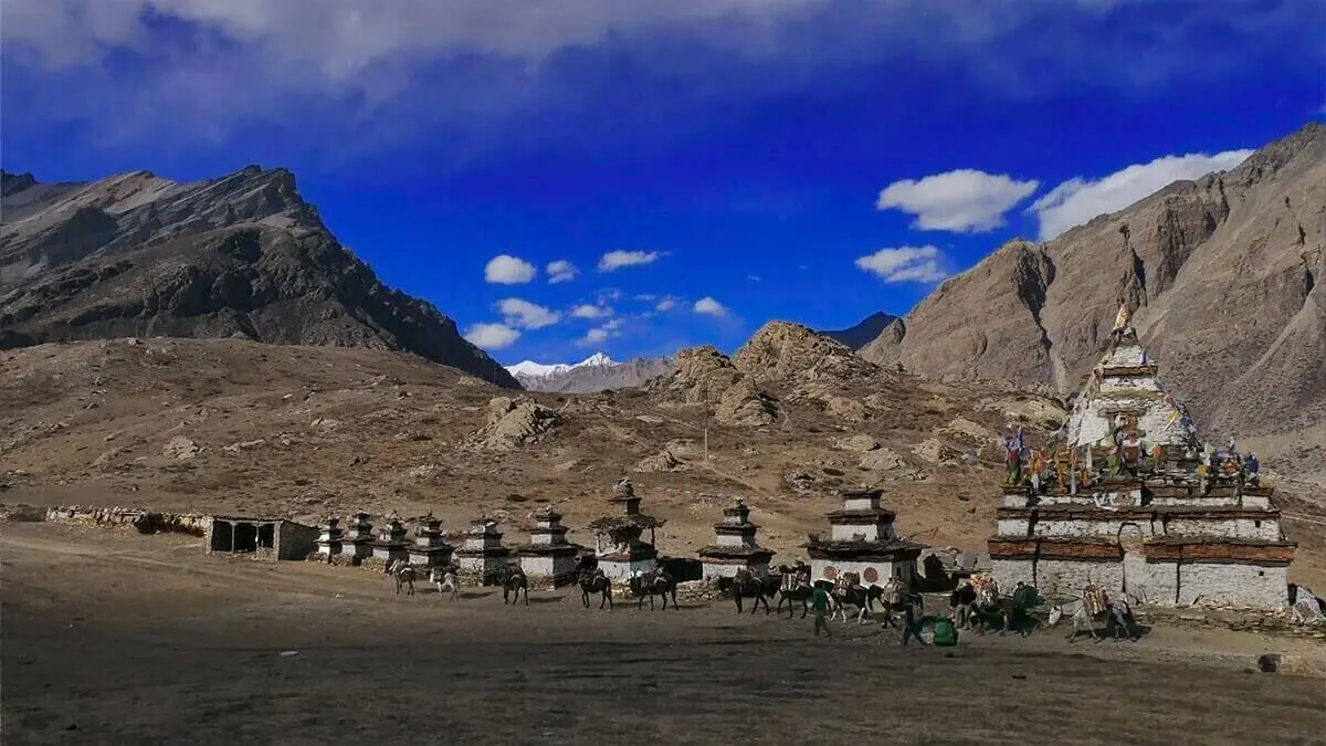
This part feels entirely different. As you go along the trail, it becomes quieter, rougher, and less crowded. As you walk through old villages, narrow valleys, and untouched landscapes, you'll experience a sense of tranquility. The culture here is very Tibetan, and the experience is more real than on the main circuit. The Nar Phu Valley Trek is a remote and restricted trekking route in Nepal.
Did you know that now immigration has eases solo trekking in restricted region of Nepal?
Rejoining Annapurna Circuit
You get back on the main Annapurna route after crossing Kang La Pass, from Ngawal to Manang to Yak Kharka. This part is important for getting better and preparing.
Most trekkers take an additional day in Manang to acclimatize to the high altitude. As you join back up with the Annapurna Circuit, the trail gets busier again.
Final Crossing & Exit Route
The last part of the Nar Phu Valley trek with the Annapurna Circuit map is the hardest and highest part. The trek's biggest accomplishment is crossing Thorong La Pass, which is 5,416 meters high, and it continues from Thorong La Pass to Muktinath and then to Jomsom.
It needs to start early, go at a steady pace, and get used to the new environment. The trail goes down toward Muktinath after the pass and then goes on to Jomsom, which is the end of the trip.
If you want to explore Annapurna Circuit Trek(ACT) independently, study ACT map well before preparing your gears.
Nar Phu Valley Trek Map with Distance, Time & Elevation
The Nar Phu Valley Trek with Annapurna Circuit Map is between 150 and 180 kilometers long, depending on the path you take and any side trips you make. The trek is possible because the altitude doesn't change too quickly. You don't climb too quickly, which helps your body adjust to the higher altitude and lowers your chances of getting sick.
Each part of the trek is different in terms of speed, distance, and height. Some parts are longer but easier, while others are shorter but harder because they are at a high altitude.
To help you understand, here's a simple summary of the whole trip:
|
Section |
Distance |
Time |
Altitude |
|
Kathmandu → Koto |
Drive |
2 days |
800m–2,600m |
|
Koto → Phu |
~35 km |
3–4 days |
2,600m–4,080m |
|
Phu → Nar |
~20 km |
2 days |
4,000m+ |
|
Nar → Kang La → Ngawal |
~15 km |
1–2 days |
up to 5,300m |
|
Manang → Thorong La → Muktinath |
~40 km |
3–4 days |
up to 5,416m |
What are the Highest Points on the Nar Phu Valley Trek with Annapurna Circuit Map?
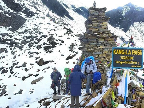
The Nar Phu Valley Trek with the Annapurna Circuit Map gets hardest at the highest points because of the higher altitude and thinner air. Kang La Pass (about 5,320 meters) and Thorong La Pass (about 5,416 meters) are the hardest parts of the trip. To cross them safely, you'll need to get up early, go at a steady pace, and get used to the conditions.
Difficulty by Section
The route gets harder as you go along the path.
- Simple: Jagat to Chame: well-marked paths with a slow rise in elevation
- Moderate: Nar Phu Valley: rough terrain, but steady walking speed
- Hard: Kang La and Thorong La are difficult to climb because they are high up and take a long time to walk.
Here, a slow and steady pace makes a big difference. The height will slow you down if you hurry.
How the Annapurna Circuit Route connects to the Nar Phu Valley?
The Nar Phu Valley Trek with the Annapurna Circuit Map has one main path and a secret loop in the middle. You don't start a new trek; you just leave the main path for a few days and then come back to it.
Koto is the place where the connection happens. This area is where you leave the Annapurna Circuit and go into the Nar Phu Valley, which is very far away. The route connects like a puzzle, step by step:
- Go from Kathmandu to Koto along the Annapurna Circuit
- Leave the main trail and go into Nar Phu Valley
- Walk through the villages of Phu and Nar
- Go over Kang La Pass
- Get back on the Annapurna Circuit close to Manang
- Keep going toward Thorong La Pass
The loop is what makes this hike unique. You can still do the classic Annapurna Circuit route and see the quiet, less-explored Nar Phu Valley. Nar Phu isn't a separate trek it's a side trip that adds depth, culture, and adventure to the main journey.
Recommended Read: Explore five best Annapurna region treks
Route Variations & Optional Side Trips You Can See on Map
You can change the Nar Phu Valley Trek with the Annapurna Circuit Map. You don't have to stick to one path. You can alter your plan based on your fitness, time, and desired adventure level. Some people who hike keep it simple. Some people add more routes to see more of the area.
Tilicho Lake Extension
This is one of the most popular side trips. You leave the main trail near Manang and head toward Tilicho Lake.
- Adds 2–3 extra days
- Reaches one of the highest lakes in the world (4,919m)
- Offers stunning mountain views
This option is excellent if you want to add something unique to your trek.
Kang La Pass Option
Crossing Kang La Pass is the standard way to complete the Nar Phu loop.
- Connects Nar Valley back to the Annapurna Circuit
- One of the highest and toughest sections
- Offers wide panoramic views
If you skip this pass, you’ll need to return the same way you came.
Full Annapurna Circuit Completion
After rejoining at Manang, you can continue the full Annapurna Circuit.
- Cross Thorong La Pass
- Descend to Muktinath
- Finish at Jomsom or extend further
This option gives you the complete experience of both Nar Phu Valley and the Annapurna Circuit in one journey.
Permits Required for Nar Phu Valley Trek
You need the following permits:
- Restricted Area Permit (RAP)
- Annapurna Conservation Area Permit (ACAP)
- TIMS Card
- A licensed guide is required due to restricted access.
Best Time to Trek (Season + Map Visibility)
The Nar Phu Valley Trek with Annapurna Circuit Map is best when the weather is clear and stable. This makes trekking safer and helps you stay on the right path without getting lost.The two best times of year are the following:
- Spring (March to May)
- Fall (September–November)
The skies are mostly clear, the trails are dry, and the views of the mountains are sharp during these months. This is especially important when crossing high passes like Thorong La Pass, where poor visibility can make it hard to find your way. Clear weather not only improves the experience, but it also helps you stay on the right path and avoid unnecessary risks on the trail.
Final Thoughts
The Nar Phu Valley Trek with Annapurna Circuit Map combines two different trips into one. You walk through quiet, out-of-the-way valleys before joining one of Nepal's most popular trekking routes.Everything is easier when you know how to read the map. You know where the trail branches off, where it comes back together, and how each part moves. That clarity helps you make better plans and hike with confidence.
With Nepal Gateway Trekking, you can plan your Nar Phu Valley trek with the Annapurna Circuit map. Our team will help you plan your route, get the right permits, and make sure you have a safe, well guided trip from start to finish. Contact us today!
FAQs
Where does the Nar Phu Valley Trek begin?
The trek usually starts in Koto, which is on the main Annapurna Circuit trail. To get to Koto, you have to drive from Kathmandu through Besisahar and Jagat. The trail branches off here and goes into the Nar Phu Valley, which is very far away. This location is where most people go to get into the restricted area.
Do I need permission to go on the Nar Phu Valley Trek?
You do need special permits to get into Nar Phu Valley. Some of these are the Restricted Area Permit (RAP), ACAP, and TIMS. There are many places along the route where permits are checked. You can't get to the valley without these permits.
Is there a network or the internet while trekking?
In remote areas, the internet and cell phone networks are not excellent. You might be able to connect in places like Manang. But most of Nar Phu Valley doesn't have a reliable network. Before you start the trek, you should tell your family.
What types of lodging are available?
Along the way, you'll stay in simple teahouses. The rooms are simple and usually have twin beds and a shared bathroom. The higher you go in Nar Phu Valley, the more basic the facilities get. Even though they are simple, they provide food, shelter, and warmth.
Is it easy to get water?
There is water at teahouses along the trail, yes. But you should clean or filter water before you drink it. You can use tablets, filters, or water that has been boiled. At high altitudes, it's critical to drink enough water.
Would it be possible to charge my devices while I'm on the trek?
Most teahouses will let you charge your phone for a small fee. Charging gets harder and pricier as you go higher. We strongly suggest using power banks as backups. In some remote areas, the power supply isn't always reliable.
What food can you get while trekking?
Teahouses serve simple meals like dal bhat, noodles, rice, and soup that fill you up. The most common and filling meal is dal bhat. As you go farther into remote areas, there are fewer types of food. You'll still get enough food for trekking.
Do you need travel insurance for this trip?
Yes, it is highly recommended that you get travel insurance. It should include emergency evacuation and trekking at high altitudes. Without insurance, it can be expensive to get help from a helicopter. Having insurance makes the trip less stressful.