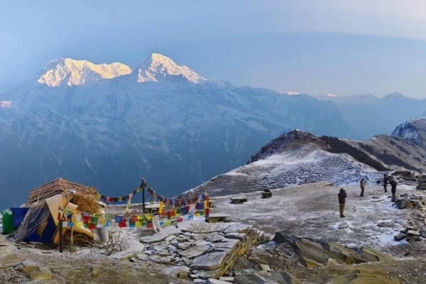
Quick Takeaways
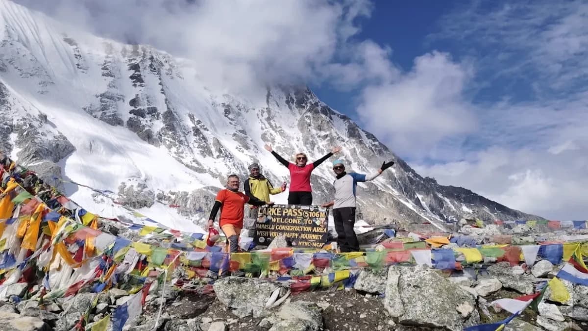
- Highest point: Larkya La Pass, 5,106 m (16,752 ft).
- Highest planned overnight stop: Dharamsala (Larke Phedi), 4,460 m (14,633 ft).
- Trekking start: Machha Khola, at 870 m (2,854 ft), where the Manaslu Circuit Trek generally begins.
- Elevation pattern: a steady climb through the river villages, the pass crossing, then a long descent via Bhimtang to Tilije and Dharapani.
- Always check the figures against the itinerary you are booking. Overnight stops can differ between operators.
The Manaslu Circuit Trek elevation runs from 870 m (2,854 ft) at Machha Khola, where the walking starts on the advertised itinerary, up to 5,106 m (16,752 ft) at Larkya La Pass, the highest point on the route. The highest planned overnight stop is Dharamsala (Larke Phedi) at 4,460 m (14,633 ft). This guide covers village elevations, daily elevation changes, total ascent and descent, and acclimatization, so you can read the numbers alongside the real overnight schedule.
What Is the Highest Elevation on the Manaslu Circuit Trek?
The highest elevation on the Manaslu Circuit Trek is Larkya La Pass (also spelled Larke Pass), which stands at 5,106 m (16,752 ft) above sea level. Some itineraries and sources estimate it closer to 5,150 to 5,160 m, so always check which figure an operator uses.
The highest point you reach and the highest place you sleep are two different things. On this route you cross the pass in a single long day and sleep far lower, at Bhimtang. That distinction matters more for acclimatization than the pass height alone.
Larkya La Pass: The Trek’s Highest Point
If you want the Manaslu Circuit trek height in one number, it is 5,106 m. The crossing starts before dawn from Dharamsala. You climb over nearby hills, follow the Larkya moraine, then walk beside the glacier on rocky ground that turns to snow in places. Most trekkers need around three to four hours to reach the prayer flags at the top.
Highest Sleeping Altitude on the Manaslu Circuit
Dharamsala is the highest overnight stop at 4,460 m (14,633 ft). Sleeping altitude matters because your body reacts to where you rest for the night, not only to the highest point you touch during the day.
The pass sits about 646 m above Dharamsala, so the crossing day starts high, climbs higher, then drops steeply. Manaslu Base Camp is an optional side trip and not part of the main circuit’s highest point.
If you are planning the trek, review the Manaslu Circuit Trek guide to see the route, overnight stops, and planned pass-crossing day.
Manaslu Circuit Trek Elevation Chart by Village
Use this Manaslu Circuit Trek elevation chart as a quick reference for the main places on the route. Soti Khola is usually passed on the drive in, while Machha Khola is where most trekkers begin walking.
|
Location |
Elevation (m) |
Elevation (ft) |
Role on the route |
|
Soti Khola |
710 |
2,329 |
Passed on the approach drive |
|
Machha Khola |
870 |
2,854 |
Common trekking start |
|
Jagat |
1,340 |
4,396 |
Overnight stop |
|
Deng |
1,860 |
6,102 |
Overnight stop |
|
Namrung |
2,630 |
8,629 |
Overnight stop |
|
Lho |
3,180* |
10,433 |
Waypoint on the way to Shyala |
|
Shyala |
3,500 |
11,483 |
Overnight stop |
|
Samagaun |
3,530 |
11,581 |
Overnight stop, acclimatization day |
|
Samdo |
3,860 |
12,664 |
Overnight stop |
|
Dharamsala (Larke Phedi) |
4,460 |
14,633 |
Highest overnight stop |
|
Larkya La Pass |
5,106 |
16,752 |
Highest point |
|
Bhimtang |
3,720 |
12,205 |
Overnight stop after the pass |
|
Tilije |
2,300 |
7,546 |
Overnight stop |
|
Dharapani |
1,860 |
6,102 |
End of the trek |
Lho is a waypoint rather than a usual overnight stop on this route pattern. Treat its figure as approximate.
How the Elevation Profile Changes Along the Route
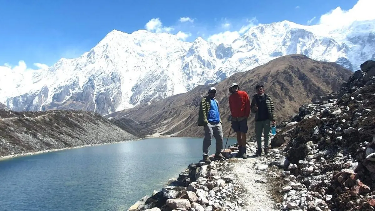
The Manaslu Circuit elevation profile starts in a low river valley, climbs gradually through alpine villages, peaks at a high mountain pass, and drops sharply on the other side. It breaks into four stages:
- Lower section (Machha Khola, Jagat, Deng): 870 m (2,854 ft) to 1,860 m (6,102 ft) through subtropical forest, gorges, and suspension bridges, with a lot of up-and-down walking.
- Middle section (Namrung, Lho, Shyala): the valley turns Tibetan in character. Namrung to Shyala adds 870 (2,854 ft) m, the biggest jump in sleeping altitude on the route.
- High-altitude section (Samagaun, Samdo, Dharamsala): daily gains shrink, but you are above 3,500 m (11,483 ft), and the days are short on purpose.
- Pass and descent (Larkya La, Bhimtang, Tilije, Dharapani): one steep push to 5,106 m (16,752 ft) , then a long drop back to 1,860 m (6,102 ft) over three days.
Manaslu Circuit Trek Elevation by Day
The standard Manaslu Circuit Trek climbs from a starting elevation of 870 (2,854 ft) meters at Machha Khola to a peak altitude of 5,106 (16,752 ft) meters at Larkya La Pass, then descends to 1,860 m (6,102 ft) at Dharapani. The table below shows a typical trekking-day pattern. Operators may split or merge stages, so treat it as a model rather than a fixed schedule.
|
Trek day |
Route |
Start |
End / sleep |
Net change |
|
1 |
Machha Khola to Jagat |
870 m (2,854 ft) |
1,340 m (4,396 ft) |
+470 m (+1,542 ft) |
|
2 |
Jagat to Deng |
1,340 m (4,396 ft) |
1,860 m (6,102 ft) |
+520 m (+1,706 ft) |
|
3 |
Deng to Namrung |
1,860 m (6,102 ft) |
2,630 m (8,629 ft) |
+770 m (+2,526 ft) |
|
4 |
Namrung to Shyala |
2,630 m (8,629 ft) |
3,500 m (11,483 ft) |
+870 m (+2,854 ft) |
|
5 |
Shyala to Samagaun |
3,500 m (11,483 ft) |
3,530 m (11,581 ft) |
+30 m (+98 ft) |
|
6 |
Acclimatization day at Samagaun |
3,530 m (11,581 ft) |
3,530 m (11,581 ft) |
- |
|
7 |
Samagaun to Samdo |
3,530 m (11,581 ft) |
3,860 m (12,664 ft) |
+330 m (+1,083 ft) |
|
8 |
Samdo to Dharamsala |
3,860 m (12,664 ft) |
4,460 m (14,633 ft) |
+600 m (+1,969 ft) |
|
9 |
Dharamsala to Bhimtang via Larkya La |
4,460 m (14,633 ft) |
3,720 m (12,205 ft) |
-740 m (-2,428 ft) |
|
10 |
Bhimtang to Tilije |
3,720 m (12,205 ft) |
2,300 m (7,546 ft) |
-1,420 m (-4,659 ft) |
|
11 |
Tilije to Dharapani |
2,300 m (7,546 ft) |
1,860 m (6,102 ft) |
-440 m (-1,444 ft) |
Trek day 9 is the pass-crossing day. The net figure of -740 m (-2,428 ft) hides the real effort: about 646 m (2,119 ft) of climbing to the pass, then roughly 1,386 m (4,547 ft) of descent to Bhimtang over around 18 km and 7 to 8 hours.
Day 6 shows no net change, but a side trip such as the hike toward Manaslu Base Camp (about 4,800 m / 15,748 ft) climbs higher and returns to Samagaun to sleep.
These figures compare where you wake up with where you sleep. They do not capture every uphill and downhill stretch along the trail, such as dips to cross rivers and bridges. Explore Manaslu Circuit Trek map and make blueprint of the trek in your mind. It will be easy.
Manaslu Circuit Trek Elevation Gain and Loss
Measured from Soti Khola (710 m) to Dharapani (1,860 m / 6,102 ft), the Manaslu Circuit Trek features a total elevation gain of approximately 4,450 m (14,600 ft) and a total elevation loss of roughly 3,300 m (10,827 ft). Starting from Machha Khola instead removes the first stage, so the totals will be slightly lower. These are approximate figures and vary with the route variation and the GPS device or profile used.
Three terms often get mixed up:
- Highest elevation: the highest point reached on the route (5,106 m / 16,752 ft).
- Net elevation change: the difference between two endpoints.
- Cumulative elevation gain and loss: every uphill and downhill section added together, which is always larger than the net figure.
When people search for the Manaslu Circuit trek elevation gain, they usually want the cumulative number. The table below shows endpoint differences for key sections, which are easier to verify.
|
Section |
From (m) |
To (m) |
Endpoint difference (m) |
|
Machha Khola to Namrung |
870 m (2,854 ft) |
2,630 m (8,629 ft) |
+1,760 m (+5,774 ft) |
|
Namrung to Samagaun |
2,630 m (8,629 ft) |
3,530 m (11,581 ft) |
+900 m (+2,953 ft) |
|
Samagaun to Dharamsala |
3,530 m (11,581 ft) |
4,460 m (14,633 ft) |
+930 m (+3,051 ft) |
|
Dharamsala to Larkya La Pass |
4,460 m (14,633 ft) |
5,106 m (16,752 ft) |
+646 m (+2,119 ft) |
|
Larkya La Pass to Bhimtang |
5,106 m (16,752 ft) |
3,720 m (12,205 ft) |
-1,386 m (-4,547 ft) |
|
Bhimtang to Dharapani |
3,720 m (12,205 ft) |
1,860 m (6,102 ft) |
-1,860 m (-6,102 ft) |
From Machha Khola to the pass, the endpoint difference is 4,236 m (13,898 ft). That is the gap between start and pass, not the cumulative gain.
Considering a longer route? Explore the Manaslu Circuit with Tsum Valley Trek and review its itinerary to understand how the additional valley section affects your overall trek plan.
Manaslu Circuit Trek Altitude Sickness and Acclimatization
Yes, altitude sickness is a real risk on the Manaslu Circuit Trek. Every night from Shyala onward is above 3,000 m (9,843 ft), the highest stop is 4,460 m (14,633 ft), and the CDC says unacclimatized travelers can be at risk from around 2,450 m. A gradual ascent, a proper acclimatization day, and prompt attention to symptoms are the main protections.
No altitude is safe for everyone, and individual risk varies a lot. The Manaslu Circuit trek altitude is not extreme on any single day. The challenge is the accumulation of high nights plus the demanding pass day.
How Altitude Affects Trekkers
Air pressure drops as you climb, so each breath delivers less oxygen. Your body adapts, but not instantly.
Common symptoms of altitude sickness are headache, nausea, dizziness, and unusual tiredness. Severe forms, such as fluid on the lungs or swelling of the brain, are medical emergencies where descent and urgent care are the standard response, as outlined in the CDC Yellow Book guidance on altitude illness. Fit and experienced trekkers can be affected as well as beginners.
How Acclimatization Fits the Route
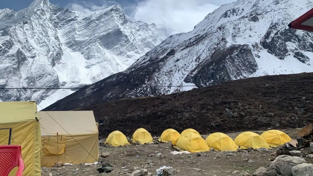
The usual acclimatization stop is Samagaun, where trekkers spend two nights at 3,530 m (11,581 ft). The short days that follow are deliberate: Samdo (3,860 m) and Dharamsala (4,460 m / 14,633 ft) add 330 m (1,083 ft) and 600 m (1,969 ft), each in a few hours of walking.
Check an itinerary’s actual overnight elevations and rest days before relying on it. Practical habits that help:
- Follow the planned ascent and acclimatization schedule rather than rushing ahead.
- Tell your guide early if symptoms develop or worsen.
- Do not continue ascending while you have symptoms of altitude illness.
- Seek medical help and descend if symptoms worsen or a serious illness is suspected.
How to Prepare for the Manaslu Circuit Trek Elevation
To prepare for the elevation of the Manaslu Circuit Trek, you need to build cardiovascular endurance, train your leg muscles for steep descents, and follow a careful acclimatisation schedule.
Build endurance for several consecutive days of long walking. Three or four cardio sessions a week in the months beforehand is a sensible base.
- Practice on hills and uneven ground, ideally with a loaded daypack.
- Strengthen your legs for descents, since the drop after the pass is long and steep.
- Choose an itinerary with realistic ascent rates and a proper acclimatisation day.
- Talk to a qualified healthcare professional before you travel, especially about existing health conditions and altitude-related medication.
- Learn the symptoms of altitude illness before you start.
Fitness helps with the walking, but it does not guarantee protection from altitude sickness. A strong hiker can still get ill, and a slower hiker can feel fine.
How Elevation Affects Manaslu Circuit Trek Difficulty
Elevation makes the Manaslu Circuit Trek harder mainly through rising sleeping altitude, a long pass-crossing day, and a steep descent afterwards. The main factors are
- Rising sleeping altitude, which builds from Shyala onward.
- The pass-crossing day, with its pre-dawn start, steep climb, and very long descent.
- Weather and trail conditions, which can bring snow, ice, and cold near the top.
- Individual response to altitude, which no fitness test can predict.
- The overnight stops and acclimatization arrangements are built into the itinerary.
Can a beginner complete it? Sometimes, with the right preparation, a well-paced itinerary, and good acclimatization. It is not a simple yes or no. For a fuller discussion, read the Manaslu Circuit Trek difficulty guide.
Final Thoughts
The Manaslu Circuit climbs from around 870 m (2,854 ft) at Machha Khola to 5,106 m (16,752 ft) at Larkya La Pass, then drops to 1,860 m (6,102 ft) at Dharapani. The highest planned night is 4,460 m (14,633 ft) at Dharamsala, well below the pass itself, which is why the crossing day feels so demanding even though you sleep lower afterwards.
The elevation chart is most useful when you read it alongside the overnight schedule and the acclimatization plan. The numbers mean little without the short high-altitude stages and rest days that give your body time to adjust.
Want to clarify the route’s elevation profile or planned overnight stops before booking? Contact Nepal Gateway Trekking to discuss your trek plans.
Frequently Asked Questions
At What Altitude Can Altitude Sickness Occur?
It can begin from around 2,450 m in susceptible travelers, according to the CDC Yellow Book, and sometimes lower. Risk depends on how fast you ascend, the elevation where you sleep, and your personal susceptibility.
Does Good Fitness Prevent Altitude Sickness on the Manaslu Circuit Trek?
No. Fitness helps with the physical effort of walking but does not remove the risk of altitude illness. See the acclimatization and preparation sections above for practical precautions.
Is Manaslu Base Camp Part of the Main Circuit’s Elevation Profile?
No. It is an optional side trip from Samagaun, at roughly 4,800 m (15,748 ft). It is not the highest point of the standard circuit.
Can a Beginner Complete the Manaslu Circuit Trek at This Elevation?
It depends on preparation, itinerary design, acclimatization, and how your body responds to altitude. Being fit is not enough on its own. The difficulty guide linked above goes deeper.
How Much Elevation Do You Lose After Crossing Larkya La Pass?
Larkya La (5,106 m / 16,752 ft) to Bhimtang (3,720 m) is a 1,386 m difference. That is an endpoint gap, not necessarily the cumulative descent on the trail.
How Does the Manaslu Circuit Trek Elevation Change from Machha Khola to Dharapani?
You climb from 870 (2,854 ft) m at Machha Khola through the upper villages to 5,106 m (16,752 ft) at Larkya La, then descend to 1,860 m (6,102 ft) at Dharapani. See the village chart and daily table above for the detail.
Is the Manaslu Circuit Trek’s Elevation Higher Than Everest Base Camp?
No. The Manaslu Circuit’s highest point is 5,106 m (16,752 ft). On the Everest Base Camp route, Base Camp is commonly cited at about 5,364 m and Kala Patthar at about 5,545 m. The highest overnight, Gorak Shep, is around 5,164 m, above Manaslu’s 4,460 m (14,633 ft). Source figures vary slightly, and elevation alone does not tell you which trek is harder.