Quick Summary: Where Is Nepal Located?
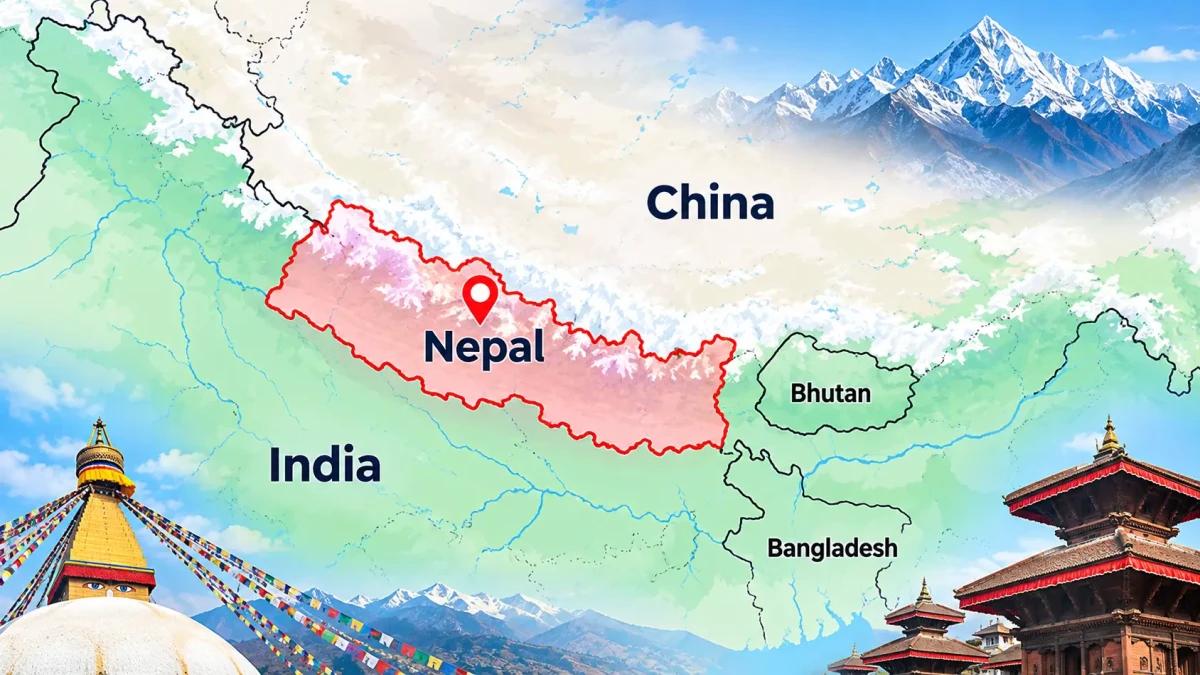
- Location: Nepal is a landlocked country in South Asia, between China and India.
- Borders: China lies to the north, while India borders Nepal to the east, south and west.
- Capital: Kathmandu, located in Bagmati Province (provincial capital: Hetauda).
- Geography: Nepal has three main ecological regions: the Terai, Hills and Himalayas.
- Mountain ranges: Nepal is home to eight of the world's 14 highest mountains (all in the global top ten), including Mount Everest (8,848.86 m).
- Climate: Weather varies from subtropical conditions in the Terai to alpine and freezing temperatures in the Himalayas.
- Trekking: Popular trekking regions include Everest, Annapurna, Langtang, Manaslu and Mustang
Nepal is a landlocked country in South Asia, located in the Himalayas between China to the north and India to the east, south and west. Its capital is Kathmandu, and the country is centred at about 28°N, 84°E.
Despite covering only 147,516 km², Nepal holds eight of the world’s 14 highest mountains (all ranking inside the global top ten), including Mount Everest. This guide explains where Nepal is located, which countries border it, how its provinces and ecological regions are arranged, and how the Himalayas shape its famous trekking routes..
Nepal Location on the World Map: Position, Shape and Size
Nepal is located in South Asia, on the northern edge of the Indian subcontinent. When looking at Nepal on a world map, it sits between the Tibetan Plateau to the north and the Indian plains to the south, shaped like a long, narrow rectangle that runs from northwest to southeast. It is about 880 km long and 150 to 240 km wide, and its area is slightly larger than New York State.
|
Fact |
Details |
|
Continent and region |
Asia, South Asia |
|
Capital |
Kathmandu |
|
Coordinates |
26°22′N to 30°27′N, 80°04′E to 88°12′E |
|
Neighbouring countries |
China (north), India (east, south and west) |
|
Coastline |
None (landlocked) |
|
Area |
147,516 km² |
|
Elevation range |
59 m to 8,848.86 m |
|
Time zone |
UTC+5:45 (Nepal Standard Time) |
- Continent and region. Nepal is in Asia, in the subregion of South Asia, which also includes India, Bhutan, Bangladesh, Sri Lanka, Pakistan, Afghanistan and the Maldives. It is a founding member of SAARC, whose secretariat is in Kathmandu.
- Nepal latitude and longitude: Nepal extends from 26°22′N to 30°27′N latitude and 80°04′E to 88°12′E longitude. Kathmandu is at about 27.7°N, 85.3°E. Nepal lies in the subtropics, but altitude shapes its climate, from hot southern plains to snow-covered peaks.
- Landlocked country. Yes, Nepal is landlocked. It has no coastline, and its nearest sea access is the Bay of Bengal, reached through India. Most imports and exports travel through Indian ports such as Kolkata and Visakhapatnam. Bhutan and Afghanistan are the only other landlocked countries in South Asia.
Nepal Neighbouring Countries: Borders with China and India
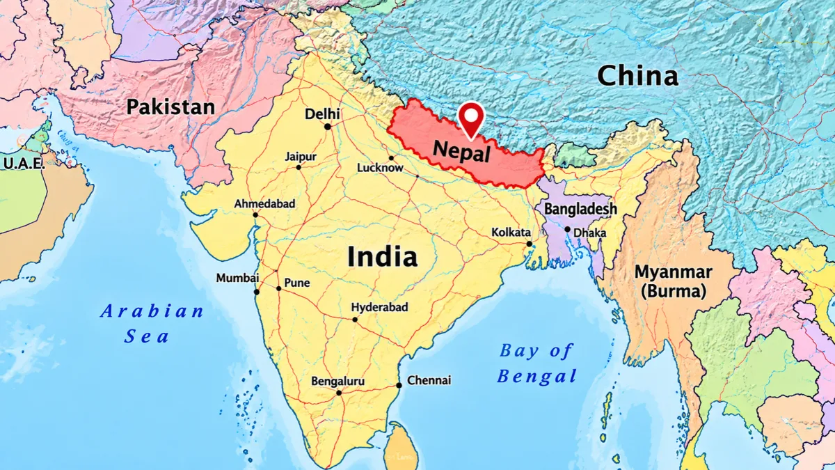
Nepal has two neighbouring countries: China to the north and India to the east, south and west. These are the only countries bordering Nepal. Bhutan and Bangladesh are close but do not share a border with Nepal. Sikkim separates it from Bhutan, and the narrow Siliguri Corridor separates it from Bangladesh.
|
Neighbour |
Direction |
Border length |
Main crossings |
|
China (Tibet Autonomous Region) |
North |
About 1,390 km |
Rasuwagadhi-Kerung |
|
India |
East, south and west |
About 1,770 km |
Kakarbhitta-Panitanki, Birgunj-Raxaul, Bhairahawa-Sunauli |
Nepal-China Border: The Tibet Autonomous Region and Himalayan Crossings
The border with the Tibet Autonomous Region follows high Himalayan ridges and passes, including the Everest region, so it is far harder to cross than the Indian border. The main road crossing is Rasuwagadhi-Kerung, the route between Kathmandu and Lhasa. Others, such as Tatopani-Zhangmu, were affected by the 2015 earthquake and later closures, so check current status before planning overland travel.
Nepal-India Border: One of the World’s Most Open Borders
Nepal borders India on three sides, and the boundary is one of the most open in the world. Under the 1950 Treaty of Peace and Friendship, citizens of both countries can cross without a visa. From east to west, the border touches five Indian states: Sikkim, West Bengal, Bihar, Uttar Pradesh and Uttarakhand. Other major crossings include Nepalgunj-Rupaidiha and Mahendranagar-Banbasa.
Is Nepal Part of India? Understanding Nepal’s Independent Identity
No. Nepal is a sovereign country with its own constitution, flag, currency, official language and government. It has been a unified state since the late 18th century and was never colonised. The confusion comes from India surrounding Nepal on three sides, the open border and shared Hindu and Buddhist traditions.
Nepal is not “more Chinese or Indian” either. The southern plains and hills have close trade and cultural ties with India, its largest trading partner, while high-altitude communities in Mustang, Manang and Solukhumbu share Tibetan Buddhist traditions. Nepal officially follows a non-aligned foreign policy.
Nepal Geography and Ecological Regions: Terai, Hills and Himalayas
Nepal's geography is shaped by three ecological regions: the Terai, the Hills and the Himalayas. According to the Nepal Tourism Board's geographical overview, the country has diverse landscapes ranging from lowland plains to the world's highest mountain peaks. In roughly 200 km from south to north, the terrain climbs from 59 m above sea level to 8,848.86 m, and the three regions run in parallel bands from east to west.
|
Region |
Elevation |
Climate |
Known for |
|
Terai |
Below about 300 m |
Hot, humid, subtropical |
Fertile farmland, Chitwan and Bardiya national parks, Lumbini |
|
Hills |
About 300 to 4,000 m |
Temperate |
Terraced slopes, Kathmandu and Pokhara valleys, historic towns |
|
Himalayas |
Above about 4,000 m |
Cold alpine to permanent snow |
Snow peaks, glaciers, high passes, Sherpa and Tibetan communities |
Hills and mountains together cover most of Nepal, while the Terai is the smallest region. Sources draw the boundaries differently, so published land-share figures vary.
Nepal Map Overview: Provinces, Capital and Major Cities
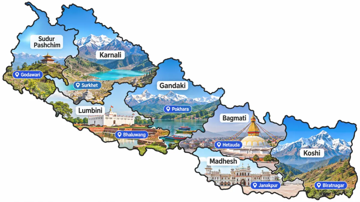
On a Nepal map, the country is divided into 7 provinces, 77 districts and 753 local governments, a federal structure created by the 2015 constitution. The provinces are arranged from east to west, and most stretch from the southern plains to the northern mountains.
|
Province |
Capital |
Location and highlights |
|
Koshi |
Biratnagar |
Eastern Nepal; Everest and Kanchenjunga regions |
|
Madhesh |
Janakpur |
Southern Terai plains along the Indian border |
|
Bagmati |
Hetauda |
Central Nepal; Kathmandu Valley and Chitwan National Park |
|
Gandaki |
West-central Nepal; Annapurna and Manaslu ranges |
|
|
Lumbini |
Deukhuri |
Western Terai and hills; Lumbini, the birthplace of Buddha |
|
Karnali |
Birendranagar |
Remote northwest; largest province, with Rara Lake and Humla |
|
Sudurpashchim |
Godawari |
Far west; borders Uttarakhand and Tibet |
Kathmandu, the national capital, lies in Bagmati Province in a valley at about 1,400 m. Pokhara, the gateway to the Annapurna region, is in Gandaki Province. Nepal’s six metropolitan cities are Kathmandu, Pokhara, Lalitpur, Bharatpur, Biratnagar and Birgunj. Koshi and Gandaki contain the main trekking regions covered later in this guide.
Nepal Himalayas and Major Mountain Ranges: Home of the World’s Highest Peaks
The Nepal Himalayas form some of the highest sections of the Himalayan mountain system. The Himalayas stretch about 2,400 km across five countries, and Nepal holds some of their highest sections, including eight of the world’s 14 highest mountains (all ranking in the global top ten).
The range began forming about 50 million years ago when the Indian plate collided with the Eurasian plate. That collision continues, which is why the mountains are still rising and why Nepal is prone to earthquakes, such as the magnitude 7.8 quake of April 2015.
Mount Everest Location: Where Nepal Meets Tibet
The Mount Everest location is in the Mahalangur Himal, on the border between Nepal and Tibet, at about 27.99°N, 86.93°E. Mount Everest (Sagarmatha in Nepali, Chomolungma in Tibetan) is the highest point on Earth above sea level. Nepal and China jointly announced its official height in 2020 as 8,848.86 m.
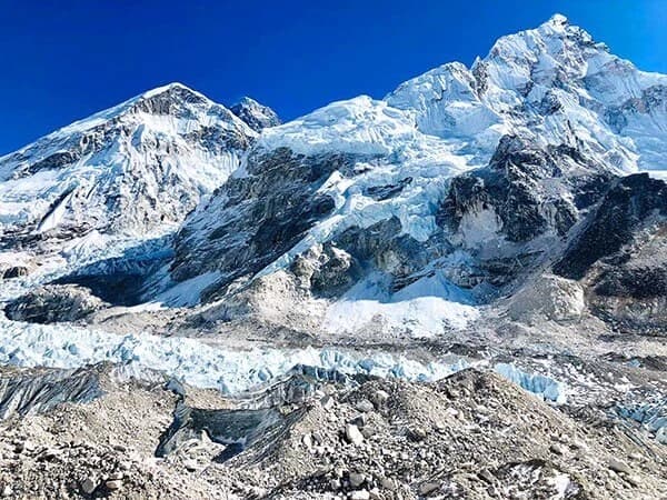
On the Nepal side, Everest lies in Sagarmatha National Park in the Solukhumbu district, a UNESCO World Heritage Site. Most visitors fly to Lukla from Kathmandu (or from Ramechhap in peak seasons) and walk to Everest Base Camp (about 5,364 m) on the Everest Base Camp Trek.
8,000m Peaks in Nepal: The Eight Giants Compared
Eight of the world’s fourteen mountains above 8,000 m are in Nepal, either entirely or on its border. The table shows each peak, its world rank and a trek that offers views of it.
|
Peak |
World Rank |
Height |
Location |
Trek with views |
|
Mount Everest |
1st |
8,848.86 m |
Nepal-China border |
|
|
Kanchenjunga |
3rd |
8,586 m |
Nepal-India border |
|
|
4th |
8,516 m |
Nepal-China border |
Everest Base Camp Trek |
|
|
Makalu |
5th |
8,485 m |
Nepal-China border |
|
|
Cho Oyu |
6th |
8,188 m |
Nepal-China border |
|
|
Dhaulagiri I |
7th |
8,167 m |
Within Nepal |
|
|
8th |
8,163 m |
Within Nepal |
||
|
Annapurna I |
10th |
8,091 m |
Within Nepal |
Main ranges. From east to west, the Nepal Himalayas include:
- Kanchenjunga Himal in the far east
- Mahalangur Himal (Everest, Lhotse, Makalu and Cho Oyu)
- Langtang, Manaslu and Annapurna Himal in the centre
- Dhaulagiri Himal further west
- Dolpo, Kanjiroba and the far-western ranges, the least visited part of the Nepal Himalayas
South of them lie the lower Mahabharat Range and the Siwalik (Churia) Hills at the edge of the Terai.
Want to see these peaks for yourself? Nepal Gateway Trekking runs guided treks across all of Nepal’s major Himalayan regions, from Everest to Annapurna and beyond.
Nepal Climate and Seasons: How Altitude and Monsoon Shape the Landscape
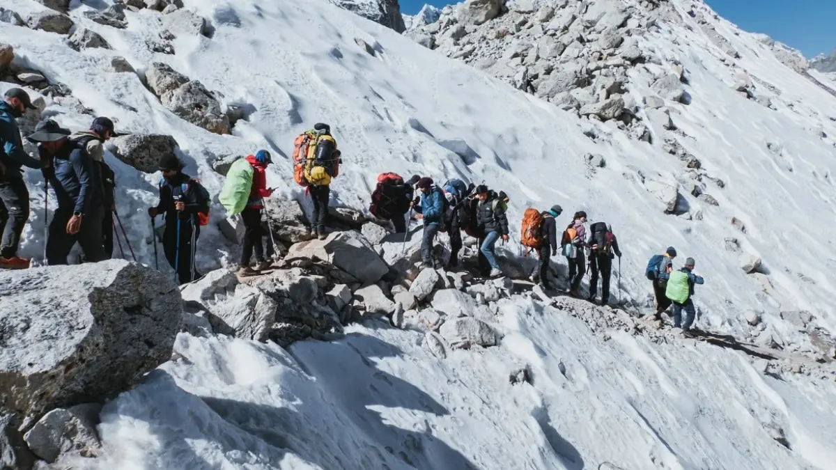
Altitude shapes Nepal’s weather more than latitude does: the Terai is subtropical, the hills are temperate and the high Himalayas are cold and alpine. The monsoon brings heavy rain to most of the country from June, often into September.
| Season | Months | Weather | Mountain views |
| Spring | Mar to May | Warm, with rhododendrons blooming in the hills | Good, with some haze |
| Summer (monsoon) | Jun to Aug | Hot and wet | Often hidden by cloud |
| Autumn | Sep to Nov | Wet in early September, then dry and stable from October | Excellent from October |
| Winter | Dec to Feb | Cold at altitude, mild in the Terai | Very clear, but high passes can close |
Autumn (Oct to Nov) and spring (Mar to May) give the clearest views and the most stable trekking weather. For route-by-route timing, see the guide to the "Which is the best trekking season in Nepal?".
Trekking in Nepal: Matching the Landscape to the Trail
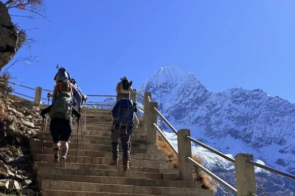
Nepal’s location and steep terrain make it one of the world’s best trekking destinations, with eight of the world’s 14 highest mountains (all inside the top ten) within its borders. A single route can climb from warm, terraced hills to glacier valleys and high passes. Most treks start from Kathmandu or Pokhara, and on popular routes trekkers stay in village lodges rather than camping.
The table links each trekking region to its geography, with example routes from Nepal Gateway Trekking, a trekking company based in Thamel, Kathmandu.
| Trekking region | Geography | Example treks |
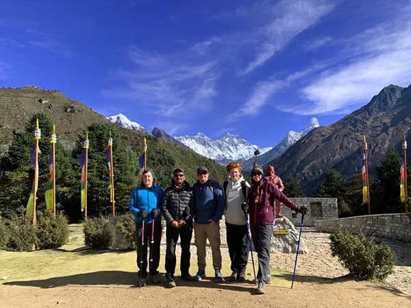
| Everest (Koshi Province) | Khumbu valleys beneath Everest, Lhotse and Cho Oyu, on the Tibet border | Everest Base Camp Trek, Gokyo Valley Trek, Everest High Passes Trek |
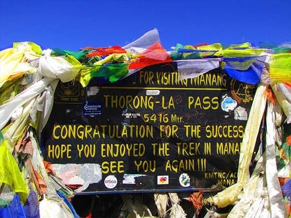
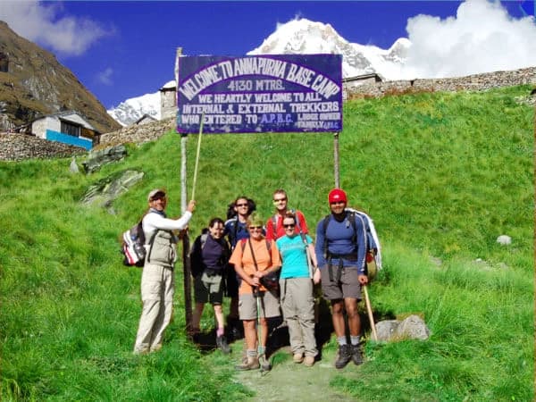
| Annapurna (Gandaki Province) | Range north of Pokhara; Thorong La Pass at 5,416 m; Kali Gandaki valley between Annapurna and Dhaulagiri | Annapurna Circuit Trek, Annapurna Base Camp Trek, Mardi Himal Trek |
| Langtang (Bagmati Province) | Valley north of Kathmandu, close to the Tibet border | Langtang Valley Trek |
| Manaslu (Gandaki Province) | Remote valleys around the eighth-highest peak; Larke Pass at 5,106 m | Manaslu Circuit Trek, Tsum Valley Trek |
| Mustang (Gandaki Province) | Dry, Tibetan-style landscape north of the Annapurna and Dhaulagiri ranges | Upper Mustang Trek |
| Off the beaten trails (Koshi and Karnali provinces) | Remote eastern and far-western Himalayas with fewer visitors | Kanchenjunga Base Camp Trek, Makalu Base Camp Trek, Upper Dolpo Trek |
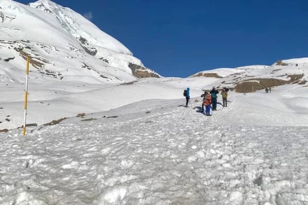
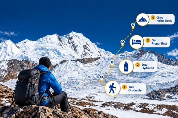
- Altitude. Many routes pass 3,000 m and some cross passes above 5,000 m, so gradual ascent and rest days matter more than fitness. See the trek grade guide and the guide to acclimatization.
- Permits. Most trekking areas need permits, and restricted regions such as Upper Mustang and Manaslu have extra rules. Remote routes like Upper Dolpo may also involve camping. Check the permit information page before booking.
Final Thoughts
So, where is Nepal located? It is a landlocked country in South Asia, set in the Himalayas between China to the north and India to the east, south and west, with Kathmandu as its capital. In a small area it combines subtropical plains, green hills and the world’s highest mountains, including Mount Everest on the border with Tibet.
That variety shapes everything from the climate and the seven provinces to the culture and the trekking routes that cross the country. Whether you are finding Nepal on a world map or planning to walk its trails, its place between the Tibetan Plateau and the Indian plains is what gives it such a wide range of landscapes in such a small area.
Planning a trip to Nepal? Contact Nepal Gateway Trekking for expert guidance and help organising your journey.
Frequently Asked Questions About Where Nepal Is Located
Which country does Nepal belong to?
Nepal does not belong to any other country. It is an independent federal democratic republic in South Asia, bordered by China to the north and India to the east, south and west. Its history, geography and national identity are distinct, as explained in the Wikipedia article on Nepal.
Is Nepal more Chinese or Indian?
Neither. The southern plains and hills have close trade and cultural ties with India, and Tibetan Buddhist culture is strong in the high Himalayas. Nepal has its own distinct identity and follows a non-aligned foreign policy.
Is Nepal a part of India?
No. Nepal is a separate sovereign country with its own government, constitution, flag and currency, and its capital is Kathmandu. It shares an open border with India, which is why the two are often confused.
Which continent is Nepal in?
Nepal is in Asia, in the subregion of South Asia, on the northern edge of the Indian subcontinent.
Is Nepal landlocked?
Yes. Nepal has no coastline, and its nearest sea access is the Bay of Bengal through India.
Where is Mount Everest located?
Mount Everest is in the Mahalangur Himal on the Nepal-Tibet border. On the Nepal side, it lies in Sagarmatha National Park in the Solukhumbu district of Koshi Province.
Which regions in Nepal are best for trekking?
Everest, Annapurna, Langtang, Manaslu and Mustang are the most popular. Everest Base Camp and the Annapurna Circuit are the best known, while Kanchenjunga, Makalu and Dolpo suit trekkers who want quieter trails.